In 1899, the C & O railroad began building a line running north alongside the Greenbrier River to tap into the rich timberlands of West Virginia. The next year, the railroad reached Cass, 80 miles north of the mainline which cut through White Sulfur Springs and Lewisburg. A few years later, the line continued north until it connected to the Western Maryland. The Greenbrier division consisted of a little over 100 miles, most of which was along the river. Of course, the success in cutting the timber led to the demise of the railroad.
By 1920, most of the virgin timber in the lower section had been cut and the line began to financially struggle. But it kept going, providing an outlet to the larger world for communities in Greenbrier and Pocahontas County such as Anthony, Spring Creek, Beard, Hillsboro, Seebert, Marlinton, Clover Lick, and Cass. Except for Marlinton, which is the seat of government for Pocahontas County, most of these communities today are a shell of their former selves.
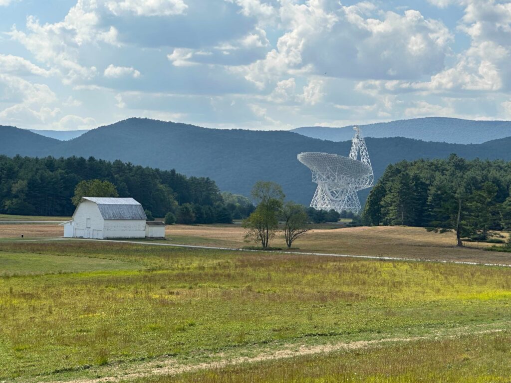
One of the more interesting pieces of freight for the railroad were sections of a large antenna for the Green Bank Observatory. This observatory has several radio telescopes, including the largest radio telescope which can track a point in space. Because of the sensitive antennas, the area is in a radio restrictive zone. This limits the height of antennas and the power of transmitters. If you visit Green Bank Observatory, you had to turn your cell phones off! Much of the area along the rail trail has no cell phone service and there is limited radio stations cover the area. The designer of the antenna had a mockup built to ensure it could be transported to near Green Bank, as it had to pass through two tunnels.
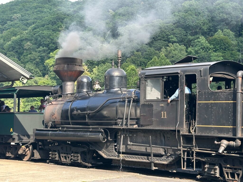
Passenger service along this branch of the C&O ended in 1958. In the late 1970s, freight traffic, which had dwindled to a weekly run, ended and the tracks removed. As the logging company which owned Cass Railroad had done when it closed in 1960, the C&O turned 80 miles of the right of way over to the state. The Cass Railroad is operated as a tourist train state park
Today, the old railroad bed is a trail is a linear park enjoyed by hikers, bicycles, and horses. Adjacent to the trail are several other state parks: Cass Scenic Railroad, Watoga, Droop Mountain Battlefield, and Beartown. Additional land is held by both state forest and the Monongahela National Forest. These parks and forest provide ample opportunity for camping or staying in cabins, many of which were built by the Civilian Conversation Corps during the Depression.
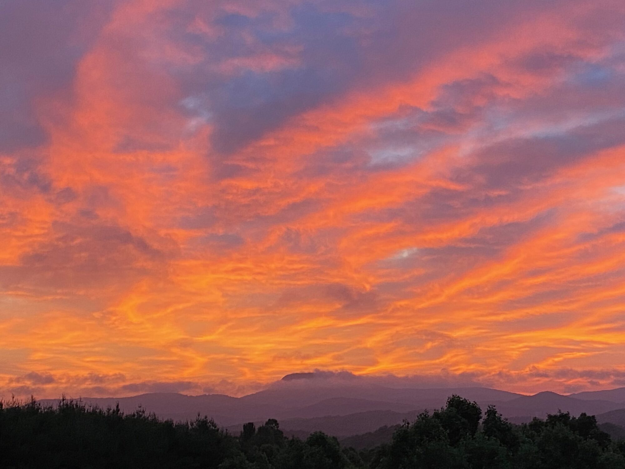
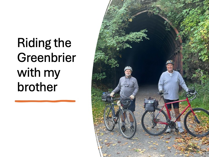
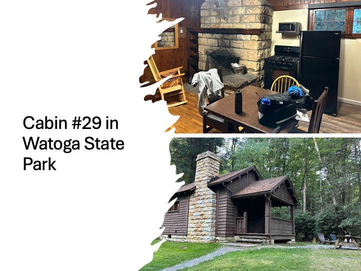
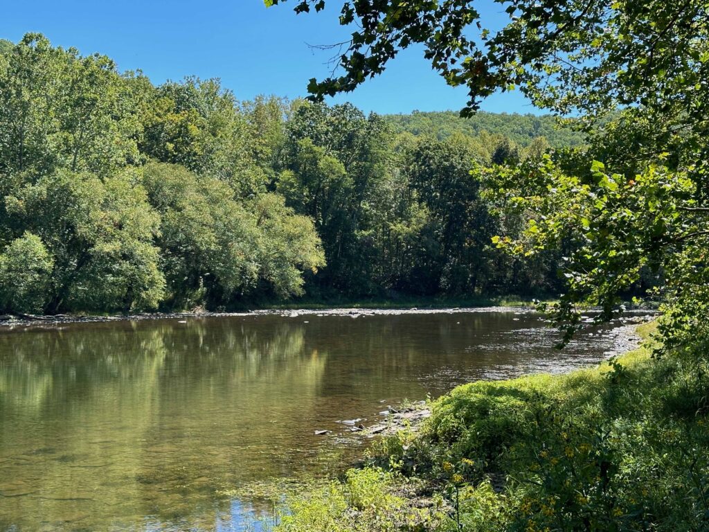
This past Sunday, my brother and I headed up to a cabin in Watoga State Park. We spent Monday and Tuesday riding 60 miles of the Greenbrier River Trail, from Cass to Spring Creek. We had two idea days to ride. Both mornings, we left the cabin with temperatures in the 30s, but my mid-day we were in t-shirts.
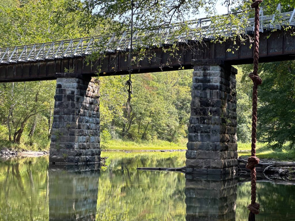
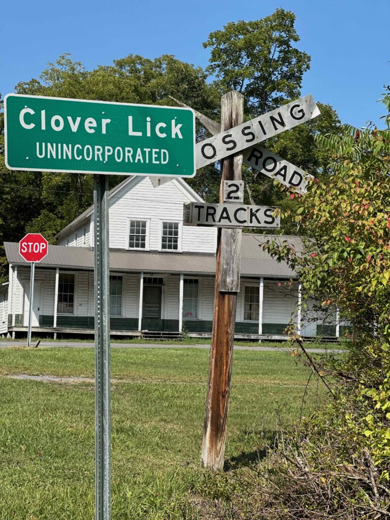
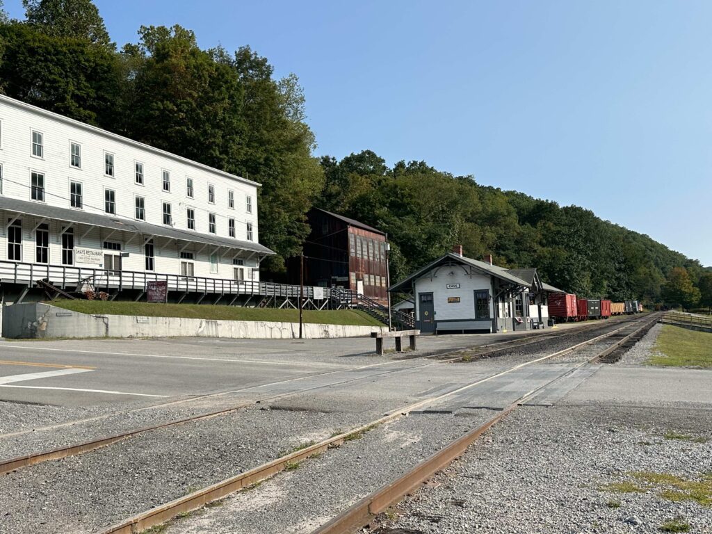
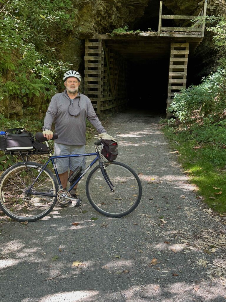
We started at Cass, at the northern end of the trail and road south. Highlights included the town of Clover Lick, which has one of the few remaining stations (others are in Cass and Marlinton. 14 miles south of Cass, we passed through the Sharp Tunnel, which exits on a trestle, taking us to the east side of the river. Below the trestle were ropes hanging from a river birch. I could imagine on warmer days, children swinging out into the river. Nearby were some camps with fire rings that may have seen a few hobos in earlier days.
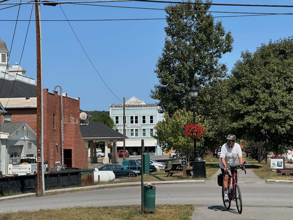
Just before you get into Marlinton, there was an old water tower, the only one which remains on the river trail. In Marlinton, there is a bike repair stand, which allowed me to put my bike up and adjust the gear changing lever. While I had enough tools with me, the stand also had such tools attached to a cable (so they’d remain for other bikers in need of a repair). We ate our picnic lunch at a table along the trail in Marlinton.
After Marlinton, we had about 12 more miles to ride before we arrived at Seebert. I had left my vehicle there, so we loaded up our bikes and drove back to Cass to pick up my brother’s vehicle. Afterwards, on the way back to Watoga, we stopped again in Marlinton for dinner at the Greenbrier Grille and Lodge. If I had known they had rooms, I might have stayed here. Then we could brag about staying at the Greenbrier (there is another 5-star Greenbrier in White Sulfur Springs, a place visited by 28 Presidents).
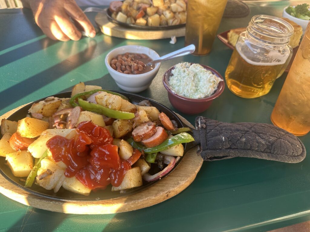
We ate outside on the porch overlooking the Greenbrier and a hoard of ducks waiting to be fed scraps. They had a meal titled “The West Virginia Original” and is probably not on the menu at the other “Greenbrier.” But as we were there, we had to try it. There were lots of fried potatoes, along with kielbasa sausage, sautéed onions and mushrooms. It was served in a cast iron frying pan and included sides (I got pinto beans and cole slaw), and a slice of cornbread. I downed it with a local IPA.
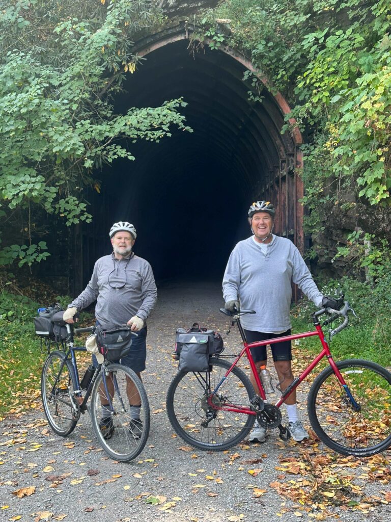
We decided not to try to ride the rest of the trail on Tuesday. We both had places to be on Wednesday. After shuttling cars, we rode our bikes to Spring Creek. This section passed a state prison, the Droop Mountain tunnel along with idyllic scenery of hayfields being cut and baled. The Droop Mountain tunnel runs under the site of a Civlil War battle up on the mountain . We finished up and had the cars shuttled by mid-afternoon, said our goodbyes and headed toward our respective homes. It had been a good trip and was nice to catch up with my brother in person for the first time since our father’s death.
I planned to stop at the Pearl Buck’s birthplace at Hillsboro on my way home. Buck was a missionary to China and a wonderful author. Her book on China (The Good Earth) won the Pulitzer Prize. She also wrote another good book on Korea titled The Living Reed. Sadly, the place was closed. This is the third time I have tried to stop there, and it seems to always be closed. So I drove on home.

Looks like a peaceful, lovely area. It’s always sad to me to see little towns die, long-standing businesses close.
It does seem like quite a few railways and depots have been repurposed around here. We have one old depot that houses a restaurant. And we have visited a couple of railroad museums not too far away and taken their tourist train rides.
Love the idea of the shareable bike tools.
The tools are nice, but in one case, someone had broken off the stolen the allen wrenches. I had my own tools, but liked being able to have my bike hanging off the ground as I adjusted my gears.
WestVirginia is such a beautiful state. I’d love to see the areas you rode through. I’d also like your dinner! We stayed at the Greenbrier once, for four glorious days! The spa services can’t be beat!
Yes, your home state is beautiful! I have been by the “other” Greenbrier and it looks amazing.
Love the photos, especially the observatory, and would love to visit someday. Sounds like a wonderful way to spend time with family or friends.
We had a great time. The Observatory is neat, but because it is radio waves that are being analyzed by computers, there’s not much to really see except some radio towards like the one in the picture.
I loved your pictures. That sounds like it was a nice place to visit with your brother.
We had a good time!
Very nice park 😀
It’s a 78 mile linear park!
You saw some really beautiful countryside. I love that last photo.
Yes, it is a beautiful area.
What a lovely reunion. Your brother looks like a good person.
I hope he doesn’t read this. It might go to his head! 🙂 (but he’s a good soul).
Riding on old railroad right-a-ways is certainly one of my favorite ways to ride these days. There is a similar long trail in central Missouri that sounds a lot like this one and lots of businesses to cater to the bicyclists.
There are several around here. The Virginia Creeper in Damascus is a long downhill run that is very popular. The “New River Trail” is a 56 mile run that ties the towns of Fries and Galax to Pulaski, and runs mostly along the river. Sadly, there are no more trains serving these areas.