Jeff Garrison
Mayberry & Bluemont Churches
May 24, 2026
Matthew 7:13-14
Theology minute on “Pentecost”

Today is Pentecost. As a theology minute, and before we get to the sermon, let’s reflect on the meaning of Pentecost. The word comes from the Greek for 50. Depending on how you count it, Pentecost is 50 days after Easter. Most of us would count 49 days, so close enough. In some English traditions the day is also known as Whitsunday, referring to the white robes of baptism often performed on this day.
Pentecost is the day the Holy Spirit descended as in a flame on the faithful who had gathered in Jerusalem, giving the disciples the spirit and the power to begin the church. From a standpoint of the church, the day is perhaps third in importance to our theology, behind Good Friday and Easter.[1] However, it often gets overlooked since many years it falls after Memorial Day, when people take off for vacations.
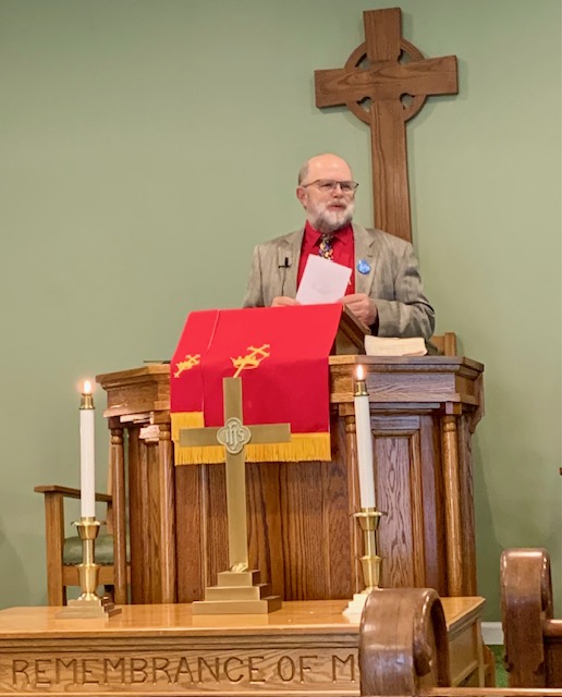
Many people wear red on Pentecost as we recall the flames of the Spirit. In most Presbyterian Churches, and in our denominational seal, you’ll find two flames. They represent the flames of the Spirit in the Old and the New Testament. The Old Testament flame was God’s encounter with Moses at the Burning Bush which didn’t burn. In the New Testament, it’s the coming on the Spirit.
In the Jewish world of the first century, this was a time for pilgrimages to Jerusalem. If you couldn’t make it for Passover, when the Mediterranean Sea was rougher, you’d come for Pentecost or, as it is known in the Old Testament, the Feast of Weeks, a harvest festival.
As we heard earlier in our reading from Acts 2, Jews throughout the Roman World gathered in the holy city on this day. The empowering of the church encouraged incredible preaching in languages people understood, allowing them to carry back the good news to all corners of the empire. God works in mysterious yet incredible ways.
Before reading the Scripture:
Today, we’ll begin the ending of Jesus’ Sermon on the Mount. Last week, we saw how Jesus provided those listening to the sermon how they might live a notable life which helped not only them, but the world around them, to flourish. Jesus now moves to his closing in which he gives three eschatology or “end times” warnings to insist those listening to him take his teachings seriously.[2] All three of Jesus’ warnings contrast two different concepts: gates, prophets, and houses. We’ll look at each set individually, starting today and in my next two sermons.
Jesus began the sermon with the beatitudes which sounds mellow. Then, in a way, the center of the sermon which we finished last week, focuses on expanding the beatitudes into helpful ways we might be more Christ-like.[3] Now, at the end, he warns us to be careful. A good life is not just obeying the law in a manner others may praise. A good life means we strive for righteous, not just in our deeds, but also in our hearts. That latter part is more difficult.
Read Matthew 7:13-14
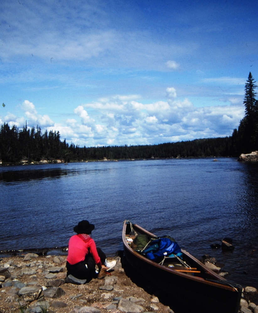
In the summer of 1992, I paddled the Missinaibi River in northern Ontario. The river ends at the James Bay in the sub-arctic region of Canada. About halfway through the trip, the river slips off the Canadian Shield, a large granite base which stretches from just north of the Great Lakes to the sub-arctic. Where the river comes off the shield, a series of waterfalls and dangerous rapids requires two long portages. The first, at Thunderhouse Falls, is a mile long. The second, around some difficult rapids, is two and a quarter mile hike through a bog. It was a workout.
Thunderhouse Falls is up there with Niagara. You don’t try to run it. The river, which has been two to three hundred yards wide narrows down into a slot between the rock that in places is less than ten yards across. If you hike up to the edge and to look down, it’s scary to see the force of the water. It’s also so noisy you must yell to talk to someone next to you. It’s so noisy you don’t even hear the buzz of mosquitoes feasting on your exposed skin.
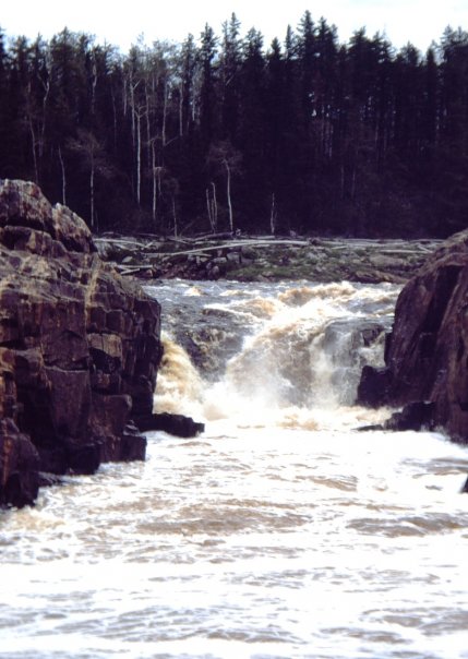
Thankfully, during this trip, the guy who helped me arrange for shuttles and stuff, sat me down with a map and pointed out this rapid and a problem which existed on the map. The map showed the portage trail on the east side of the river, but it was on the west side. Making it even more dangerous for those who didn’t know this, they would have to ferry back across the river at a point where the flow accelerates. A little mistake could easily pull you past the point of no return and you’d be sweep down a mile long rock crushing gorge with a series of good-sized waterfalls.
The guide suggested after we passed a small easily identified rapid a mile upstream, we hug the west or left bank and carefully look for the trail.[4] We did and didn’t have any problems other than sore shoulders from lugging the canoe and gear overland. I later learned that over a dozen years the misguided map was in circulation, ten paddlers died in the river.
Had the guide not given us the clues needed, I don’t know what would have happened. Like with Jesus’ teachings in our text today, we must find the right gate and travel on the right path. Moses and a generation later, Joshua, called the Hebrew people to decide between life and death.[5] Jesus issues a similar challenge to those who listen to him preach. The passage today calls us to seek the narrow gate and the hard road.
But it’s tempting to enter the wide gate and the easy road. But that journey will end in destruction. Think of getting caught in the current on the Missinaibi and drawn down the roaring river toward Thunderhouse Falls. Once the current catches you, it’s hard to make it out before it’s too late.
With this warning from Jesus, we could be tempted to throw our hands up in resignation. After all, it appears Jesus suggests most people don’t take his path and are bound for damnation. But with these warnings, as he’s done throughout the Sermon on the Mount, Jesus offers practical and not dogmatic advice.[6] He’s not saying, look at all the people bound for perdition. Instead, he encourages us to take the right path.
We don’t know who or how many are saved. Instead, this passage challenges the idea that we should make our determination on what is right or wrong based on an opinion poll. Don’t strive to be in the majority. Think about this. Jesus may be calling us to join the “moral minority.”[7] Just because everyone else is on a particular path doesn’t mean it’s the right way.
And, the right path isn’t easy. We’ve seen this throughout Jesus’ teachings here. Jesus wants us to follow him, and we know the direction of his travels. Jesus’ path led to Golgotha. His path took him to the cross. Jesus willingly gave up a life he loved for us. And we’re called to be willing to give up our own lives for others. As the hymn The Old Rugged Cross goes, to lay down the trophies of this life for a cross for which we, one day, can exchange for a crown.
Jesus, at the end of the Sermon on the Mount, calls us to a conversion. We’re to make him our Lord,[8] and be willing to live for him. For, as Peter would later claim in John’s gospel, only Jesus has the words of eternal life.[9] The wide and easy road may look appealing, but that’s not where our Savior leads. Often, we want to take the easy way, along with everyone else, but such a path is not where we’re called as followers of Jesus. The life of discipleship requires us to make Jesus our Lord and to commitment ourselves, day after day, to follow him and not the crowd.
One of the problems with an over emphasis on making the decision to follow Jesus is that it sounds as if all you must do is confess your sins and invite him into your heart and then your set. But that’s not scriptural. Think about the Hebrew people. When they crossed the Sea, they experienced salvation from the Egyptian army, but still had the wilderness to cross and would spend 40 years there. The Apostle Paul encourages us to work out our “own salvation with fear and trembling,” but Paul also goes on to remind us that God also works within us to make our own work possible.[10]
The gate represents our decision to accept Jesus as Lord. The road represents the ongoing journey, which we struggle throughout our lives as we move closer toward the eternal kingdom. This struggle, as we’ve seen throughout the Sermon on the Mount, involves not just external piety. Obeying the letter of the law, as demonstrated by the Pharisees of Jesus’ day, could be done. But Jesus desires a deeper change within our hearts, as he pointed out repeatedly in the Sermon on the Mount.[11] Our call and our only hope for salvation is to follow him through the tight gate and down the narrow and hard road. Amen.
[1] I place Pentecost before Christmas because without the church, we’d not even have a reason to celebrate Jesus’ birth. Besides, only two of the Gospels recall Jesus’ birth. Good Friday offers us salvation; Easter provides us with a future hope. These two realities, transmitted to the world through the church, starts on Pentecost.
[2] Douglas R. A. Hare, Matthew: Interpretation, a Commentary for Teaching and Preaching (Louisville, KY, JKP, 1993), 81.
[3] See https://fromarockyhillside.com/2026/05/17/asking-god-and-the-golden-rule/
[4] There were no good guidebooks to the river in 1992. Hap Wilson has since published Missinaibi: Journey to the Northern Sky (Erin, Ontario: Boston Mills Press, 2004). Wilson mentioned the deaths at Thunderhouse Falls due to the mistaken map.
[5] Deuteronomy 30:15-20 and Joshua 24:15.
[6] Hare, 82.
[7] Frederick Dale Bruner, The Christbook: Matthew 1-12 (1990, Grand Rapids, MI: Eerdmans, 2004), 350
[8] Bruner, 349.
[9] John 6:68.
[10] Philippians 2:3-4.
[11] Jonathan T. Pennington, The Sermon on the Mount and Human Flourishing: A Theological Commentary (Grand Rapids, Baker Academics, 2017), 274.