Four days and three nights in the Dry Tortugas

Dad, my sister Sharon, and me

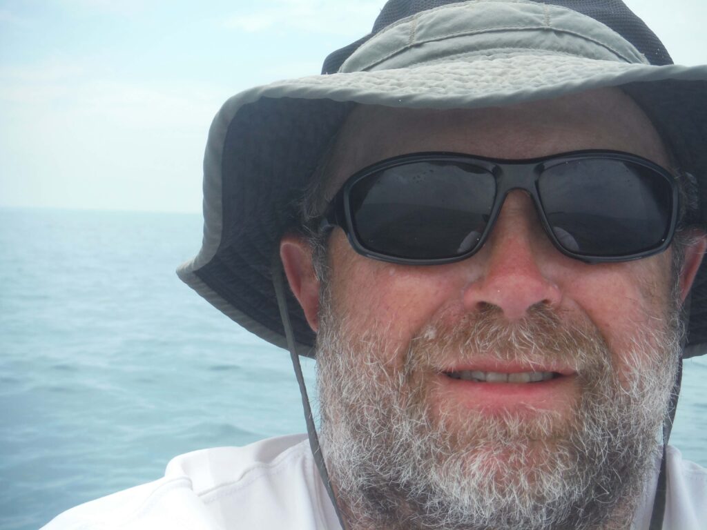
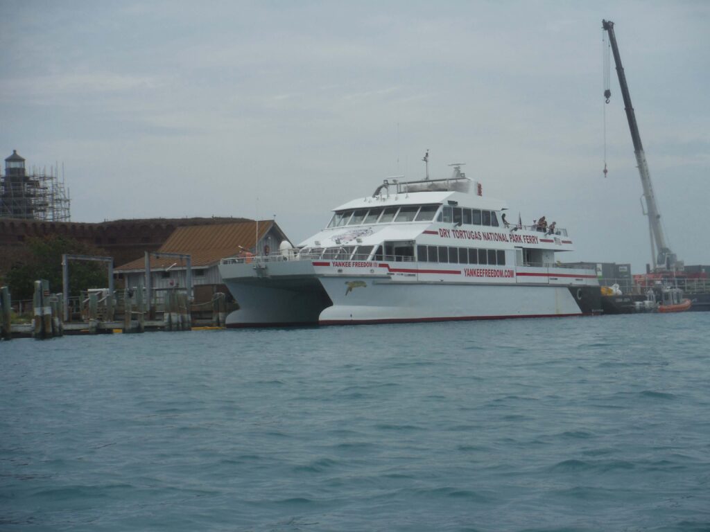
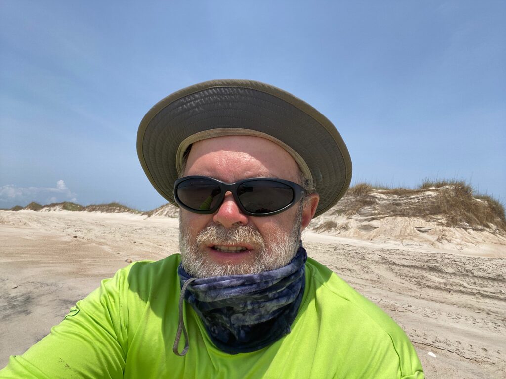
Part of this was posted in a previous blog that is no longer available. I added more information to include the entire trip and am reposting it. In late April 2018, my father, sister, and I made this trip to the Dry Tortugas, which sit 68 miles west of Key West. There are no services on the island and it’s primitive camping. We brought kayaks with us along with everything we needed (including water). Thankfully, as a ferry makes it way to the islands every day, we could buy ice at an inflated price. We could also buy ice cream aboard the ferry!

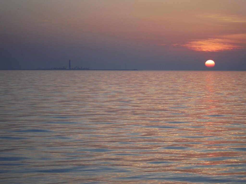
Most of us camping on Garden Key stand together on the beach watching the light fade from the western sky. The skies are clear and the water surrounding the Key and Fort Jefferson ripple from the southerly wind. There’s a group of four women from South Florida along with several bird watchers from around the country. Soon a star appears in the southwest, Sirius, the Dog Star as well as Venus just above the horizon in the West. A few minutes later, the sky is darker. Rigel and Betelgeuse, the red star in Orion, are visible. “There’s Orion, setting early after having been up high all winter,” I say as I point out the stars. Soon we can make out the stars in Orion’s belt. In the spring, it appears as if the hunter is falling face-first out of the sky. In a few minutes, all the stars of Orion and his faithful dog, Canis Major, are clearly visible as is as well as the charioteer, Auriga, the V in Taurus the Bull, as well as the Seven Sisters, who according to mythology look out for travelers.  

Moored sailboats and the setting sun

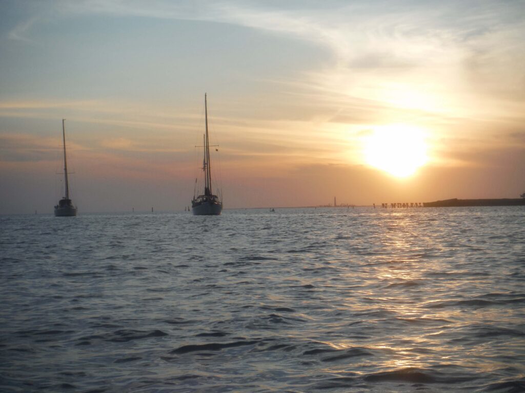
We’re all travelers, enjoying a few days 70 miles from civilization. There are no signals on our cell phones and no way, unless someone brought a satellite hookup, to connect to the internet. I look back over my head to the northeast, I see the Big Dipper climbing higher in the sky. From it, I can easily find the North Star, low on the northern horizon, just above the ramparts of the fort. I point it out to the group.

How you know so much about the stars and night skies, one of the women from Miami asks. 

“I don’t know,” I say, “I just like spending time outdoors, especially at night.”  

My father checking out the terns (or was it the other way around?)

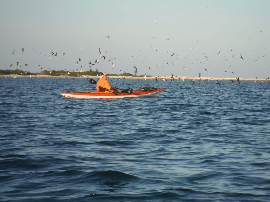
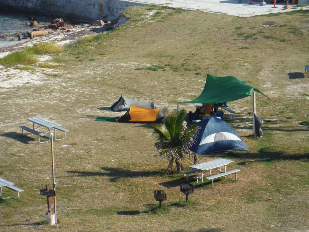
Slowly people drift back to their tents. It’s been a tiring day as my sister, father and I had gotten up at 4:30 AM, in order to have our gear and kayaks by the ferry at 6 AM for the run from Key West to the Tortugas. Then there was setting up camp for our three nights on the island, followed by a cooling snorkel around the outside of the fort’s moot. By then, it was time for dinner and then we went out for an evening paddle. We’d taken our kayaks out by Bush Key, where tens of thousands of Snooty Terns nest. The key now connected to Garden Key, but the park service has it closed off so as not to disturb the birds, which seem never to nest but mostly to fly around the key and out over the water, constantly chirping with one another. On Long Key, frigates nest. These large birds are as graceful as any navy frigate and the males, who puff up a red pouch under their head to attract females can strut better than any sailor on shore leave.  

I crawl into my bivy tent. The wind is blowing hard and the tarp, which we erected to protect us from the tropic sun, flaps constantly.  I am soon asleep.

Bush and Long Key from the walls of Fort Jefferson

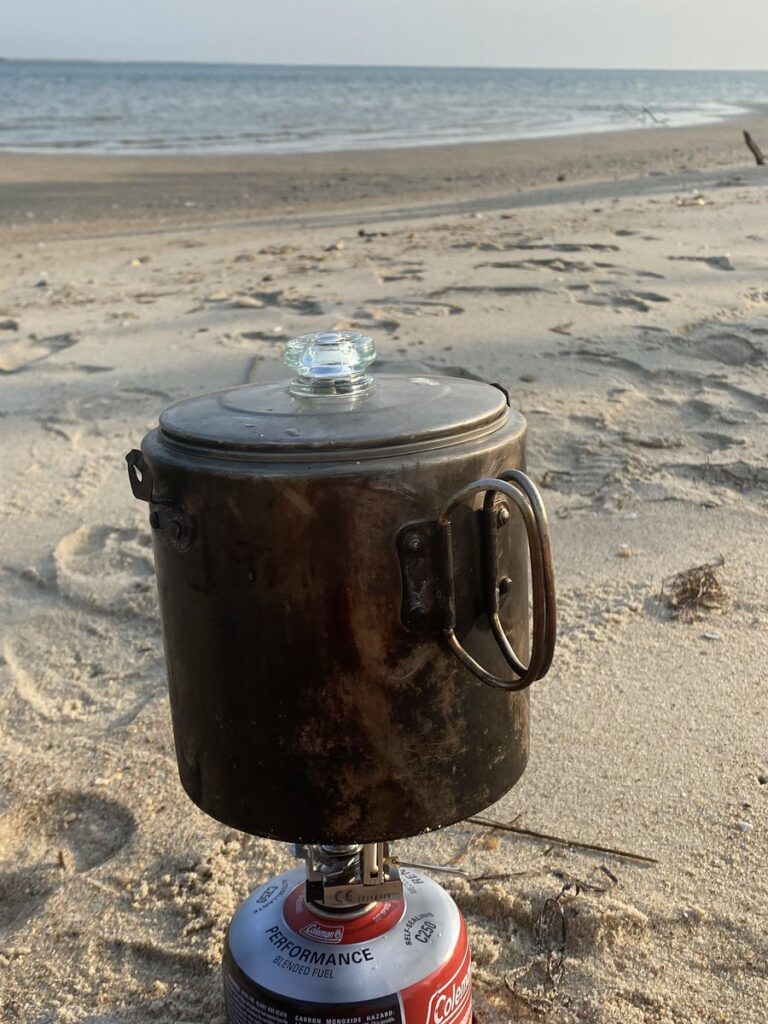
I arise at 6:30.  The eastern sky is bright red.  My sister has already started the charcoal in my stove and boiled water for her tea.  I put coffee and water in my camping percolator and in a few minutes can see the water turn into dark black coffee.  When Dad gets up, we have breakfast. I’ve brought oatmeal. My sister has boiled eggs and precooked bacon and grits. We cut up some fruit and split it between us.

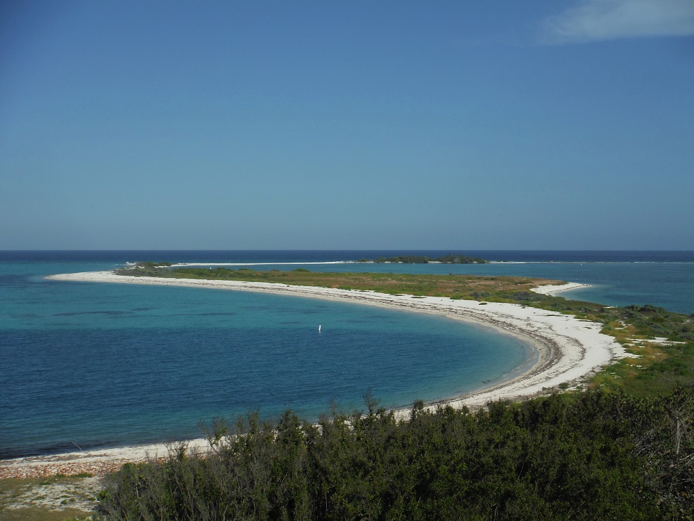
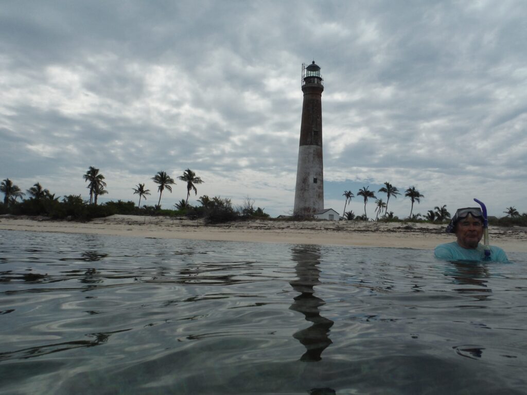
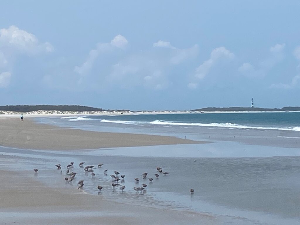
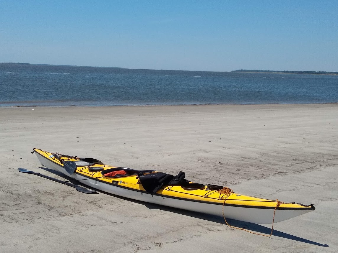
Our plan is to paddle to Loggerhead Key, which is located three miles to the west of Garden Key, the location of a long standing lighthouse (that went dark in 2014 and is no longer in use).  We pack lunches and snorkel gear. I have a marine radio, but the rangers insist we take at least one more and loan my sister one. Although the tide doesn’t vary much here (just a foot to eighteen inches) it does create a flow that runs the channel between the two keys, so we are warned to watch for currents. Unless a fog rolls in, which doesn’t seem likely in this weather, we’ll not have any problem as long as we stay focused on the Loggerhead lighthouse which rises 150 feet above the small strip of land.  The wind is still strong and coming out of the south, which requires us to paddle harder than normal.

About a quarter way to the island, my sister complains of her hands hurting and decides to go back to Garden Key. We were told that on a calm day it’d take an hour to paddle to the island and generally two hours to paddle back.  My dad and I keep paddling. It takes us almost an hour to paddle the three miles to Loggerhead, but that’s with a strong wind coming in at an angle, creating some swell. 

We arrive at Loggerhead Key at the same time as two guys on a dingy from their sailboat to the island. Like me, they have come to snorkel. Soon, we run into the lighthouse keeper. He has volunteered to stay on the island and watch over those who visit for a month. The park service provides him a home with electricity (they have huge panels of solar cells).  He checks in with visitors (he provided us with tips on where to snorkel), and operates a water desalination system that provides water to rangers in the Tortugas. He’s responsible for his own food.  

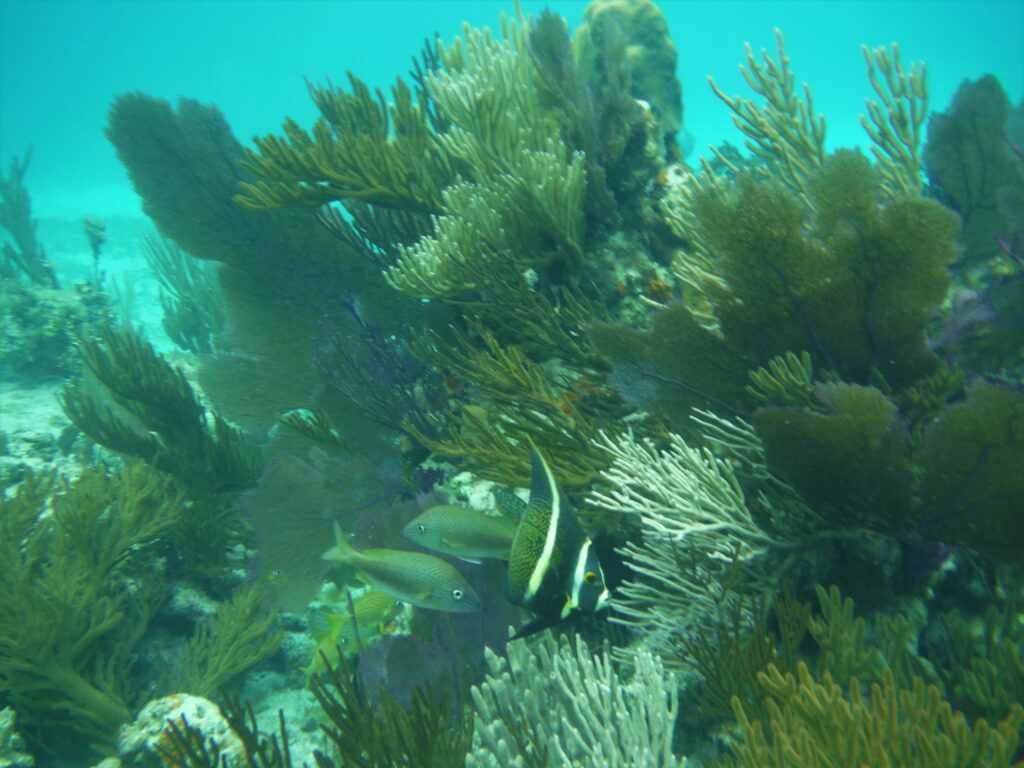
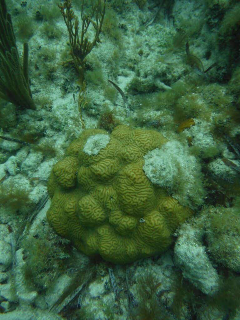
We walk across the island and snorkel on the west side. He points out some places to check out. We are blessed with seeing huge growths of brain coral along with large aquatic plants. I love the huge purple sea fans that half my size. I see plenty of fish: angelfish, butterflyfish, a variety of snapper and grouper, the seemingly ubiquitous “Sergeant Majors”, and several large barracuda. Hiding inside hollow parts of the coral are long-spined sea urchin.  After an hour and a half of snorkeling (my dad gave it up much earlier), I join him on the beach for lunch (Vienna sausage, cheese and crackers, a pear, and plenty of water).  After lunch, I go back out and snorkel for another 40 minutes or so, before packing up and heading across the island to our kayaks.  

Snorkeling off Loggerhead Key
Selfie, paddling back

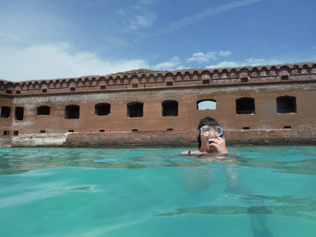
We leave at 1 PM.  The wind has calmed, and the paddle back is easy. We don’t rush. It only takes us a little over an hour and fifteen minutes, well less than the two hours we were told to expect.  We make it back in time to buy some ice and ice cream on the ferry (it leaves at 2:45 PM).  After resting, I join my sister with snorkeling around the fort.  The wind dies and the squawk of terns replace the sound of the flapping tarp. We enjoy steak for dinner. We froze the steaks and let them thaw in the cooler. We also have steamed cauliflower I’d brought from my garden. I am sure I’m the only person on this key eating homegrown cauliflower. 

I spend some time in the late afternoon and evening inside the fort, finding a shady spot, where I read and journal. It’s been a long day and shortly after sunset, I’m in bed. There is no wind and it’s warm. I lay on top of my sleeping bag and fall asleep.  

Campsite from the walls of the fort

Nature calls at 5 AM, and I crawl out of my tent to take care of business. The ground is soaked with a heavy dew. As I look up at the morning stars. The summer constellations are out and they are not generally this bright, but without any artificial light, the sky is brilliant. I easily spot Scorpius. It’s much higher above the southern horizon than I am accustomed to seeing it. At higher latitude, the constellation is only partly seen above the southern horizon. This morning, its pinchers are reaching out as if to grab Jupiter. To the left of the scorpion is the winged-horse archer, Sagittarius. Its arrow drawn and aimed at the deadly cosmic insect. Mars and Saturn appear to be resting on its wings. I’m treated to three planets in close proximity. There is no wind, but there is no silence either. I don’t think any of the terns on Bush Key slept last night. I crawl back into my tent and snooze for another hour.

Sharon Snorkeling

On the second full day on the island, we spend time snorkeling and paddle around the three keys. On this trip, I spot several turtles from where the islands get their name (Tortugas is turtle in Spanish). The dry part of the name was added to charts to indicate to seafarers the lack of fresh water on the islands. 

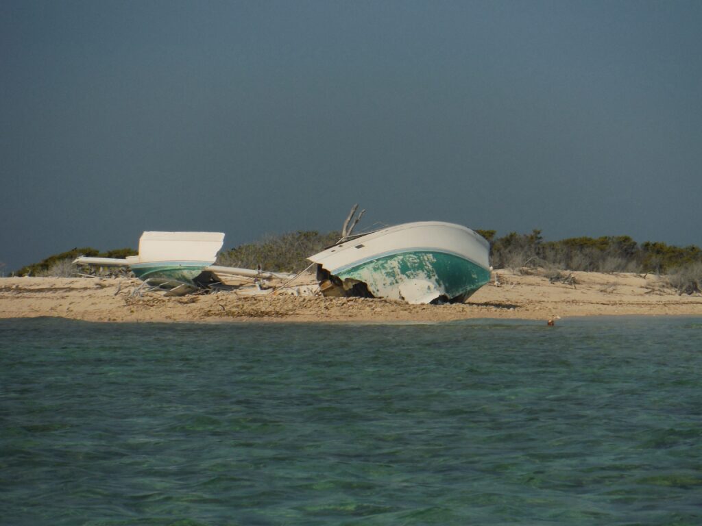
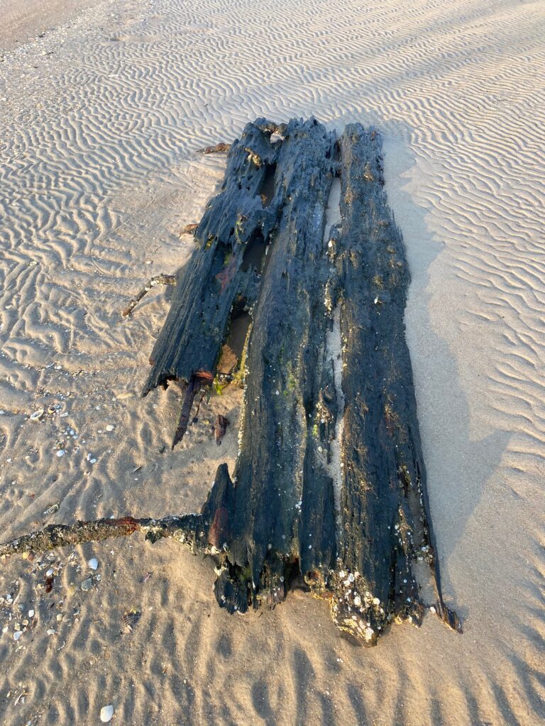
We also see a wreck sailboat that broke apart between Bush and Long Key. I later learned from a ranger that the owner of the boat had decided not to ride out a hurricane in Key West and tried to sail it single handed to the protected waters of the Tortugas. Because of the approach of the storm, the rangers had been evacuated, but there were several fishing boats moored in the natural harbor south of the fort. They saw him coming in, trying to make a channel between the keys, which had filled in. Sadly, the sailor had an old chart. He lost everything and one of the fishing crews rescued him, saving his life.

Fish fry

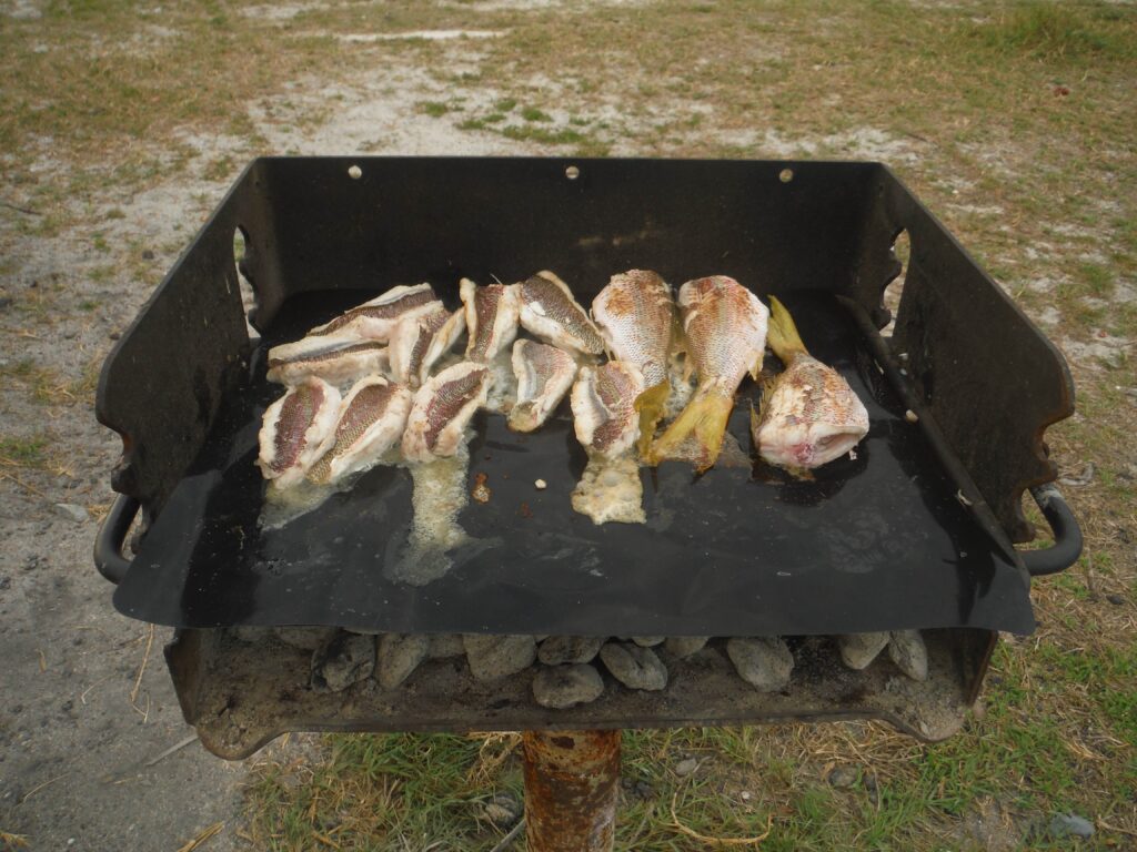
On the way back, Sharon and I snorkel offshore, looking for an old shipwreck. We don’t find it, but do see some nursing sharks, of which the island is famous. We also trade for some fish with a commercial fishing operator who is cleaning his fish just offshore.  That evening, we have fresh fish, enough that we share with others camping on the island.

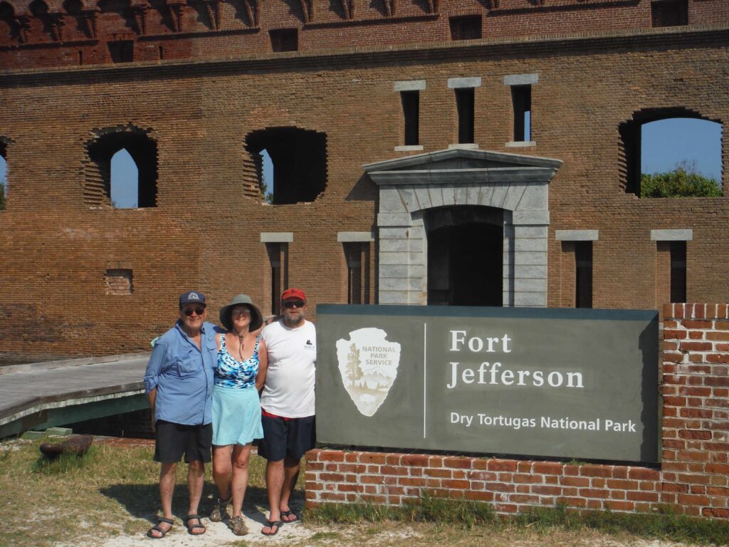
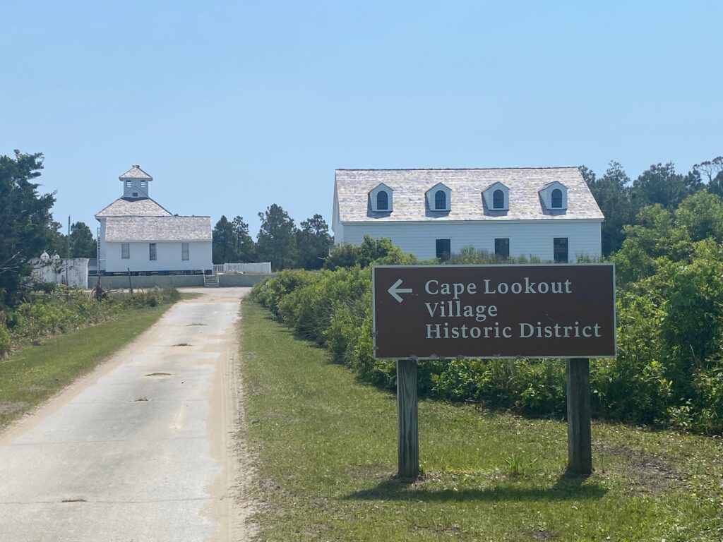
On our last full day on the island, we do more snorkeling. I also spend several hours going through Fort Jefferson. Building the fort began in 1835. Its purpose was to support a Southern fleet protecting the ports of Mobile and New Orleans. During the Civil War, the north quickly garrisoned soldiers on the island keeping it from falling into Southern hands. Up until this time, those on the key were construction workers including many slaves. Work continued on the fort, as they brought in bricks from New England. The lower part of the fort had bricks from Florida, which are a pale orange color. The top bricks are redder. 

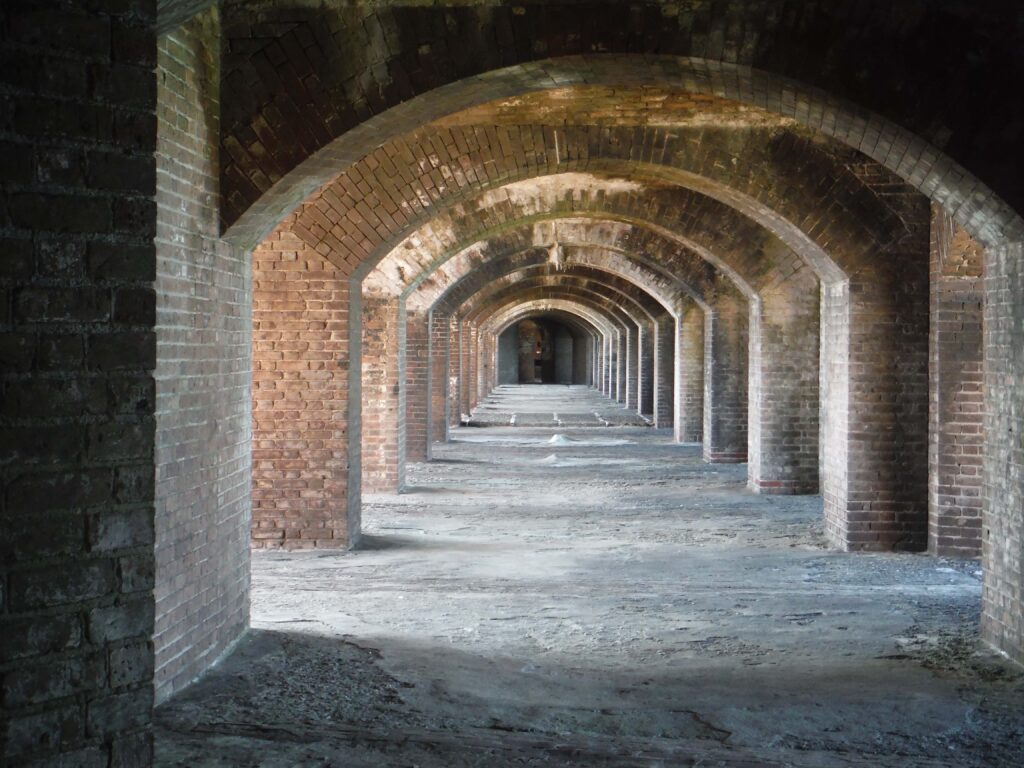
Also During the Civil War, the army added canons, which were never fired. The fort’s main use was as a prison. The fort was built upon a series of cisterns in which rain was collected. This was to allow the fort to withstand a siege (they also could grow vegetables inside the walls of the fort). However, the weight of the bricks cracked the walls of the cisterns. Only three cisterns could be used as salt water infiltrated the rest. Another design flaw was the moot. Like other similar forts (such as Fort Pulaski near Savannah), the sewage dumped into the moot and flushed during high tide. However, the closer one gets to the equator, the less tidal difference one has, so the sewage just sat and never completely washed out, creating a terrible stench (thankfully, the National Park Service no longer uses the moot to handle sewage). The last design flaw were the bricks that made up the fort. While these forts proved strong against round cannonballs, the introduction of rifled canons just before the Civil War made the fort less safe. Construction halted in 1875. The fort was never completed. 

Fort view from waterline

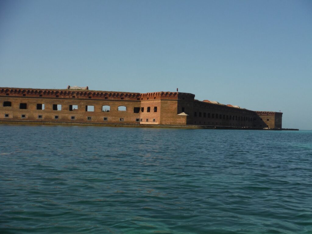
But the fort didn’t stay abandoned long. Before the Century was out, the navy maintained a coaling station on the island. They also operated a large desalination plant for fresh water for navy ships and personnel on the island. However, this was short lived as the navy abandoned its coal burning ships for oil burners. 

In the afternoon a three-some of peregrine falcons show up, perched on the fort’s ramparts. Obviously, there is one too many and there seems to be some kind of courting ritual going on. Their presence, however, affects the behavior of other birds around us. When they take to the air, the birds around our campsite hang close to the ground, even flying under the picnic table where I sit. I suppose we are of less threat to them than to be attacked in mid-flight by a hungry falcon.

Ferry from Key West

Out last day was busy as we had to have everything back at the ship by 10:30 AM, so that they could load everything. Thankfully, the ferry also had freshwater showers which allowed us to clean up before the trip back to Key West. We had four beautiful sunny days on the island.  

A Solo Paddle to Cape Lookout

I rolled over a few minutes before 5:30 AM and glanced at the sky. The stars are beginning to disappear, but bright above the eastern horizon were Jupiter and Venus, separating from their conjunction a few days earlier.  Although I wasn’t planning on it, I dozed off and woke at 6 AM. Not wanting to miss the sunrise, I jumped up, quickly dressed, and trotted across the island to the ocean side. I’d missed a sunset the evening before as cumulonimbus clouds covered the horizon. After dark, these clouds produced a spectacular lightning show on the horizon. Thankfully, the storms stayed well inland.  
As I crossed the dunes, the sun appeared. It was a beautiful start to a lovely day.
Paddling Over
I had paddled over to Cape Lookout from Harker’s Island the day before. I started paddling approximately two hours after high tide, assuming I would ride the falling tide out through Barden’s Inlet. I wasn’t counting on 18 mile-an-hour winds out of the Southwest. The wind in my face made for a tough paddle. As the wind was against the tide, it created a chop on the water. The paddle across took two hours, twice as long as I thought it would take to make the 4.5 miles paddle. My plan had been to camp on the beach side, but the wind was high enough that I found a nice place a few hundred yards south of the lighthouse. After walking around the lighthouse grounds, I fixed dinner at sat watching the night fall as several sailboats along with a Coast Guard cutter and a trawler moored for the night in the safety of Lookout Blight. As the skies darken, I could see lightning in the clouds to the west, but the sky above was clear and full of stars. Shortly after dark, crawled into my bivy tent. I was tired and ready for rest. Sleep came quickly. I woke up a couple of times, looking up at the summer stars as Scopious and Sagittarius climbed higher in the southern sky. 
Lighthouse and assistant tenders home
After my early morning walk out to the beach to catch the sunrise, I came back to my camp and fixed breakfast (oatmeal and perked coffee). I enjoyed a pot of coffee, as I began to read Billy Beasley’s newest book, Home. 
After packing up my gear and pulling my kayak beyond the dunes so it was not too noticeable, I set off on a hike. While I have been to Lookout many times, including camping in the woods north of the Lighthouse, I have never explored the island. Those late fall trips, which were always with others, main purpose was to fish. This time, I wanted to walk around the cape.
snake beside the water
Stuffing a water bottle and some food into a pack, I headed south along the inlet side of the island. Along the way I saw pieces of old ships that had floundered in these waters. I passed a number of old fishing shacks as I made my way to the village that once contained a Life Saving Station (where those in attendance would take surf boats out to save the crew of ships floundering in the offshore shoals). Later, the Coast Guard maintained a station here, and during the Second World War, the army stationed troops here and built machine gun bunkers as well as maintained artillery capable of firing upon enemy submarines offshore. They even had a landing strip and kept planes that were used to spot submarines in the shallow water

flowers among the dunes
me
part of a hull of a wrecked ship
Old Life Saving and Coast Guard buildings
I walked through the wooded areas which are covered with pines. I found the trees odd for a maritime forest, as they generally consist of more hardwoods like live oaks. But a historical interpretation sign indicated that the pines were planted between the 1940s and 70s.  My first stop was at the jetty, a rock wall jutting out into the ocean to control erosion and to keep the inlet from closing in. I stopped for lunch, and then took off my shoes as I planned to walk back in the sand along the water.
 
From there, I headed toward the cape. Along the way, I picked up several old balloons to properly dispose. I wish people realized the danger of letting helium balloons go as they often end up in the ocean where large fish see them as jelly fish. Thinking they are getting a snack; they eat the balloon and die.
 
At the cape, there were a many people who had backed up their trucks and were fishing. These trucks would have been hauled over on a ferry to the north end of the island and then driven south to the cape. I only saw one fish caught, a small shark. I continued walking north, along the ocean, toward the distant light house. 
the lighthouse from the cape
 
Horse on Morgan Island

After walking probably 8 or 9 miles, I got in my kayak and paddled over the Shackleford Banks, a barrier island that runs east to west. I hoped to see some of the wild horses on the island as I paddled around it. The tide had just started coming in and the waters were very shallow. I final found several horses on Morgan Island, but to the reach them involved walking my kayak in inches of water, as I was on the shallow side of these islands behind Shackleford.  I arrived back at Harker’s Island at 7:30 PM. I quickly loaded my gear into the car and stowed the boat on the roof rack. By 8 PM, I was off to find something to eat on the mainland. Later, as I tired, I stopped at a hotel in Kinston, breaking up the drive back to the mountains. 

Cuppy and Stew (and a moon-rise)

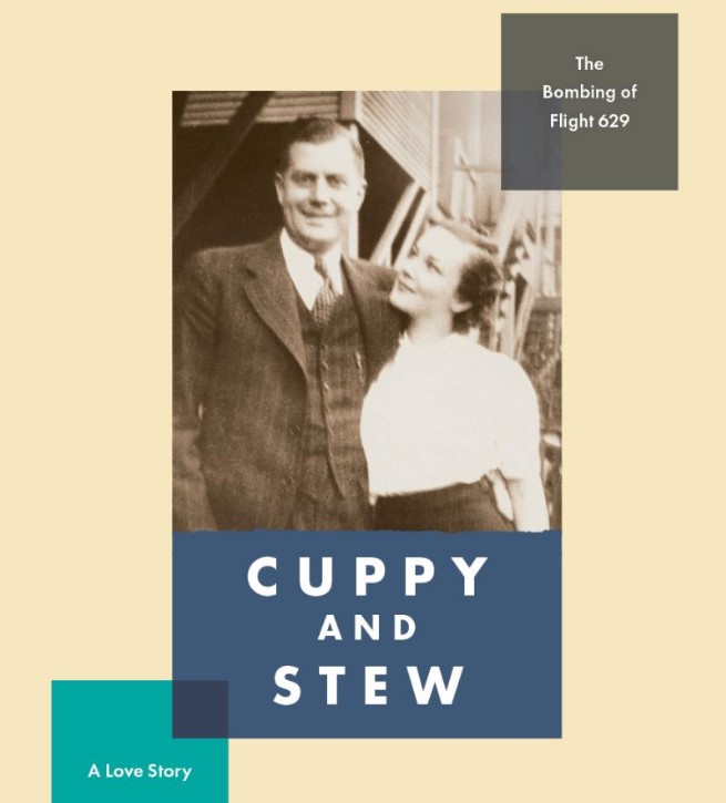
Eric Goodman, Cuppy and Stew: The Bombing of Flight 629, A Love Story (San Francisco: IF SF Publishing, 2020), 220 pages with a few photographs.

The narrator is Susan, the youngest daughter of Cuppy and Stew, who died in the crash of United 629 in 1955. She and her sister, Sherry, are orphaned and sent to Canada, where their parents are from, even though they were born in South Africa and were living in the United States. The book nicely divides in half, with the first part providing us the background of their parent’s steamy romance. This led their father accepting a position as a mining engineer in South Africa. Then came the Second World War. Stuck in South Africa, they had two kids. After the war, they move to the United States and are living near Chicago. With the father having been estranged from his family (I won’t give it away, you will have to read the book to learn why), the girls maternal grandmother stays with them while their parents travel by plane to the West Coast. They change planes in Denver, at which time their lives unknowingly intersect a disturbed young man who had stashed a dynamite bomb in his mother’s suitcase. The man then purchased insurance on his mother. The plane, which should have been high over the mountains when the dynamite exploded, had been delayed and was only ten minutes into the flight. Everyone died, but because the crash was over farmland, it was quickly discovered how the plane crashed and who had done the deed. The bomber’s pending execution hangs over the two girls.

After the crash, the girl’s adolescent years in Canada are horrible. They first live with the grandmother who has many problems of her own. Then there are other relatives and foster families and a boarding school. The girls face abuse-emotional, physical and sexual. Susan, the narrator, is able to escape (she goes to Northwestern for college), while Sherry is trapped and unable to escape the dysfunctional situation she and her sister found themselves in as younger girls. The book is both hopeful and sad. There are adults whom the reader will want to slap upside the head and ask why they have to be such a monster or so cruel. And there are others who do what they can to look out for the girls. Children should never be pawns. Sadly, however, too many are pawns in an impersonal world, as show in this story.

This is a very personal book for Goodman. While it is book of fiction, it is based on his wife’s and sister-in-law’s story. Their parents died on United 629. The book reads well and quickly. This is the second book I’ve read by Goodman. Two years ago, in preparation to taking a writing class from him at the Iowa Summer Writing Festival, I read and reviewed his book, Days of Awe.
###

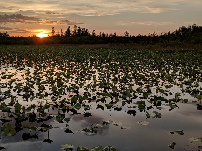
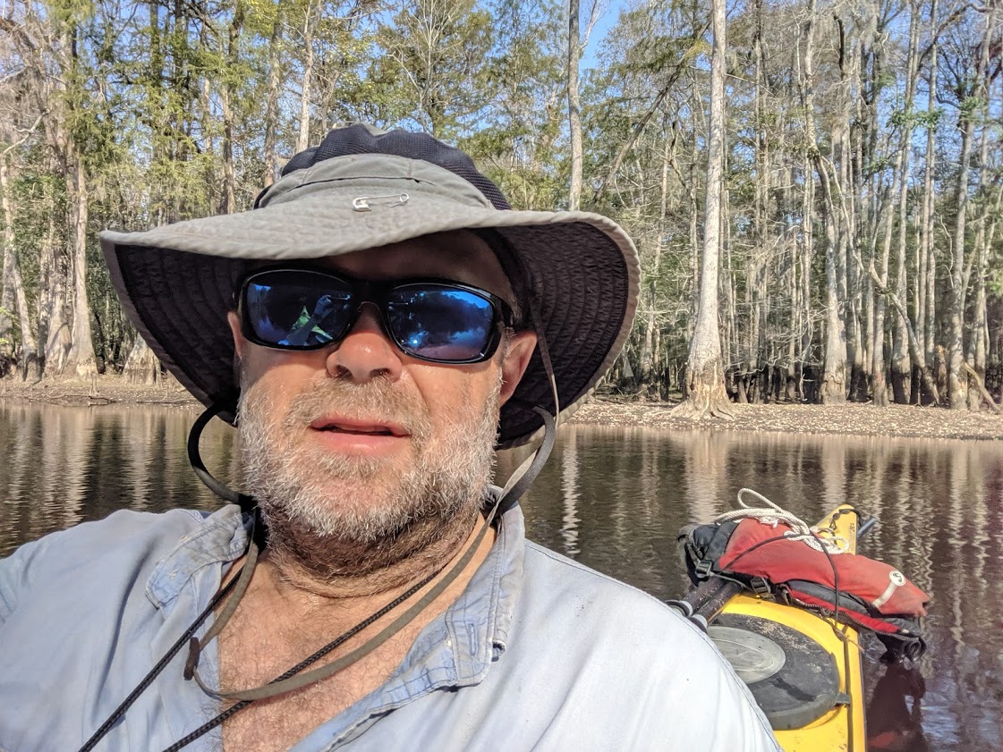
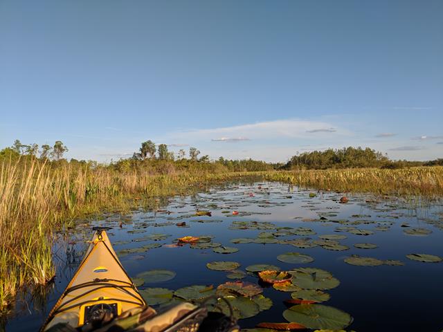
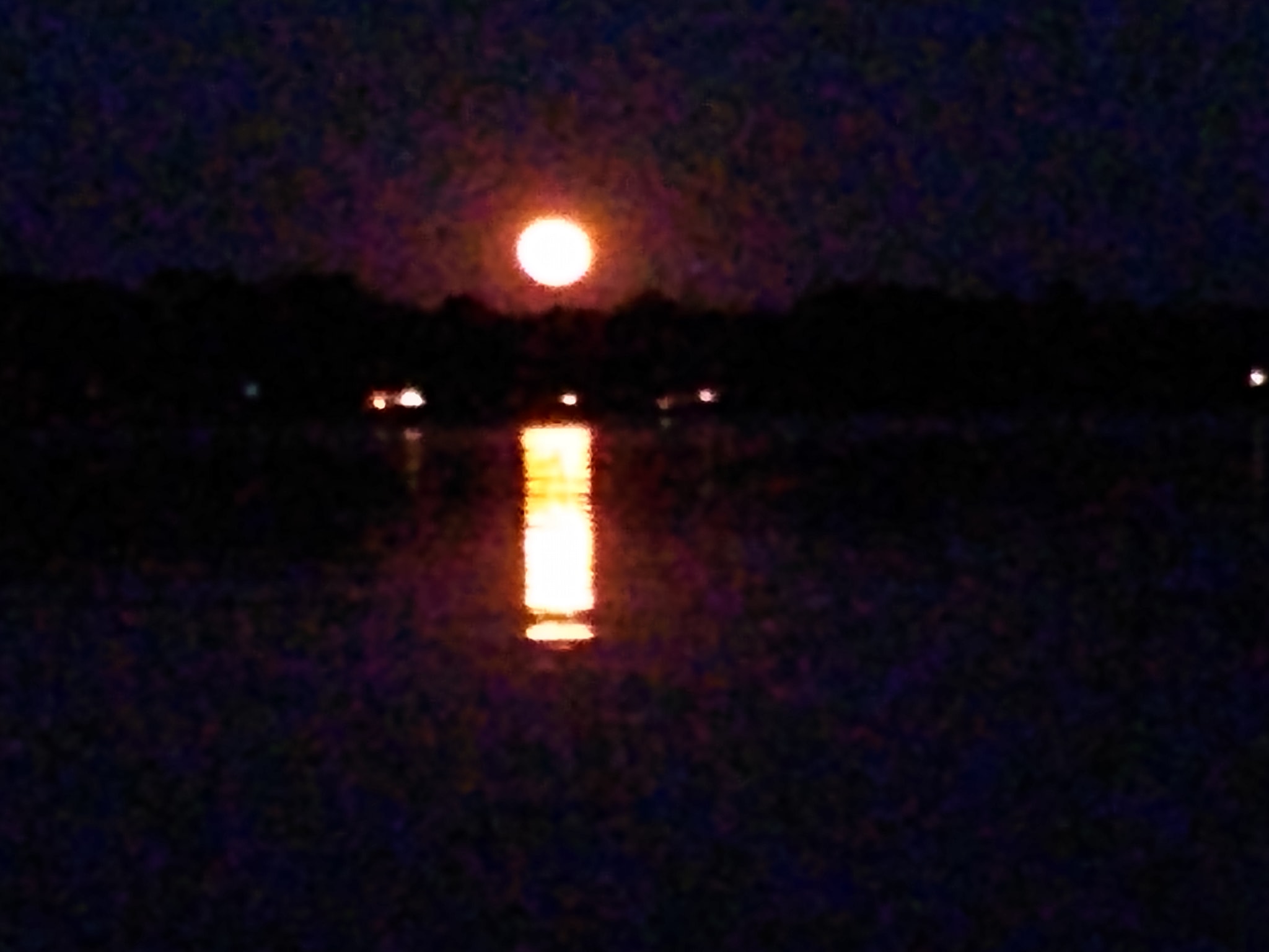
High tide last night was at 9 PM. I went out around 8 PM, catching the last of the sunset and then watching the moonrise, paddling around Pigeon Island (approximately 5 miles). The tide was very high and I could easily go through the marsh. Here’s a poor quality photo taken with a smart phone from a kayak that was slightly rocking from the gentle waves. The photo doesn’t do the view justice. It was an incredible sight and the paddle was delightful


Making the best of things during a pandemic

lunch and morning coffee included

Surprisingly, things have been pretty busy for the past six weeks. You’d think t hat wouldn’t be the case since many places are closed down to visitors so I’m not making hospital or nursing home visits. Our office is closed for public visitation, but since they’re all separated, some of us still come in. Learning how to keep a congregation somewhat connected during a time of pandemic has taken it’s toll. Nothing is as easy as you’d think. The main thing that has keep me sane is that I’ve been able to regularly bike to work–which is good for the 3.2 miles each way gives me some physical exercise since the fitness center is closed. Plus, if I’m not going to the hospital, I don’t need a car, and since people only see me via a zoom camera, I can wear a dress shirt and shorts!  That’s me, riding to work one cool morning this week.


But by last week, things were clicking and I was able to get out on the water twice. Last Wednesday, I paddled over to Wassaw Island, took a nap and did some reading and writing while on the island, then paddled back. It’s about five miles each way. While I paddled with the tide, I had quite a wind against me heading out (thankfully the wind was to my back when I paddled home.

Nap Time on Wassaw

On the two trips I did, I decided to try to do a “devotion” from my kayak. I recorded these on Facebook live and had a lot of folks watching and commenting. Then I copied and posted in my newly created YouTube channel, so you can watch. I need to learn to do this a little smoother, but I’m curious as to what you think. The first (3 minutes) is a prayer by a favorite Scottish theologian of the early 20th Century, John Braille. The second includes two poems (one by Mary Karr and the other by me) along with a Puritan prayer. Clink on the links below:

Earth Day Prayer

Two Poems and a Prayer

Friday, Paddling around Pigeon Island

How are you surviving the pandemic? I hope you have been able to get outside–it’s a great way to enjoy while creating social distance.

Paddling the Lumber River with my Dad (September 30-October 2, 2019)

A high bluff along the western bank of the Lumber River just south of US 74, Pea Ridge is a lovely spot. We arrive early enough to enjoy it. For a wilderness site that is only accessible to the public from the water, this is near perfection. There are a few benches, a picnic table and a trash can and grass! Across the river stands several huge cypresses, their needles turning brown. Around us are a variety of trees. The bank of the river is lined with cypress and water birch. The site itself features sweet gum, maple, sycamore, pines and holly. I place my hammock between trees and find a mossy place to set up my tent so that I have a good view of the river. After setting up camp, I lie in my hammock resting and reading for an hour, then go for a swim before dinner.

This is our second night on the river.  We’ve covered 14 or so miles after launching at Matthew Bluff bridge late yesterday morning. The first day was supposed to be easy for we knew it was going to take time to shuttle vehicles. Not wanting to leave a vehicle at a bridge for two days, Joe Washburn, the pastor of First Presbyterian in Whiteville agreed to help us with the shuttle. After we got everything ready and loaded in our boats, we slid them down the muddy bank into the river. My dad has his boat in the water first but falls into the water as he tries to enter his boat. The river drops off quickly. After fishing out his equipment and restowing it, we were soon on the way. The river around the Matthew Bluff bridge was trashed with beer and soda cans and household waste, as some people treat the area as a dump. Thankfully, after a couple turns, the river becomes more natural. We’d been warned when we presented the ranger with our float plans that the river had not been cleared of blow-down trees since Hurricane Florence. That was a year ago. Sadly, they’d just finished clearing the entire 100-mile waterway from on Drowning Creek and the Lumber River of down trees from Hurricane Matthew which occurred in 2016 a month before Florence struck. He told us to be aware that there would be some blow downs above Boardman (Highway 74). He was right. About a mile into our trip, we came across the first, a huge old oak that laid across the river. The water was deep and I pulled my kayak parallel to the log, slid out of the boat and straddled the log (as if I was riding a Clydesdale, pulled my boat over the log and tied it off and then helped my father get his boat across. Thankfully, there were no problems and we were soon on our way.

After crossing the Willouby Bridge, four or so miles down the river, we came to another blowdown where we had to get out and cut a path for our boats to make it through the branches of the down tree. Our first campsite, Buck Landing, was a mile or so south of the Willouby Bridge, on the east side. I kept wondering when the site was going to show up, as I saw few pine, trees that indicate high ground. This area was swampy and populated with cypress, tupelo, river birch and a few bay trees. But soon after wondering where the pines were, they appeared and right afterwards was the campsite.

my tent at Buck Landing

Like Pea Ridge, Buck Landing was also a wilderness/canoe-in site but with easier access by locals as the one trash can “over-runneth” with beer cans. I spent a good deal of time emptying the trash and crushing the beer cans so that they were all able to be contained within the provided can. Although I may be mistaken, I was pretty sure the no one had paddled the river with that many cases of beer. This site also had a small pavilion, which wasn’t needed due to the clear skies, but the supports made a good place to sling my hammock. As the site was on the eastern side of the river, we saw a nice sunset through the hardwood swamp on the other side. Shortly thereafter, a thin crescent of the new moon was visible. After a dinner of some MREs that my father had brought along, we both decided to avoid the mosquito battle and headed off to bed, listening to the owls hoot and the buzz of insects.

The next morning, I’m a little panicked. When I pulled out my glucose test meter (I am a diabetic) to check my blood sugar level, it wasn’t working. I wasn’t bothered too much until I made my way over to my boat and pulled out the small dry bag I always carry with me whether kayaking or sailing, in which I keep a backup meter. The battery was dead. As they are different kind of meters, I can’t change the battery from one to the other. I wasn’t sure what to do, but my father was more concerned than me as he’s never dealt with diabetes. I told him I thought I would be okay and hopefully I could get a new meter when we crossed US 74 at Boardman, later in the morning.

cutting our way through a blow-down so we can push the boats under

After breakfast of coffee, an orange, and oatmeal, we shoved off a little after 9 AM. It was to be a difficult morning. It takes two hours to cover just a few miles as we spend almost as much time in the water as in the boat as we pulled over, under, through, and around fallen trees. When we weren’t pulling ourselves through down trees, we enjoyed watching kingfishers dart up and down the river, and great blue herons led us downriver when we interrupt their hunting. I even saw a red tail hawk. Throughout the morning, I keep snacking, not wanting my blood sugar to drop.  After two hours of exhausting work, we finally get to where the river opens up more. Then, maybe a mile from the bridge, we passed a fisherman who’d pushed a jon boat up the river with a small battery powered motor. Only then did we know we were done with blowdowns.

Going over a blow-down

At the wildlife boat ramp at US 74, I knew better than walking into the village of Boardman. It used to be a large town, back in the early 1900s when the area was heavily lumbered,but the only business left today is a gas station. I tried calling local pharmacies in Fairmont and Chadbourn, hoping to find one that delivered. Unfortunately, as it was now noon, all their delivery drivers had gone out to make their daily runs. They laughed when I asked about Uber or Lyft.  But, while I was waiting, with my meter out in the sun, it began working again, which made me pretty sure it was a problem with humidity. Being able to see that my blood sugar was in a good range, we continued paddling another mile to Pea Ridge campsite.

For being in his 80s, my dad did well on this trip!

Notice the grass around the fire pit

That night, we built a fire and talk. For some reason, my dad asked me about which of his guns I want him to leave me. While I have guns (all of which are in need of being oiled because they haven’t been shot in decades), I’m not a gun collector. All my guns stay locked up in a gun safe. But I told him I’d take the 30-30 Winchester lever action in case I move back out west. He suggests instead taking a higher powered gun, but I told him the Winchester was enough. Then he asks about shotguns and I was surprised to learn that he has a 20 gauge double barrel coachman (short barrel gun that those who rode “shotgun” on stagecoaches carried). What are you doing with that? I ask. “It’s your moms.” “What?” Then I learn the story. They were visiting my great aunt who, after my father’s uncle had died. She lived by herself out in the country. My mother asked if she wasn’t scared living out there. She said no, and showed my mother the gun. My mom, who I am sure was trying to be nice or trying to make a joke, said “maybe that’s what I need.” Well, lets just say, “I don’t think her next birthday went over well.”

Pea Ridge Campsite launch

After crawling into bed, I have a great view of Cassiopeia, Pegasus, and Andromeda, rising over eastern bank of the river. I fall quickly asleep and wake up once before morning. Taurus is overhead and Orion is rising just behind him.  It must be well after midnight, but I don’t check the time and when I wake up again, it’s dawn. I get up, write a bit, then prepare coffee and water for oatmeal.

timbers left over from an old logging railroad


not what I thought Paradise would look like…

Queen Anne Landing

We’re on the river at 9 AM. It’d been cleared from here on down to our takeout point at the State Park at Queen Anne’s Landing. It was an easy 9 ½ miles. Down trees are not a problem, but at one place there’s a sandbar that runs across the river and we end up getting out of our boats and pulling them across it. After a lazy float, we arrive at the landing a little after noon.


The Lumber River is located in Southeastern North Carolina. The river starts north of Laurinburg, as Drowning Creek and wanders 115 miles as it passes the city of Lumberton and the town of Fair Bluff on its way to merge with the Pee Dee RIver a few miles into South Carolina. The state of North Carolina maintains a linear park along the river from the 15-501 bridge to Fair Bluff. In 2016, Hurricane Matthew dropped so much water into the river basin that much of Lumberton and Fair Bluff were below water. I used to work this area back in the early 80s for the Boy Scouts of America. At the time, Fair Bluff was a delightful small town. Today, the town is mostly deserted. To learn more about the river, check out the Lumber River State Park website.

that’s me (a selfie)


Days 4 and 5 in the Okefenokee (May 6-7)

This is my third and final post about a 5 day, 4 night paddle in the Okefenokee Swamp. The map shows our route as we started at Kingfisher and paddled to Maul Hammock platform. I wrote about this on my post for Day 1. From there, we paddled to Big Water on Day 2 and to Floyd’s Island on Day. This is covered my post on Days 2 & 3.  Counting the extra miles I paddled on Day 4, I paddled a little over 50 miles in 5 days, covering a variety of wilderness settings. 

Map of the Okefenokee. We put in at Kingfisher Landing, spent nights at Maul Hammock, Big Water, Floyd Island, and Round Top, and took out at the Suwannee Canal Recreation area.

The storms clear out early Sunday evening while we camp on Floyd’s Island. After dark, we can see the stars overhead, through the trees, along with hundreds of lightning bugs, more lightning bugs than I’ve seen since I left Michigan. Of course, there are also mosquitoes and biting flies. In fact, the biting flies are so bad that when away from the fire, I find myself wearing a bug net over my head. But things are fine once I crawl into my hammock where I read and catch up with my journal before falling asleep. On Monday, we plan to make it an early start as Gary needs to get back home in order to be at a meeting on Tuesday morning.

East side of Floyd Island (Notice cart for portaging gear)

We wake early and begin to pack up our gear. As we’d portaged our kayaks across Floyd’s Island the day before, we quickly eat some fruit and granola and haul our gear down to the boats. After loading up, we cast off into a narrow trail clogged with cut chunks of logs. The last time I was here, this trail wasn’t even open. A hurricane several years earlier had clogged the trail with down trees. It appears as if someone came through with a chainsaw, cut the down trees into firewood lengths of logs, and left them floating in the water. Because the logs are small, we can pushed them under the bows of our boats or push them off to the side. While it is hard work, it’s doable. After a hundred or so yards of difficulty, the path clears from logs

Egret in Chase Prairie

Like the path into the island from the west side, the east side was fairly narrow, but is only a mile or so long. It’s also fairly shallow and we follow (chase?) a rather large alligator (13-14 feet) for a while. He’ll come up, look at us, and then swim fast for a ways, before stopping. I’m pretty sure it’s male, for females don’t generally grow this large. As we paddle straight ahead, we soon close back in on him, and he takes off again. He does this several times until he finds a place to leave the channel for the swamp. All I can figure is that water is too shallow to dive and let us pass over top, which is what the alligators normally do.

After thirty minutes of paddling, the heavy vegetation departs as we entered Chase Prairie. A few hundred yards later, we came to the point where the trail runs back up through Bluff Lake to Kingfisher Landing (where we had started our paddle on Friday). I have been to this spot a few years before, on a solo trip with an overnight on Bluff Lake platform. But instead of turning north, we turn south toward the Suwannee Canal, 2 1/2 miles away. Along the way we pass the turn off for Round Top platform, where I plan to camp for the evening. It’s just three miles down the purple trail. I decide to go around the long way to make sure that Gary finds the Suwannee Canal, which will take him back to the main entrance to the swamp.

This is my third time in Chase Prairie and, like the other times, there are plenty of alligators around. The prairie is fairly open with lots of pitch plants and irises in bloom. There are also a number of egrets and herons around. In the distant, I can hear the calls of a sandhill crane.

When we reach the canal, the path opens up with the tall trees forming a nice canopy blocking the sun. We paddle south, and shortly after the 9 mile marker (the mileage to the main entrance where Okefenokee Outfitters is located), Gary and I say goodbye. He continues paddling on straight, while I slip through a channel that takes me back into Chase Prairie. I have a reservation for one more night at Round Top platform, which is about two miles back into the prairie. The sun is up and its warm, but the paddling is easy and a little before 11 in the morning, I arrive at the platform. I’d stayed here once before and it is by far my favorite place to camp in the swamp as it has nearly 360 degree views of the swamp.  Getting out, I set up camp, fix an early lunch and then catch up with my journal. Later I start reading. I’m only half way through David Halberstam’s The Fifties and with nearly 400 pages left, I have plenty to do to occupy my time.

Late afternoon paddle

After an afternoon of reading and napping (I found myself enjoying two nice naps), I put the kayak back in the water and paddle north on the purple trail which takes me, after three miles of paddling, back to where we had been earlier in the morning. I had not paddled this section before and am glad I decided to make the effort for its beautiful, especially as the light softens late in the day. On the way down, I see an alligator catch a duck by the tail. The duck is flapping and the gator, which is in very shallow water, drags the duck toward the channel, where I am located. Seeing me, the gator pauses and the duck quickly flies away. I assume the gator had planned to drown the duck in the deeper water and enjoy duck for dinner. I also spot a pair of sandhill cranes.

Paddling back in the evening light
mileage sign on purple trail

As I come back after a six mile paddle (three up and three down), I notice the crescent new moon is in the west. Most of this trip was in the dark of the moon, but not that I could tell it as the clouds had pretty thick. In the east, the sun sets as I snap a few photos. Then it is time to fix dinner, some noodles and canned pork. Twenty minutes after the sunsets, the mosquitoes appear as soon as I can finish my dinner and clean up, I crawl into my hammock, under the safety of my bug net.  I wake up in the middle of the night and step to relieve myself. In the south, Scorpius and Sagittarius are just above the horizon. But the mosquitoes soon find me and I crawl back into my hammock.

Around 3 AM, I wake again, as I was the first night, to what appears to be the sound of a chainsaw attempting to be started. Soon, all over the prairie, alligators are bellowing and making this weird sound. I listen off and on, between snoozing. They are so loud (one sounds as if it might be underneath the platform), that I can’t hear the mosquitoes buzzing just outside my netting. They continue on till dawn, and by the time I get up, they are quiet.

In the morning, I fix coffee and oatmeal for breakfast and enjoy eating slowly, taking in the sights. I leave around 9 AM and paddle to Coffee Bay platform, where I stop and rest, taking time to read a few chapters in my book, before resuming my paddle. I don’t see anyone until I run into a couple fishing in a jon boat a mile or so from the entrance into the swamp. They are the first people I’ve seen well over 24 hours. I am back to entrance at 1:30 AM. After loading my gear in the car and putting my boat on top, I am soon heading north to Savannah.

Click here to go to Day 1

Click here to go to Days 2-3

Pitcher plants in bloom

Adventures in the Okefenokee, Days 2 & 3 (May 4 & 5)

Preparing to leave Maul Hammock

This is Part 2 of a 3 part series on a recent trip through the Okefenokee Swamp. Click here for part 1

It is amazing how tired one can be after a day of paddling. Last night, we both were in our hammocks about 30 minutes after sunset, when we were suddenly bombarded by mosquitoes. For a while, I tried to read, but found myself falling asleep to the sound of night, frogs croaking and insects singing. The most bothersome insects, mosquitoes, were just inches away, on the outside of the hammock’s netting. I wake only one during the evening, to find my left arm pressed against the netting. Several mosquitoes had already feasted upon me through the net. The next time I wake, it is getting light. I hear the mating roar of a few alligators around the edge of the lake. They sound like someone trying to start a two cycle engine, such as an old boat motor or a chainsaw.  I get up. With long pants and a long shirt and a little repellant, the mosquitoes aren’t too bad. I decide to fish a bit while Gary slept in.  There were only a few open places around the hammock where I am able to drop a popping bug on a fly rod.  After a few casts, a fish rises for the bait, but doesn’t take it and soon, I have an alligator friend, a small dude about four feet, watching me. Knowing what I’m doing, like a good friend, he’s ready to help me take any fish off a hook without me getting my hands all slimy. Sadly, for him, I don’t have another bite and, when I put my rod away and began to make breakfast, he heads back under the lily pads in search of his own breakfast.


Gary paddling in Maul Hammock Lake

With only a little over ten miles to paddle to the next platform at Big Water, we take our time getting ready. The morning is gray with a light breeze. As soon as the sun rises, the mosquitoes mostly disappear. We enjoy a breakfast of oatmeal and coffee, finish drying out our clothes from the day before, and pack up. At ten, we leave the platform and paddle toward what we thought was the exit from lake only to find that we’ve missed it. In the high lily pads, it takes us several attempts to find the narrow channel that leads us back to the red trail. As it was with the last five miles the day before, we are often paddling through lily pads that are high and require and extra effort to push our boats through. It’s exhausting work and soon I’m sweaty.

Shortly after leaving Maul Hammock, the trail begins to look more like a regular stream bed as we are entering the headwaters of the Suwanee River. We spend the rest of the morning and into the early afternoon fighting through the lily pads, making a measly mile and a half an hour. The highlight of this day is seeing a large owl fly out from the trees just over me and down the river, where he gains elevation until it’s above the trees and then it turns and leaves the channel and flies into the swam. At one in the afternoon, when we break for some lunch, which we eat in our kayaks. We’ve covered less than five miles. Shortly after lunch, we arrive where, sometime in the past few months, they’ve cut back the lily pads with a machine mounted on a small dredge that chops up the lily pads roots. These roots or rhizome, when floating on the surface, look a lot like an alligator. Despite the looks of the floating rhizomes, the paddling is now easy.

A selfie with Gary in background

We arrive at Big Water platform at 3 PM. There’s a group of three guys who’d paddled up from Stephen Foster State Park. They are taking a rest before paddling back out, as they were not planning on staying the night. They have a cooler with them and offer us a cool beer. I enjoy not just drinking it, but putting the cold can on my sweaty forehead. This platform is on the western edge of a wide spot in the river, with nice views of the cypress line stream in both direction.  Later that evening as we prepare dinner, we notice how the bullfrog chorus will seemingly start in one direction and slowly make its way up or down the river, almost like a wave makes itself around a ball park. There are also a number of alligators and we watch several of them argue over territory (or mates).  I spend a few minutes fishing but have no luck, but as it was in the morning at Maul Hammock, an alligator stands on point, waiting for something to bite my line so he (or she) might help me keep my hands clean by relieving me of any fish I might catch. There’s a journal in the shelter register and someone suggests that if you hook a fish, you have to reel very fast if you want to keep it away from gators. With all the good food we have with us, we are not going to starve without fish. Instead, we enjoy a peaceful dinner along with a couple of ounces of Woodford Reserve Bourbon (Gary brought the good stuff) as we watch the light fade in the evening. Again, soon after the sun sets, the mosquitoes are back out and we head to our respective hammocks.

Big Water Platform (notice privy in the background)

Sleep isn’t quite as deep this evening. I leave the fly off my hammock in order to get maximum airflow, but at 1:30 AM, a storm is approaching. I get up and put my fly on (while we are under a tin roof, it’s not that wide and the rain will be blown under the roof). Next, I make sure that everything is put up and secured and won’t blow away. Once done, I watch the approaching lightning turn the swamp into a magical place as the cypress and their bearded Spanish moss are silhouetted by the flashes of light. Soon, instead of flashes, we there are streaks of lightning dancing across the sky. I’m in awe. The wind picks up and I get back into my hammock in order to stay dry. Soon, I’m asleep, but wake up several more times as more storms move through the area.

Paddling through Big Water

When I wake in the morning, there is still thunder to the south. But the birds are singing throughout the swamp and the heavy humidity is moderated with an occasional cool breeze. Gary has brought along a can of corn beef hash along with eggs. We have a feast for breakfast, taking our time as we have a fairly short day paddling to Floyd’s Island.


Notice young cypress growing in a burned over area


We leave Big Water at 10 AM.  The river stays wide for the next mile or so, then it narrows up into channels where there is some flow of the water, but with tight turns that I often have to stop and backup to get my big kayak (18 foot) through the passage. We paddle through areas that have been burned in fires. Over the past two decades, there have been several summers in which the swamp and surrounding areas have experienced massive fires. But the good news is that the cypress is coming back and are standing eight to twelve feet tall. But it is still sad to see many of these burned out areas, but fire is a natural part of the ecosystem and they open up opportunities for new species of plants and animals to thrive.

Five miles south of Big Water platform, we come to the cut off trail to Floyd’s Island. Both Gary and I have been here before, when we paddled into Floyd’s Island from Stephen Foster State Park. The canal pathway takes us across the bottom of Floyd’s Prairie and then narrows up into a tight tunnel like passage where paddles are used for poling instead of paddling. It rains off and on, but never very hard. Before we know it, we pull up on the sandy beach. We are at Floyd’s Island and it wasn’t even 1 PM. We’d paddled 7 ½ miles.

Floyd’s Island Cabin

Floyd’s Island is named for the leader of the Georgia militia who invaded the swamp during the second Seminole war in 1838. His men found and burned a Seminole village, and named the island for him. They then continued to bushwhack through the swamp. As they headed into the swamp, they were in good condition and well equipped. When they came out on the other side, having done something no Europeans had done, they were ragged, but they had conquered a vast unknown section of the country. Floyd was both intrigued and horrified at the swamp. He called it a most beautiful and an infernal place.


With all afternoon to kill, we haul our gear up to the old cabin on Floyd’s island. We string our hammocks and set up a living room on the front porch. The back of the cabin is blocked off because a huge pine had fallen and crushed part of the back of the cabin. The last time we were here, in 2015, Gary and several others (there was a group of nine of us) slept in the cabin. I decided that night I would stay in my hammock. After hearing about the rats, I assumed I’d made the right decision.


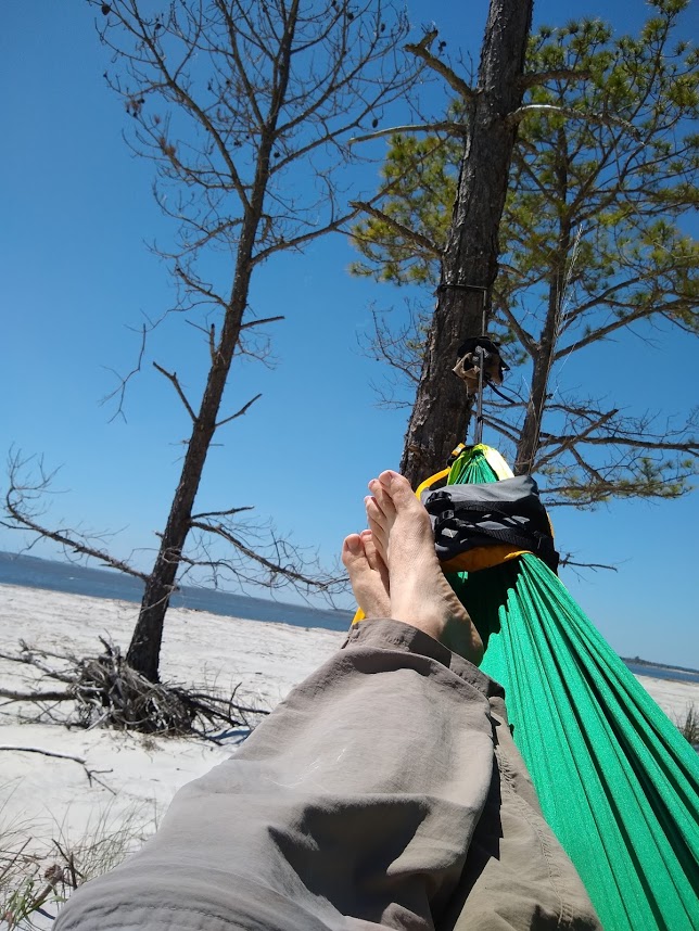
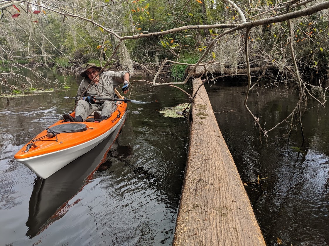
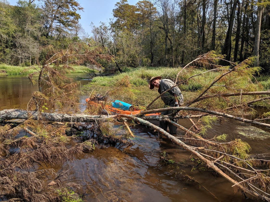
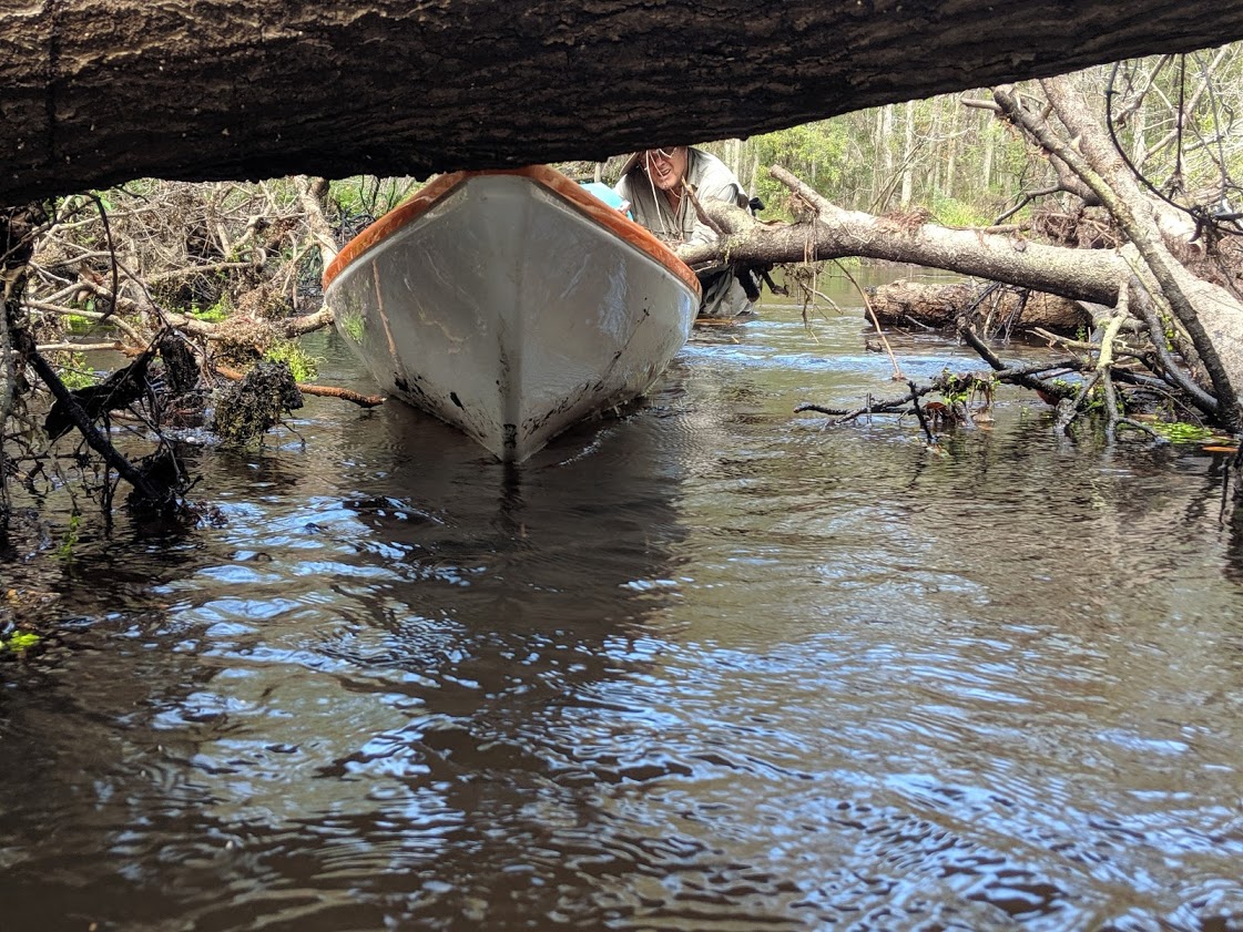
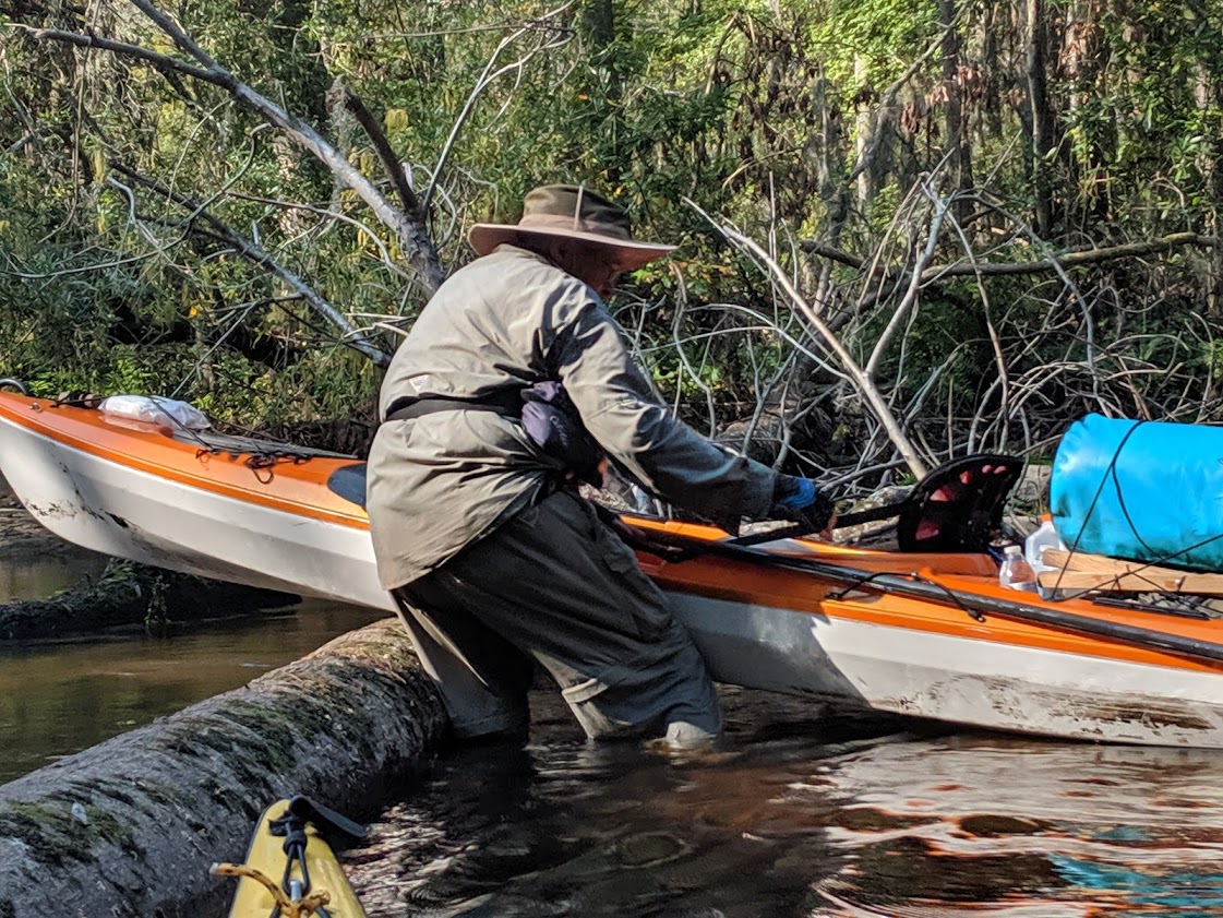
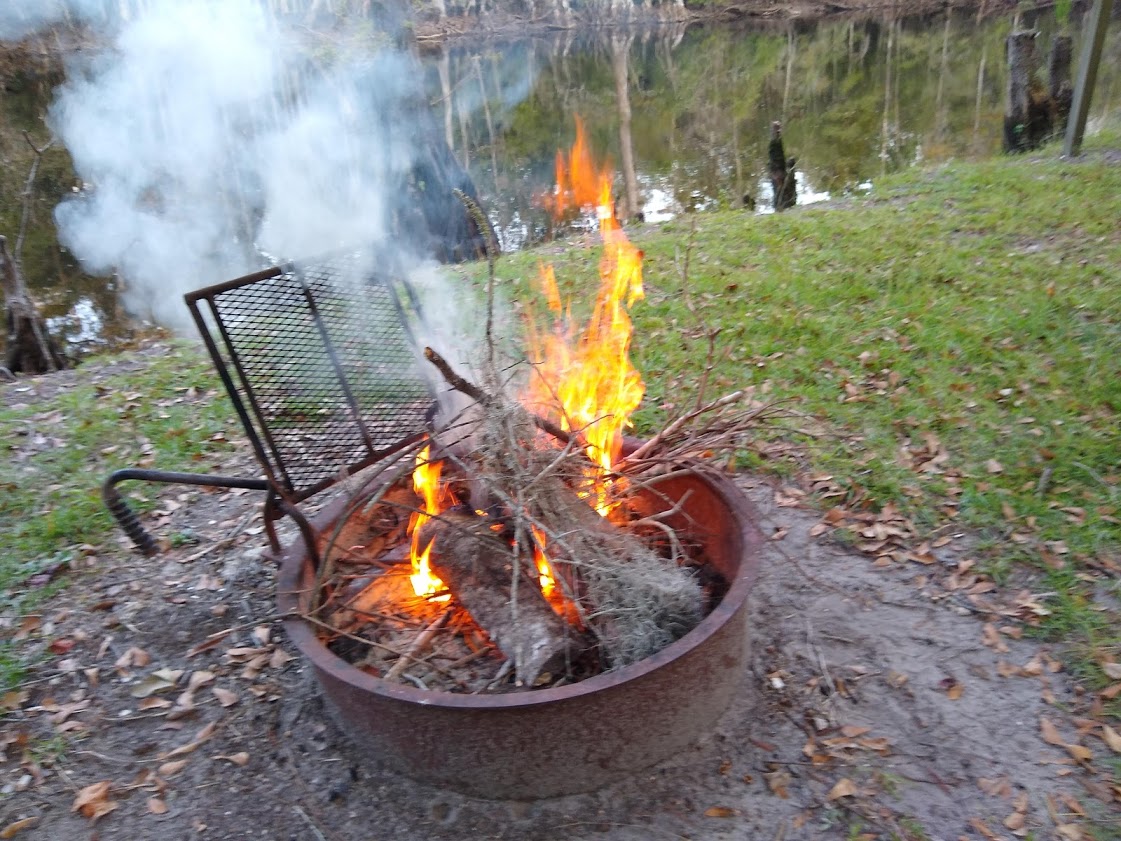
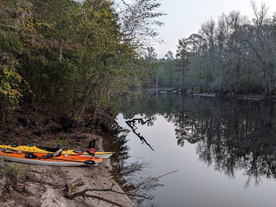
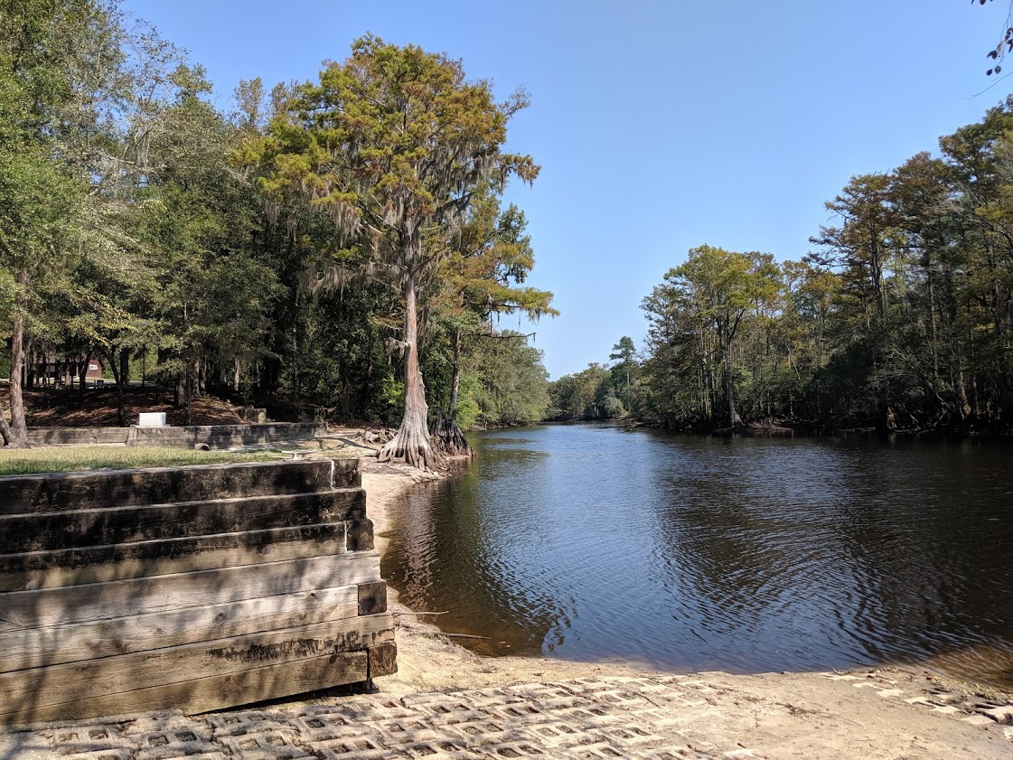
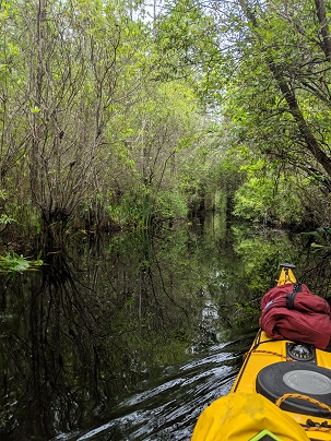
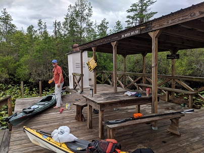
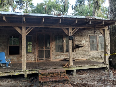
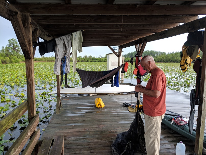
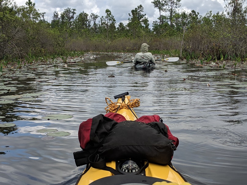
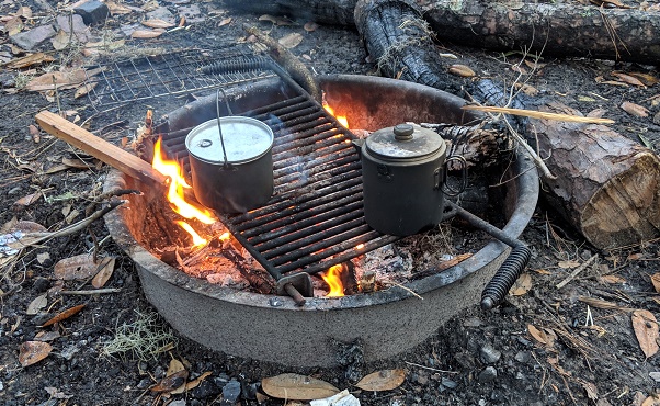
We eat lunch under the front porch during a downpour. A turkey and a fawn with spots make their way through our camp as we wait for the rain to clear. Later in the afternoon, when the storms have cleared, we move our kayaks, portaging over the quarter mile or so of the island, so that we’d be ready for the next day’s paddle. That evening, we cook over an open fire. The smoke helps deter the biting flies. We enjoy crackers and cheese, party nuts, along with some Johnny Walker Black Label. Again, I’m impressed with Gary’s beverage selection. I’m saving my cheap bourbon. Tomorrow, Gary will paddle out of the swamp while I will stay for another night.

Write up of Day 2-3

Write up of Day 1

A final view of Big Water

Day One in the Okefenokee (May 3)

Paddling through a prairie (before Double Lake)

Old Railroad logging skidder

We leave our vehicles at Okefenokee Adventures where we have arranged for a shuttle to our put-in site some twenty-five miles to the north. In five days (four for Gary, who will leave a day before me), I’ll come out of the swamp here. Our shuttle driver is a retired mechanic from CSX railroad. As he drives us to Kingfisher Landing, he points out old Hard-shell Baptist Churches that still sing shape-note music. When he hears that our first night will be at Maul Hammock, he tells us the story of the first reported account of Bigfoot, which occurred in the early part of the 19th Century near where will be camping. Seven men went into the swamp and were attacked by a huge hairy beast. Supposedly, the beast was killed but not before he killed five of the men. The other two fled before any of Bigfoot’s friends could finish the job. A hammock, in this country, is a piece of high ground with trees. The “Maul” part comes from the supposedly attack by Bigfoot. When we arrive at Kingfisher Landing, he points us over to the woods opposite the canal, where the rusty remains of an old logging truck designed to run on rails sits.


Preparing to launch

We push off from Kingfisher Landing a little after 10 AM. The air is hot and heavy with humidity. There are some clouds in the sky. Our trail, an old canal, is mostly straight, fairly wide, and runs eastward into the swamp. We pass a few alligators. Occasionally a frog jumps into the water as we approach. At the two mile mark, we take the red trail to the northeast and skirt along the northern edge of Cedar Prairie. The water is low, as it often is this time of the year. I am a little worried that we may have a hard time in places, but the first five or so miles, to where there trail folks with a side trail running to Double Lakes, is clear and easy to paddle. This area is open to boats with motors under 10 horsepower. It seems the fishermen have kept the channel clean. I hope they bring plenty of shear pins for their prop, for the lily pads would do a number on them.  I’d thought about paddling up into Double Lakes, but there’s now clouds in the sky and thunder is occasionally heard in the distance. We are only halfway to Maul Hammock, where we will spend the evening on a platform above the water.


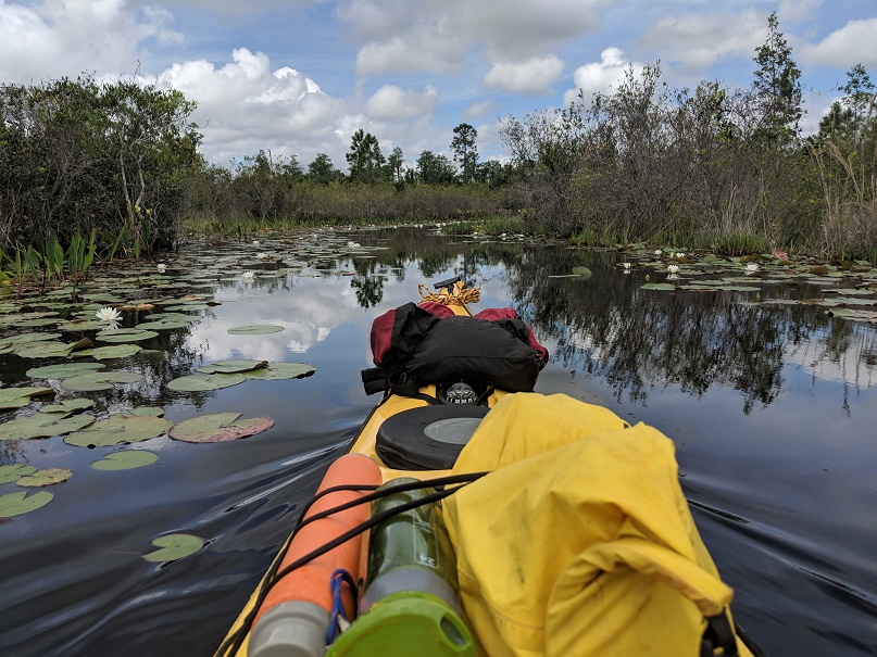
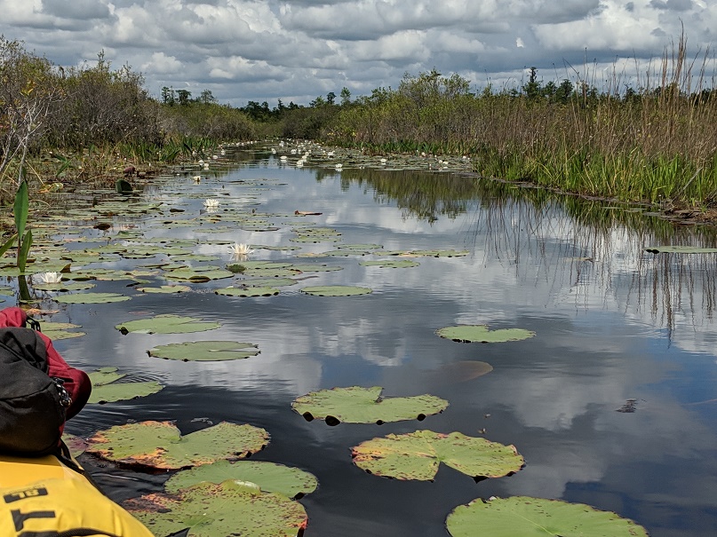
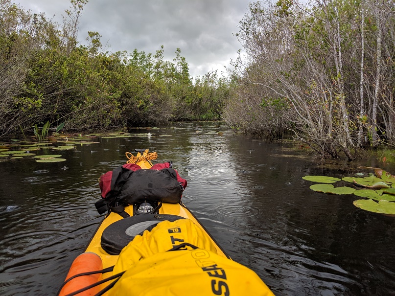
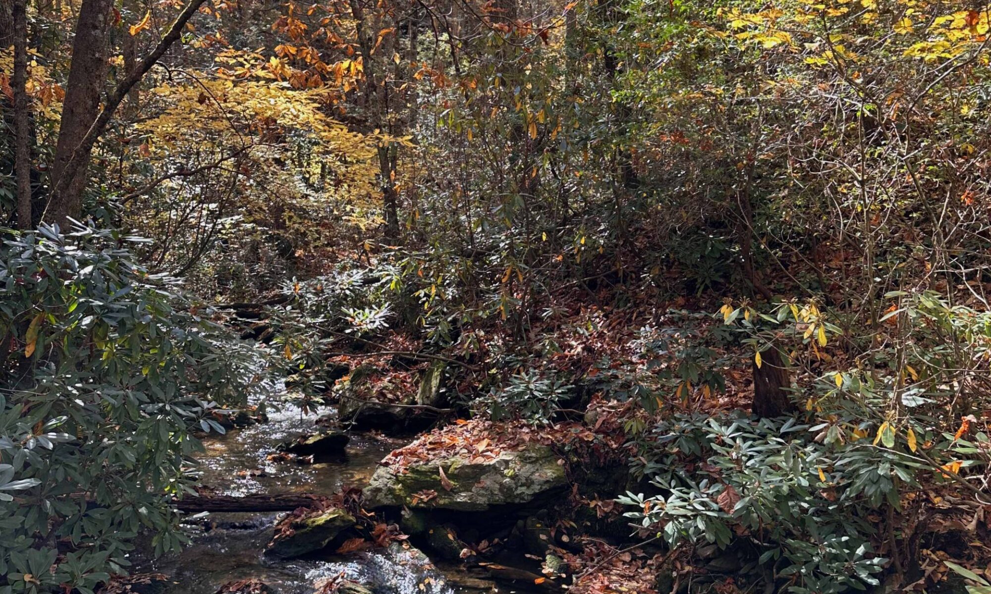
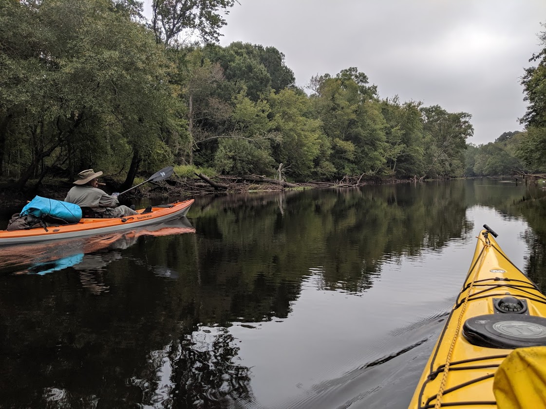
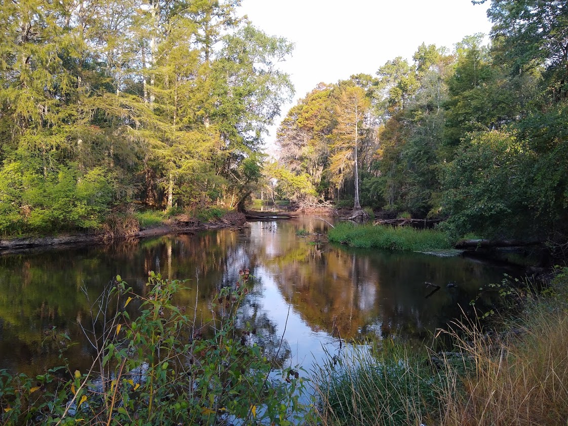
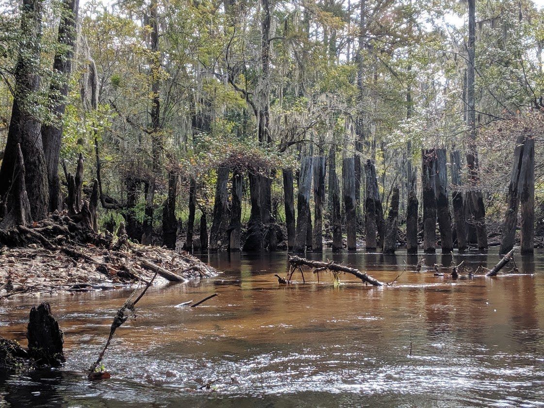
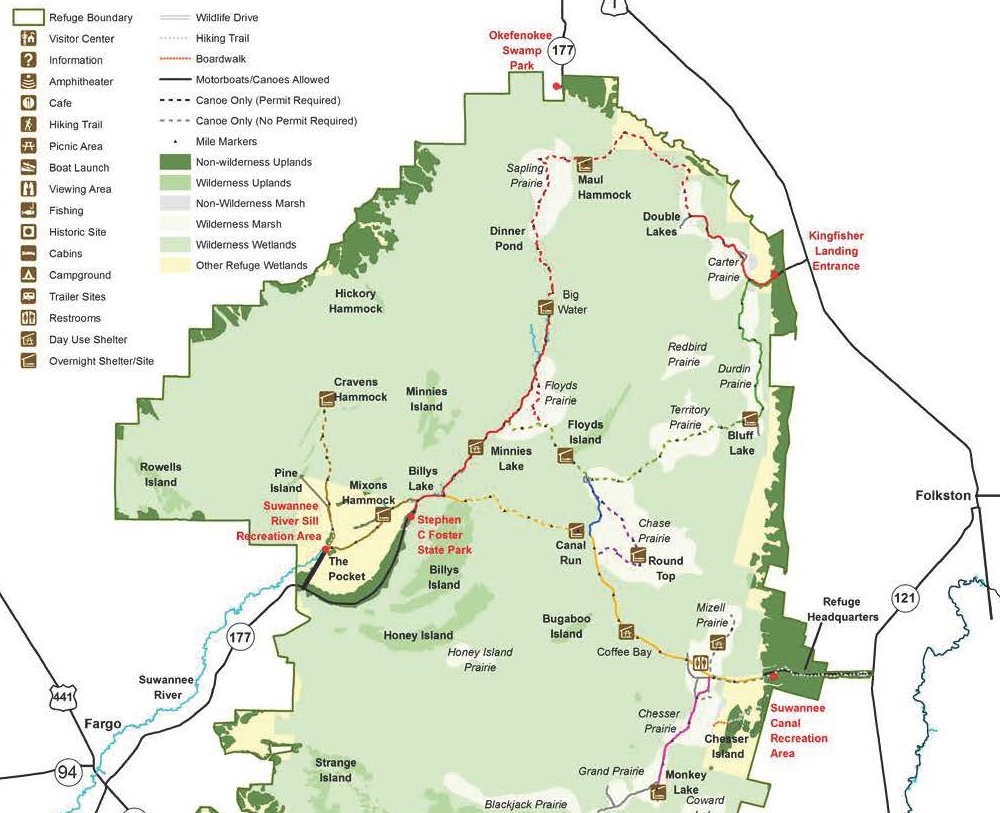
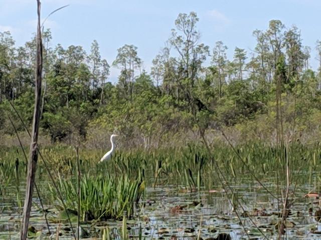
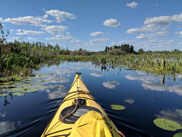
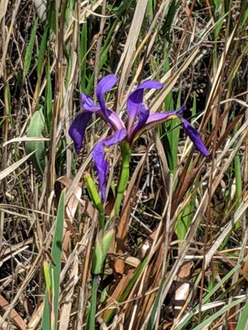
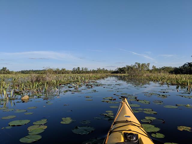
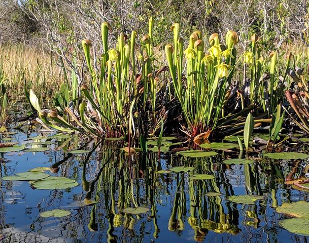
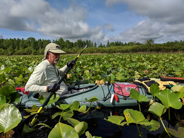
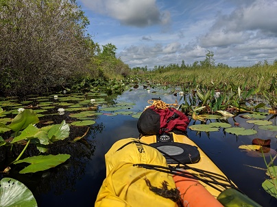
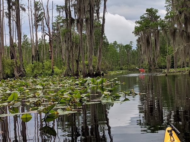
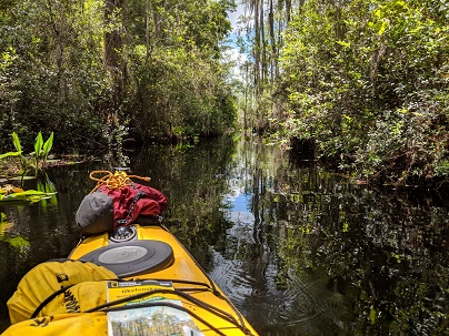
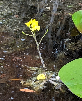
It’s good that we didn’t explore because after the turn-off to Double Lakes, the trail becomes more difficult. In places, lily pads and other weeds fill the channel and often seem to grab and hold on to your paddle. It’s a workout, but we keep paddling. The lily pads include the elegant blooming white lotus plants and some of the more bland yellow blooms. Along the sides of the path, where it is open, are hooded pitcher plants, purple swamp irises and pickerel weed with its purple torch-like flowers. At places, bladderworts, odd flowering plants that grow in water, are seen. Like the pitcher plants, they too are carnivorous. With so many insect eating plants, you’d think bugs wouldn’t be a problem. The abundance of these plants are an indication of the poor soil, so they have evolved to obtain nutrients from other sources. And there seems to be plenty of mosquitoes and biting flies to feed these plants, as we’ll later experience.

Finally, the trail turns to the southwest. We still two miles to go, but the thunder that’s been rolling for the past hour or so has moved closer. We pick up the pace, but paddling through thick vegetation is exhausting.


the start of the rain

We leave the prairie and paddle through tall cypress and bay trees, with briers and other vegetation lining the channel. There are few lily pads to fight, but the channel is so tight that we must keep the paddle up and down, close to the sides of the boat. The thunder becomes more intense and we hear it crackle across the sky. When we enter another prairie and have a better view, clearly defined lightning bolts are popping all around. It’s beginning to rain. Soon, the bolts are striking only a few hundred yards away, followed by a nearly instantaneous boom that vibrates across the swamp. We paddle harder as the rain comes. The drops are think and heavy and drown out the sounds of the swamp. As the rain becomes heavier, the lightning moves further away. We continue to paddle harder and after an intense 20 minute downpour, that soaks us both and, since neither are us are wearing spray skirts, drops a few inches of water into our boats.


Gary setting up his hammock at Maul Hammock Platform

As the rain subsides, we pump out some of the water from the boat and paddle on toward the side trail to Maul Hammock platform. We enter a lake filled with lily pads that, in places, are up to our shoulders. The platform is to our left, at the edge of the lake. We head toward it as the water continues to drizzle. As we are pulling the boats up onto the platform, we notice a few stray bolts of lightning on the backside of the storm. It’ll be good to get into dry clothes, to fix a drink and dinner, and to rest. It’s been a long day as we’ve covered nearly 13 long miles.

Sunset from Maul Hammock Platform (right before an air force of mosquitoes descend)