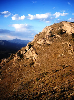
The fossil ledges which are found on the north and northeastern side of the island.
After the windy evening, the morning turned out calm. The calm mornings are normally the pattern, with the exception being on Thursday. But on Wednesday, I woke early, fixed coffee and oatmeal, read and wrote in my journal before beginning my paddle along the north shore of Drummond. Much of the paddling this morning was along the fossil ledges, where the alvar limestone meets the lakeshore.
For the first few miles, there was no one else in sight, but a couple of miles from Chippewa Point, I began to run into boats fishing just offshore. Chatting with two of the boats, I learned that no one had caught any fished. One said this was the worse for fishing that he recalled. Normally there were a couple of inland lakes along the north side which one could explore, but the lake was so low that wasn’t possible. I also saw two bald eagles during the morning.
I stopped for lunch on a rock bar between Chippewa Point. The wind was blowing out of the east, just strong enough to keep the bugs from bothering me. After lunch, I headed due south, across the wide waters of Potagannissing Bay. The bay is filled with islands. I kept my sights on Bald and Grape Island, setting a course between the two which would land me back on the mainland approximately where Pine Street met the water. I wasn’t exactly sure where I was heading as an address doesn’t do much good on the water, but I knew it was just east of H&H Boat Launch.
Approaching Chippewa Point
After three days of paddling, my arms were tired. I had considered exploring Harbor Island, which has a large inside lake which creates a safe harbor, but since I had been to the island a few years earlier when a member of the DeTour Union Church took me out on his boat, I decided against it. I paddled on, between islands and could make out the marina.
After about an hour of paddling, I found myself just east of the marina. There was a woman out with a toddler. I asked her if she knew the Ledy’s. “You must be Jeff,” she said and introduced herself as Irma. The toddler was her granddaughter. I pulled my kayak up on their sandy beach and spend the next couple of hours talking to her and her husband Clayt, while enjoying a tall Long Island Iced Tea. Clayt, a contractor, had spent time building mission projects in Ethiopia. His stories were fascinating.
That night, I joined them, along with Dave and Sandy for dinner. Dave and Sandy had brought the meal which included tender pork chops which were a lot better than anything I could have fixed. While their cabin was full, they invited me to camp on their porch. I decided my hammock strung between trees would be more comfortable and I could get up earlier in the morning and be on my way.
Thursday morning, June 26
The rain came at 4 AM. Not expecting it, I crawled out of my hammock and pitched out my fly to keep the water from seeping in. I checked the weather. Off and on showers through the morning, but winds only 6-8 mph. It’d be a good day to paddle. Soon, I was back asleep.
At 6:30 I woke. It’d been light for nearly an hour, but the dark low hanging clouds made it seem earlier. I wanted to get a good start to the day, as I was going to complete my circumnavigation around Drummond Island. I needed to be back on the mainland in time to clean up before driving over to St. Ignace to pick up my friend, Bob.
Quickly packing my stuff., most of the gear I stored in a shed where, the night before Clayt, said I could I could store anything I didn’t want to carry. Since I wasn’t camping, I dropped most of my gear in the shed, taking only what I needed for the morning paddle. Then I ate a couple granola bars but decided to forgo coffee to get out earlier on the water.
A little after 7 AM, I was ready to push off. I noticed that the wind seemed to be blowing a lot more than forecasted, but it didn’t seem too bad. Heading out a way into the water, I turned due west. The wind blew out of the northeast, helping me make good time. Quickly passing Sandstone Point, I set my sights on Sims Point, some three miles away.
This course took me across the mouth of Sturgeon Bay. I noticed the water looked choppier than expected. As I moved further from the islands that I’d paddled through the day before, the wind picked up. About a 1/3 of the way across the mouth, I found myself in gale force winds. The waves built and the wind kept pushing me southeast, into Sturgeon Bay, I had to fight to stay on course, dropping my skeg (a small keel) and surfing at a 45-degree angle across 2- and 3-foot swells. The water foamed from the whitecaps.
Paddling with my life jacket zipped up (After crossing the lee of the island)
There were no boats out this morning. I wore my life vest over my rain jacket. Most of this trip, I only snapped the jacket at the bottom, but now I quickly zipped it up tight. In my jacket was a marine radio, in case I got into real trouble, along with snacks and bug spray. The later wasn’t needed this morning. Whatever happened to those 6-8 mile per hour breezes? Paddling became exhausting, but my boat handled the waves well. About a quarter mile from Sim’s point, I slipped behind an unnamed and uninhabited island for a break.
I rested for a good half hour. At least, I thought, I was done with the open water piece. From now on, I’d be along the shoreline, with roads and cabins if I got into trouble. I set back out paddling, with a half mile more to go till I would be on the lee side of Drummond. The waves grew taller as the wind pushed around the islands. A few waves appeared to be nearly 4 feet tall. Several times, I would miss a stroke as I crested a wave, with the water too far below the paddle.
Shelter on the lee side of an island. It’s hard to see the white caps in the photo.
Once, a wave caught me sideways and I almost rolled the kayak. At the last second, using a high brace, I pulled myself back upright and over the swell. This was scary. While continuing to paddle hard, I prayed for God to protect me and give me strength. Then, after another hundred yards, I passed Dix Point and turned my boat south, paralleling the island. The water calmed. I watched an ore freighter make its way north toward the Soo in the St. Mary’s River The current pushed me south. I relaxed.
waiting for the ferry to clear the dock before passing the terminal.
Limestone quarry loading docks
For the next hour, I paddled south along the west side of Drummond. The only obstacle was the ferry, which I decided to wait for it to leave instead of trying to race across it’s bow as it made its way back and forth from DeTour Village. Since there were no ships loading at the limestone quarry dock, I was able to see the operation up close as crush limestone falls into piles based on its size and use. Some of the rock is used in the steel making process, other is used in construction and agricultural.
Soon, I was at the southwestern end of the island. I thought I could skirt through the gap between Barbed Point and Crab Island but found that because of the low water in the Great Lakes, the channel was closed. Across the rocky bridge, waves were beating on the other side. I realized my challenge wasn’t quite over. I paddled around Crab Island and headed northwest, with the wind in my face. For a few minutes I was able to rest behind Arnold Island, but as I headed back northeast the wind howled. There was nothing to do but to keep paddling as I was taken back out into open water. But paddling into the wind is just tiring, not as dangerous as when the wind is coming across the boat. After about two miles I was finally in the tributary where Fort Drummond Marina was located. Once there, the last mile was a little easier as the shoreline blocked the wind.
Fort Drummond was named for the British General during the War of 1812 who controlled British troops in Southern Canada. At the time, the British held Mackinac Island. After the war, they gave it up. At first, Drummond moved his solders to the island that now bears his name. Later, they would move back into Canada, which was just north or east of the island.
Thursday morning, back where I started on Monday
I arrived at the marina a little before noon. After loading my boat on the top of the car, talked to the guy at the marina, then drove over to the Ledy’s to pick up my gear. I had to wait a few minutes for the ferry, but by 1 PM, I was back on the mainland, setting out my gear to dry in the garage. I had lunch, took a nap, and late in the afternoon set out for St. Ignace to pick up Bob.
Rounding Raynolds Point, the northeastern corner of the island, the situation changed. I was no longer on the lee side of the island. The wind was in my face and much stronger. Swells suddenly appeared, breaking over my bow and attempting to push me onto the rocky ledges around the shore. Dark clouds gathered. I headed out away from the ledges and paddled harder. Having already covered approximately 19 miles, I was tired. As rain pelted me, I decided to head into Raynolds Bay. The wind helped this decision. I was not sure what’s public and private land, but there were no signs of human activity. The bay provided enough protection for me to safely come ashore. After thirty minutes of excitement, I was exhausted. This was the first bit of difficulty on my trip, but it would not be the last.
Beaver’s Work
I walked along the cobblestoned beach that’s sprinkled with fossils. There is also evidence of beaver activity, but wonder what they might attempt to dam up here. A dam on these waters would be beyond the Army Corp of Engineers ability. Finding a nice place where I could pitch my hammock and with a good view of the shore, I move my kayak.
Fossils
Again, as the previous night, I found a rock out near the water where I set up my kitchen. After dinner, I gathered wood for a fire along the beach. The skies cleared. As the daylight fades, I read and write by the water. Then I build a fire and fix a pot of tea. I hope to see the northern lights., but don’t see them. As darkness falls, I see distant lights of navigation markers and Canadian radio towers. I also pick out cabins by their lanterns on islands on the Canadian side of the water. Twilight seemed to last forever. I crawled in my hammock at 11 PM, after making sure the fire was extinguished. The stars had just begun to appear.
Sunset from Raynolds Bay. The waves are now much calmer than when I came ashore.
Monday, June 23, 2025
My trip started on the previous morning. I take the 7:50 AM ferry from Detour Village to Drummond Island. Arriving at the Fort Drummond Marina at 8:15 AM, shortly after they opened, I unloaded my boat from the top of the car and stowed my gear into the hatches. While I plan for a three-night, four-day trip, I bring extra food in case the weather deteriorates. After loading my boat and moving my car to where it’ll be out of the way. I then leave a float plan with the operator.
Easy paddling
I’m on the water at 9 AM, paddling south out of the tributary where the marina is located. At first I paddle rather slowly as I finish my thermos mug of coffee. Then paddle much faster as I reach Whitney Bay and set my course between Bird and Garden Island. Once I clear Garden, I’m in the upper ends of Lake Huron. From here, I can watch freighters coming up from the south. I turn east and round Anderson Point, then aim between Bootjack and Espanore Island. Next, I head southeast toward Cream City Point. At 11 AM, I pull up on the backside of Gravel Island in Huron Bay for a rest and lunch. I’ve covered 8 miles in two hours of paddling.
Today’s lunch is fancy. I have a left-over steak over from Saturday night dinner. Placing the steak inside a hoagie bun, I eat it while watching another freighter make its way from below the horizon towards the Soo. I then take care of a few messages I received on my phone. One is from my brother and I snap and send him a photo of my kayak resting on the cobblestones. Another is from Dave, a friend on Drummond, who invites me to dinner at a friend’s place on the third night. He asks if I can make it. I think I can. This will be the last reliable cell service until I have paddled around most of the island. For the rest of the day, I leave my phone on airplane mode to save battery.
Gravel Island
After lunch, I paddle around the north side of Gravel Island, and set my course for the distant Traverse Point, 2 ½ miles away. My course takes me further from land. Having paddled by several points, I realize I must give these points wide berth to avoid the rocks which often sit at or just below surface.
After Traverse Point, I head due east toward Scammon Point. This route takes me far from the shore as I pass Canoe Point and Scammon Cover. There are also fewer cabins along this isolated part of the shore. Most of this land is managed as a Michigan State Forest. Leaving Scammon Point, I am tempted to head into Big Shoal Cove, where there is a sandy beach. Having been there before, several years ago, I decide against it. I head southeast toward Long Point, the third of four points I can see (the last is an island).
I arrived at Long Point around 4 PM and paddle around both sides of the point. After looking around, I decided to camp on the west side, a 100 or so yards inside a small bay. The beaches were covered with cobble stones. As I had done at lunch, I paddled close to the water’s edge and get out of the boat while it’s still in about a foot of water. I lift the boat up, to avoid most of the rocks. After unloading and my boat was lighter, I carry the boat up onto dry land.
Before setting up camp, I take a brief swim. The water in the shallow bay was cool, but not cold. Then I put on long pants, socks, a clean long sleeve shirt.
I find two cedar trees at the edge of the woods, where I hang my hammock. Around it, I felt I am in a garden with purple irises, buttercups, Indian paintbrush, and other flowers. On a large rock about 75 feet away, I place my stove and pot along with my folding chair. After everything is up, I update my journal before preparing dinner. This consists of a beef stew which just had to be heated along with two tortillas and some apple sauce in a squeeze container. Paddling allows for heavier food than backpacking.
After dinner, I hang my food between two trees and explore the shoreline. Afterwards, I fixed a cup of tea. Sitting down, I sip my tea as I watch the sun set and a thunderstorm build south of me. For the next half hour, I observe the storms moving east, just south of me. Huge lightning bolts strike the water a mile or two to my south. These are followed with delayed rolls of thunder. As darkness falls I am treated with a display of synchronous fireflies. Each of these bugs, along the woods, emits four or five quick blinks of light. This is followed by 10 seconds or so of darkness before another set of blinks. To the west, I caught glimpses of the new moon hang between the clouds, low in the west.
Sunset from my camp on Long Point
I fell asleep to the waning sound of thunder. About 3 AM, I wake and crawled out from my hammock to take care of business. The skies have cleared and to the south I see the pincher stars of Scorpio above the horizon. Moments later, I snuggle back in my hammock home and fall back asleep.
Tuesday, June 24, Morning to Midafternoon
Perking coffee
When I wake again, a mosquito buzzes just outside my netting. The sun rays are lighting the trees on the other side of the bay. I get up and fixed breakfast. This consists of oatmeal and perked coffee. Then I packed up everything, and spend some time reading and writing in my journal.
By 9 AM, I am again on the water. I paddle east, crossing to the outside of Shelter Island and the points on each side of Bass Cove. Afterwards, I turn northeast as I reached the eastern side of the island. Unlike the day before, where the island consisted of many points of land the eastern side is smoother. There are only a few jagged points extending into the water. Around Bass Cove, I pass many cabins, As I paddle north, I see fewer cabins. Most of this land is owned by the state. With Drummond Island just a hundred yards to my left, Canada is less than a mile to my right.
Unlike the day before in which, after leaving Whitney Bay, I saw no boats (except for distant freighters), I passed a large sailboat heading east. The boats sails are furled, and it motored on. I later see a few boats come down through the False Detour Passage that links the Northern Passage to Lake Huron.
South of Marblehead
I planned to make my first stop at Marble Head, a rough outcrop of limestone at the eastern most point of Drummond Island. Who knows why they named this place Marblehead. Drummond, as far as I know, has no marble. It is mostly limestone and the mine on the island produces shiploads of limestone every week, which is used in steelmaking, cement, and agriculture. I suppose the name had a nautical sound. I crossed by Marblehead and pulled ashore on the north side. Stepping out of the boat, the biting flies started. I grabbed snacks for lunch and bug spray. I sprayed my bear legs, where the flies seemed drawn (I wore a long sleeve sun shirt which seemed to provide some protection from the flies. But the spray didn’t deter these buggers, and I spent lunch swatting them away.
I had planned to hike up to Marblehead, but the bugs seemed just as nasty inside the forested canopy, so I returned to my boat and slowly continued to work my way north toward Stigraves Bay. I’d also planned to paddle into Pilot Harbor, which has a narrow entry that opens into an inland lake, but decided against it. I paddled north around Glen Point and into Glen Cove. It was only 1:30 PM.
map of the northeast side of Drummond
Most people who paddle around Drummond Island spend their second night at Glen Cove, but since it was too early to stop, I decided to continue north. In the distance, I see a rock that looks like a giant bald eagle sitting. Getting closer I see the white part is from bird poop. But, as I pass this rock, I do see a bald eagle soaring above.
The weather was delightful with a breeze out of the northwest, keeping me cool when I stayed offshore. When I came in close, to explore the limestone ledges which began appearing north of Marblehead, the shore blocked the wind and the bugs would attack. I assumed once I crossed Raynolds Point, 6 or 7 miles ahead, the wind would blow the bugs away.
My decision to continue also was influence by the invitation to have dinner with Dave, Sandy, and their friends on Wednesday night. Except for the bugs, I find the northeast side of Drummond delightful. Much of the shoreline consisted of flat ledges, table-like limestone, a few feet above the waterline. The “tables” appeared properly set with wildflowers growing in cracks. In most places, a second ledge extended out six or 12 inches below the water line.
Getting ashore isn’t difficult, as I exit the boat in six inches of water and climb upon the ledge. It would have been more difficult to have camped along the shoreline north of Glenn Cove, as one would have to load and pack the boat in the water and then lift the boat up onto the higher shelf to keep it safe at night. I decided to camp west of Raynolds Bay. Furthermore, most of this land is privately owned. However, only a few cabins dot the shoreline.
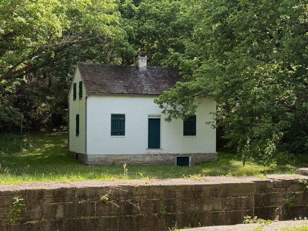
Lock and a lock house. Some of the lock houses can be rented for those traveling on the C&O.
A couple of miles from the Paw Paw tunnel, we came around a bend and noticed bicycles thrown on the ground and several people kneeling over one of them. I peddled faster, thinking someone was hurt. When we pulled up, we saw Max and three women cyclists. No one was hurt, but one of the bikes had been taken apart. She’d had a flat. Max, seeing the stuff on the ground from the bike, said he threw up his hands and said, “there’s some engineers just behind me who can help.” At dinner the evening before, Max and Warren discussed various metals used in bicycles. From the discussion he learned my brother was a mechanical engineer. For some reason, he thought I was one, too. The women greeted us like saviors. When I shook my head at not being an engineer and pointed to my brother, they dropped interest in me and lauded praise on his arrival.
Warren to the rescue
We spent the next 30 minutes trying to get the bike back together. They had removed the entire back sockets and de-railer. While Warren and the woman with the broken bike worked finding what goes where, Max and I talked to the other women. They were all serious cyclists. When asked what they do when there’s a problem, they pointed to the woman whose bike was torn apart. “We call her husband. He’s a serious racer and knows everything about bikes and can walk us through what needs to happen.” Sadly, for them, we were in an area without cell service.
Once the bike was back together, we had the owner get on it and ride it a ways, making sure everything worked. It did. We ran into them again, late in the afternoon at the bicycle shop in Hancock. This was after 30 some miles of riding. One of the employees went through the bike and confirmed everything was back as it should be. The only issue was the tire pressure was a little low, but that’s to be expected with those emergency pumps which go on bicycles.
As they rode away, my brother joked about telling his wife how he had satisfied three women this morning.
Saturday, Cumberland to Hancock (61 miles of which we rode roughly 40)
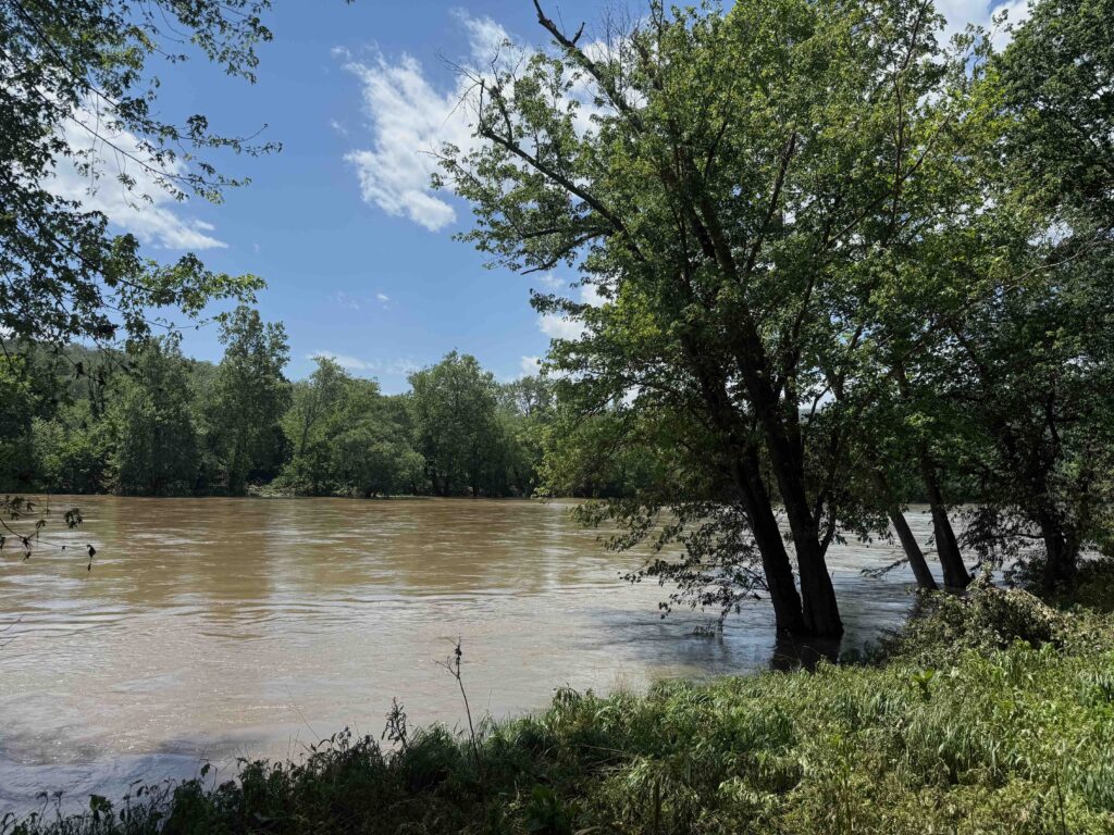
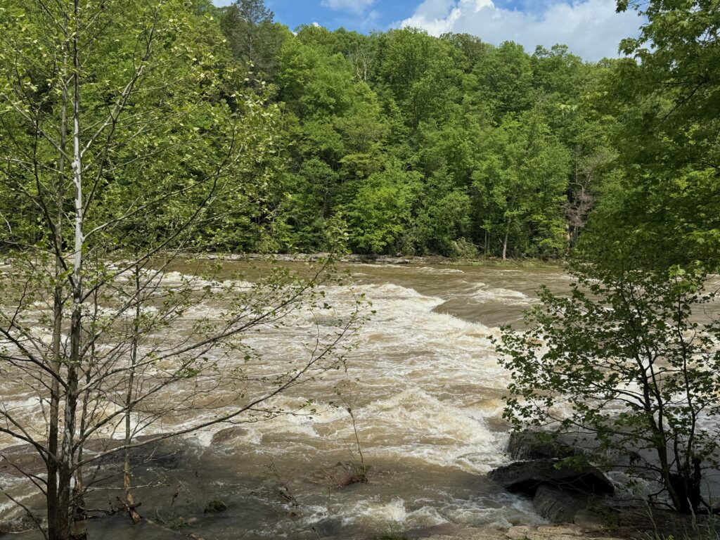
Potomac RiPonver, having fallen but still well out of its banks
This was to be the big day, 61 miles. The only problem was knowing there was a section of trail washed away in the floods about ten miles away. The National Park Service said there was no acceptable detour. We also learned from the bike shop that the road around this section was narrow, curvy, and unsafe to ride because of tractor trailers. So that morning, we arranged a shuttle for us and for Max, whom we’d talked to at breakfast. We had them drop us off at Paw Paw, cutting out about 25 miles of trail and the section that had been washed out.
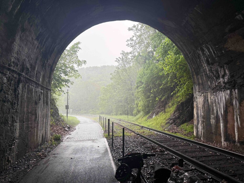
Paw Paw Tunnel
Paw Paw Tunnel (My bike is pointing the wrong way)
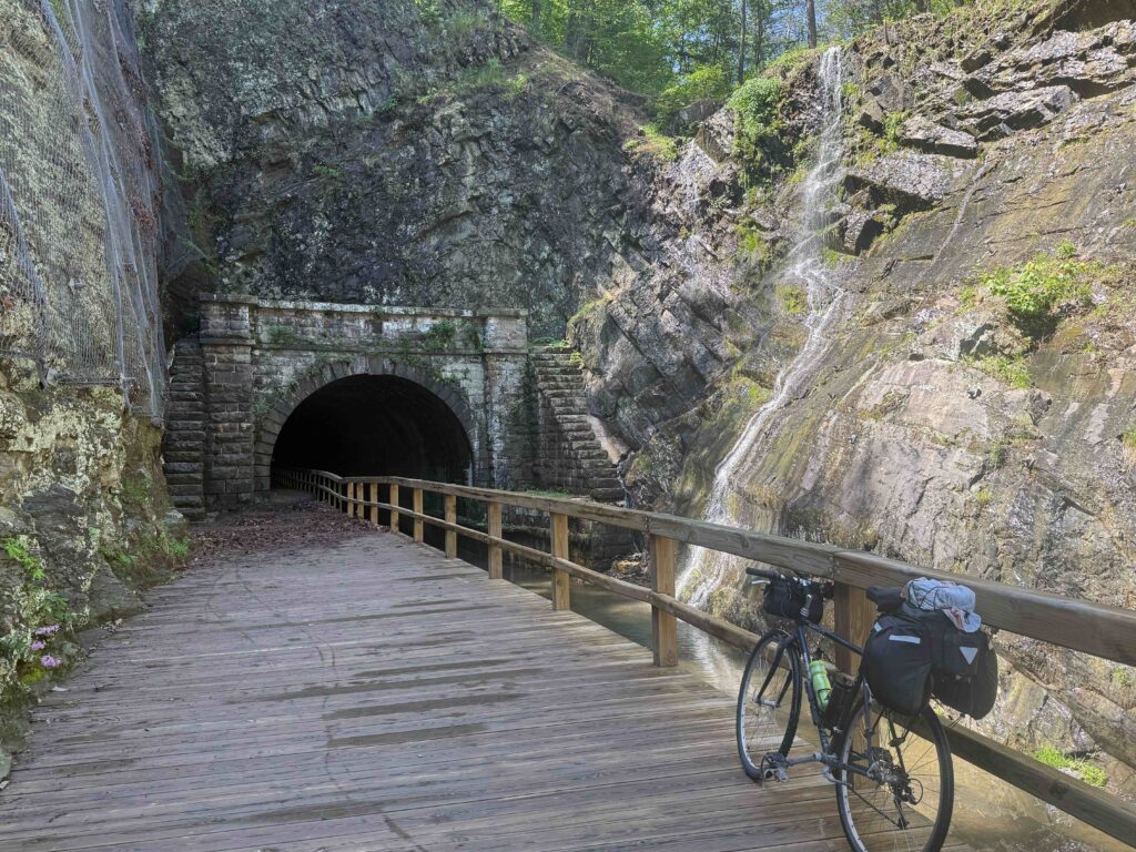
The highlight of the day was the Paw Paw tunnel, an engineering marvel for the early 19th Century. We entered the tunnel just a mile or two from where the shuttle dropped us off. Bricks lined the walls of the tunnel. Bicycles (and mules in the day) travel on a wooden walkway that was so unleveled and bumpy we quickly heeded the warning to walk and not ride our bikes. Besides, the railing was only three foot tall, making it easy to tumble over if your bike fell. I attached the light to my handlebars and began the dark cool journey through the 3118-foot tunnel.
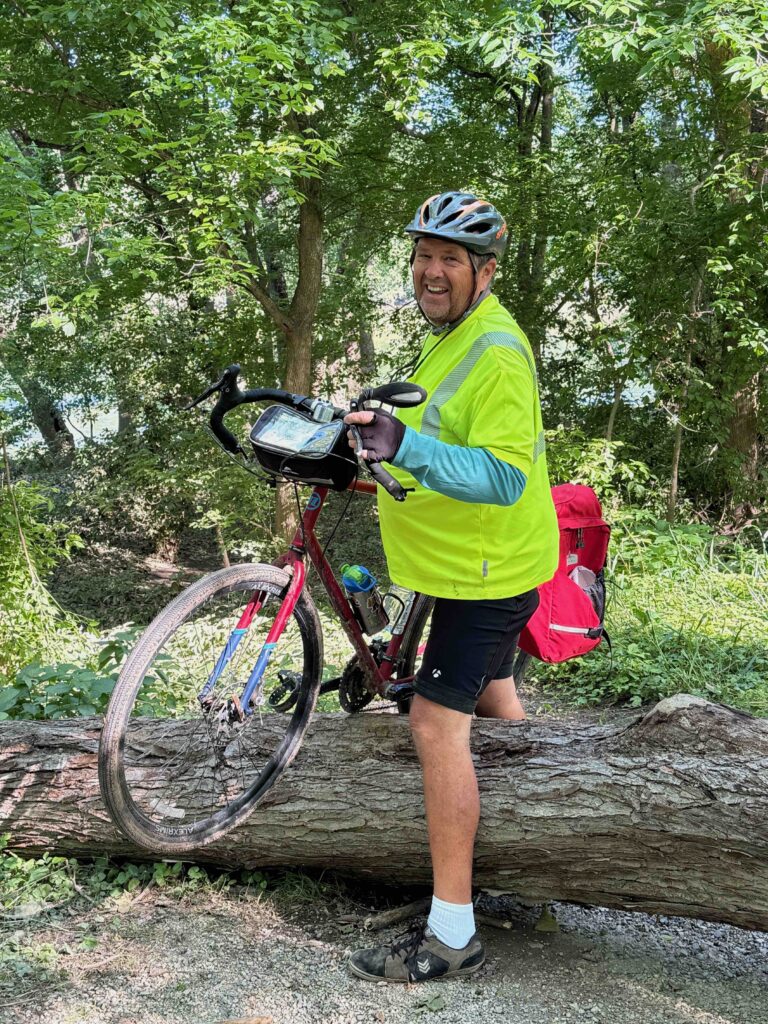
Warren pulling his bike over a tree
Little Orleans
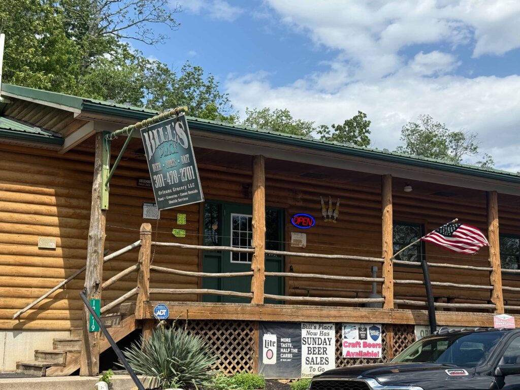
The trail appeared better than we expected. While there were places with mud and many trees had fallen, requiring us to dismount and lift our bikes over them, it wasn’t as bad as some of the other places we’d heard of. We ate lunch at the Devil’s Alley Campground. When we came to Little Orleans, we left the trail and headed to Billy’s Place for ice cream. The place was a bar that served food. They advertised in large letters, “Beer, Boats, Bait.” In smaller letters the sign mentioned food, groceries, and shuttles. While we’d just had lunch, the burgers they’d fixed for a man and his wife we met outside of the establishment were enticing.
It didn’t take long this day before my left foot became sore. Over the past couple of days, the soreness would manifest itself late in the afternoon. The evening before I realized the area around the Achilles tendon had swelled. This slowed my pace and made me want to take more frequent stops, sometimes even walking my bicycle.
Western Maryland Railroad bike trail.
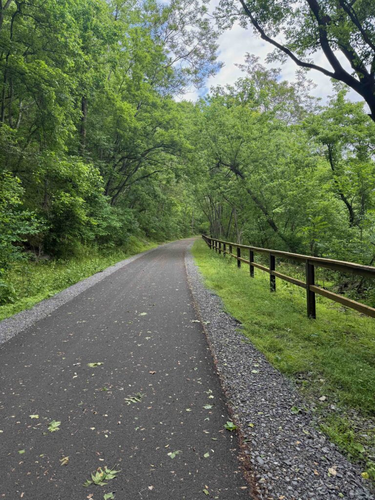
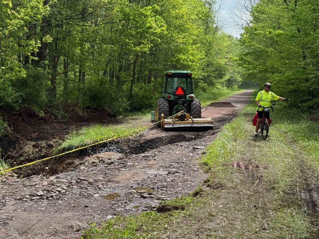
The Western Maryland Trail begins at Little Orleans. While this path parallels the C&O canal, it’s high above the river and is paved. This old rail bed, which we’d ridden on from Connellsville on the GAP, was a welcome relief to the mud of the C&O. It was nice to bel able to ride on pavement, even though we still had trees to pull over. We rode it all the way to Hancock, except for one detour for about a mile onto the C&O as there is a tunnel that hasn’t yet opened. About three miles outside of Hancock, we came upon a group of trail workers from the Maryland Parks clearing trees which had fallen during the recent storms.
Arriving back in Hancock
We arrived at Hancock at 5 PM, riding to the Presbyterian Church where I had left my car on Tuesday. We loaded our bikes and drove to Motel 8, where I had made reservations. On Monday night, I had stayed at the Potomac River Hotel, which looked like a bedbug haven. While it seemed to be free of bugs, the hotel had the ambiance of the 1940s. About half the lights were missing bulbs and the bathroom was small and the tub dirty. After discussing it, we decided to try the only other hotel in town. At least the bathroom was clean and larger, but the floors between the bed were soft and I wondered if one of us would fall through.
After cleaning up, we met Max at the Potomac River Grill, across from the hotel of the same name. The food was excellent, and the place crowed. It appears to be owned by the same folks at the hotel. At least they’re doing something right. I had a wonderful burger with a salad and a Stella beer.
After we got back to the hotel, Warren called his daughter, a physical therapist. She had me do a few moves and said she didn’t think my tendon was torn, but thought my tendon and muscles were angry and I may be suffering from Achilles tendinitis. She also recommended taking it easy, icing my ankle after walking or biking, taking ibuprofen for the swelling, and stretching in the morning. While riding, she suggested that while riding not to use toe-caps and to move my foot forward on the peddle so that I weight would be more on the arch of the foot.
Sunday morning, May 18
Not an illusion
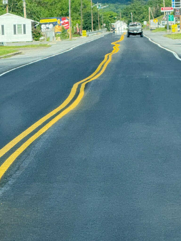
As Super 8s don’t provide breakfast, we drove to the IHOP on the east side of town, near the interstate. Coming back, I noticed some of the most creative line painting on a highway I’ve ever seen. Obviously, the Maryland line painters believe in drinking on the job!
Then we worshipped with the good people at Hancock Presbyterian Church. I met Pastor Terry on Tuesday, when I left my car in the church’s parking lot. The 1845 sanctuary reminded me of the church where I was ordained as a Presbyterian minister, the United Church of Ellicottville in New York. Both brick sanctuaries featured high ceilings and a square design with cathedral style windows. While the United Church (formerly First Presbyterian) served as a stop on the Underground Railroad, the Hancock Church suffered damage during the Civil War when Stonewall Jackson’s men shelled the town.
This morning the service honored the church’s graduates and featured a musical trio (soloist, keyboard, and bass) from Fredrick called “Solid Ground.” They lead the congregation in singing and sang several songs themselves. Afterwards, the congregation had a wonderful potluck lunch which they do once a month. If you’re ever in Hancock on the potluck Sunday, don’t miss it!
Fort Frederick
Ft. Frederick
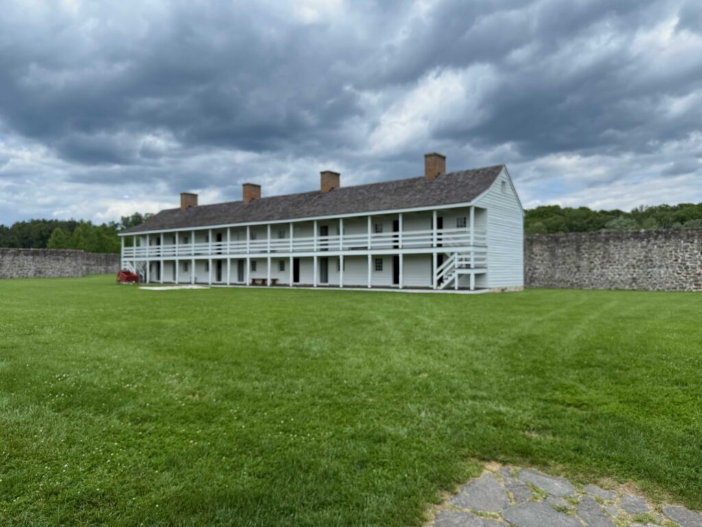
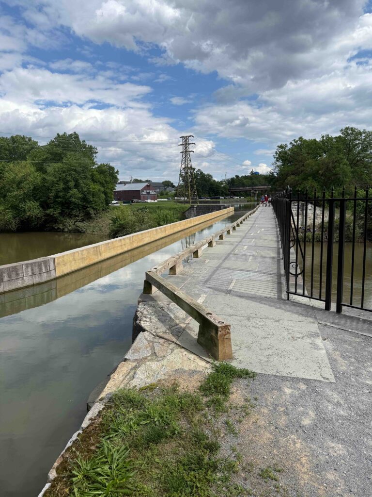
Taking my niece’s advice, I decided not to ride on Sunday, which had been scheduled for our shortest day on the C&O, only 27 miles. Instead, I drove to Fort Frederick. The British governor had the rock-walled fort built during the French and Indian Wars to protect the frontier. In the American Revolutionary War, the fort housed British POWs. It never experienced the tragedy of a battle. Overtime, much of the fort had fell into disrepair, but the CCCs rebuilt it in the 1930s. Today, it’s a Maryland State Park. I toured the fort and reconnected with Warren as the C&O passes by the site of the fort. Then I moved on to Williamsport waterfront, where I waited to pick up Warren later in the afternoon. Williamsport features an aqueduct, where the canal (and its water) crossed a local creek, which was amazing to see.
Williamsport’s Acqueduct
That night, we stayed at a Hampton Inn in Hagerstown. For dinner, I had a pecan chicken salad and sausage chili at Bob Evans, which was across the street from the hotel.
Monday, May 19. A free day of touring the area
First Washington Monument
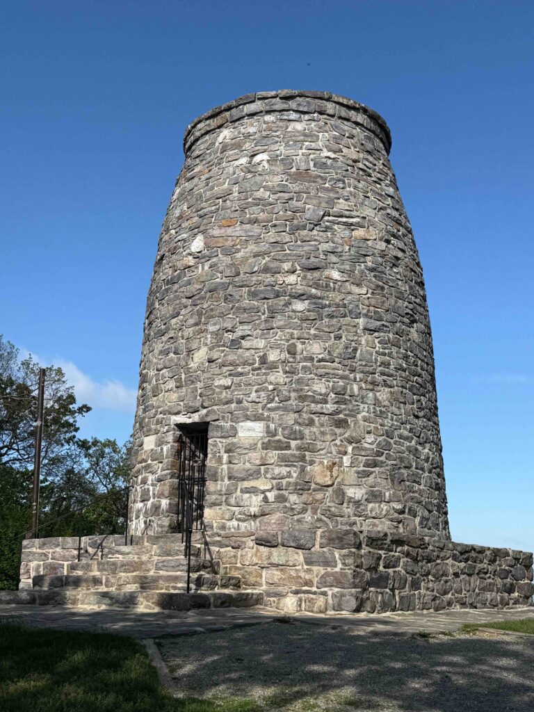
We had planned a day off, since I had a car in the area and was wanting to see the Antietam battlefield. Leaving early, we first drove to the nation’s first Washington Monument along South Mountain. This monument was built in 1827 by the people of Boonsboro, Maryland. In 1862, the people living in the valley used the site to watch the battle of South Mountain and Antietam. I first visited the monument in 1987, while hiking the Appalachian Trail. In our few minutes at the site, I met several section hikers on the trail.
Fish tacos
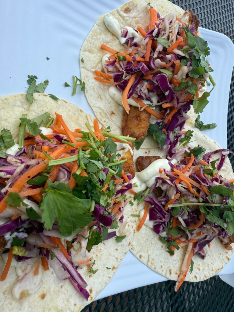
After the Washington Monument, we headed to Point of the Rocks, to look at the C&O trail. We had seen Facebook posts of riders who became bogged in mud between Brunswick and Point of the Rocks and, talking with a bike shop owner, learned several had busted their de-railers by trying to ride through the muck. Then we drove along roads which parallel the trail, across from Harper’s Ferry and then across the Potomac to Shepherdstown, the oldest community in West Virginia. We had lunch in this quaint town at Marie’s Taqueria, where I had three delicious fish tacos.
Antietam
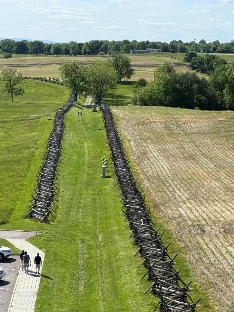
Sunken road, sight of fierce fighting, taken from observation tower
After lunch, we headed to the Antietam battlefield, first stopping at the visitor’s center to watch a movie introducing us to the battle and exploring the museum. September 17, 1862 is the bloodiest day in American history. While more died at Gettysburg, that battle lasted three full days. Lee had assembled his troops between the town of Sharpsburg (some still refer to the battle as Sharpsburg) and Antietam Creek. Fighting began that early that morning in a cornfield north of town. It continued in several different locations over the next twelve hours, before coming to an end. Strategically, the north won the battle. They forced the South to retreat into Virginia. But the price was heavy on both armies. The significantly larger northern army lost more soldiers than the south. Dinner for the evening was picked up at a grocery store that had a hot food and a large salad bar.
Tuesday, May 20 (36 miles)
With the reports of muddy and nearly impossible sections of the trail, we decided a new plan. We would start where we planned in Williamsport and ride as far east as possible before the mud became too deep. Leaving Williamsport, we peddled east. The two days’ rest made my ankle and Achilles feel better. I also stopped wearing my toe clips and moved my foot further up on my pedals. I wouldn’t have problems with my ankle until later in the afternoon.
As I was leaving Williamsport, I came up on a man walking his dog. “On your left,” I yelled, to warn him of my passing. He jumped, looked around at me, and started cussing me out. Here, I had tried to be polite and not scare him and instead, I both scared and upset him.
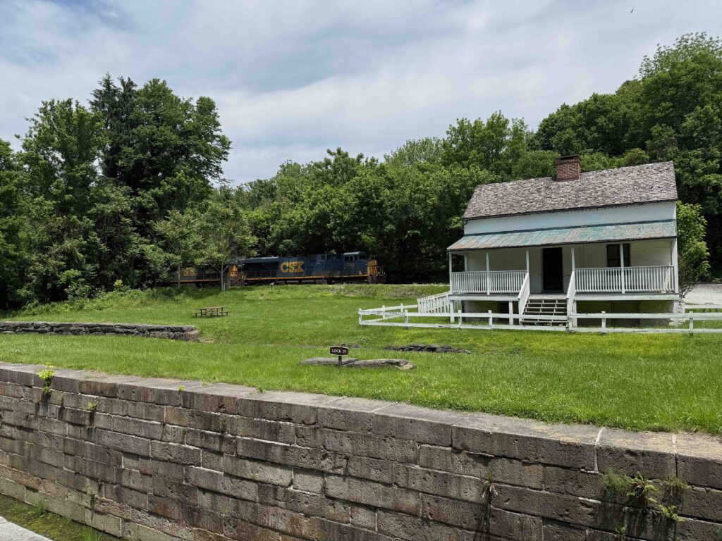
Competing modes of transportation: Lock, lock houses and train
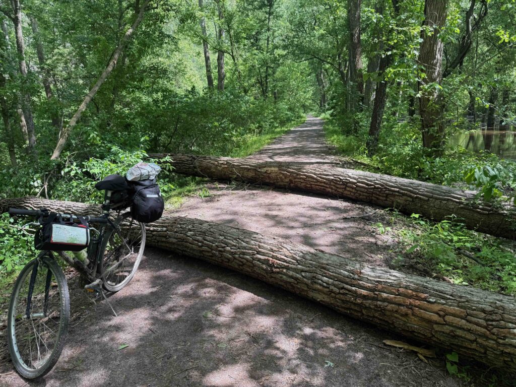
At first, our only challenge was stopping every little bit to pull our bikes over trees. This area is filled with history as we passed where Lee and his army were held up by a flooded Potomac as they retreated from Gettysburg, a year after Antietam. After about 7 miles, the path started to become muddier. After another half mile, we decided to turn around and head back to my car. On our way, just after we passed a huge down tree, in which we’d each be on a different side of the tree and hand bikes over, we met a park service crew cutting fallen trees. The last half of the ride back to my car was much easier.
Afternoon ride
Then we headed to Brunswick. We had hoped to peddle here today, but knowing there were sections of the trail out, we set out and road east to Point of the Rocks, stopping for lunch on the trail about halfway to our destination. Our thoughts were that this would give us only 48 miles to Washington on Wednesday. I appreciated seeing this site in the afternoon. The day before, still early in the morning, had the sun behind the unique train station.
Point of Rocks
Point of Rocks station
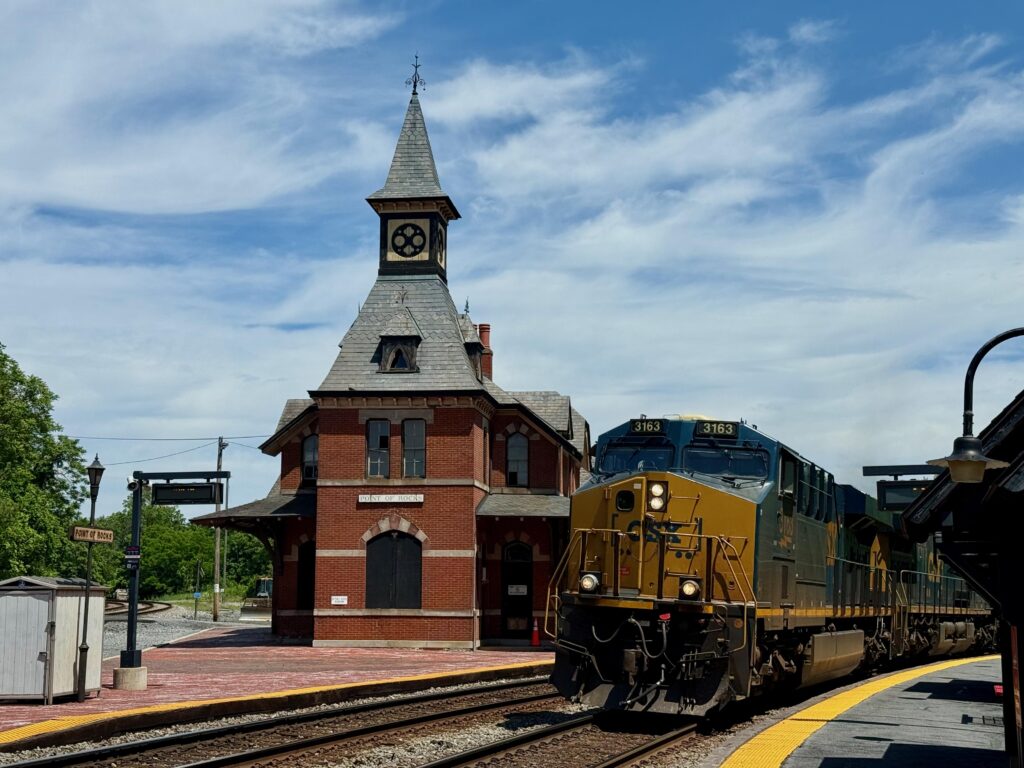
The original Baltimore and Ohio (B&O) tracks tracks ended at Point of Rocks, Maryland . Here, the railroad and the canal locked in legal wrangling over right away. It was eventually settled, with the railroad building a tunnel, which allowed them to move the lines westward. The railroad also began building a line eastward, to serve Washington DC. In the 1870s, where the two tracks converged, forming a wye, they built a station. Today, the station closed and owned and used by railroad. The Maryland commuter rail that runs into DC boards just west of the old station.
I waited to catch a photo of the station with a train that was slowly approaching. The train was going slow and I could have easily jumped aboard as a hobo, but then I noticed that this unit train on open containers marked with the symbol of Republic Trash Service. Dirty water poured from the containers and a rotten smell filled the air. The stench encouraged me not to take up hoboing.
Harpers Ferry
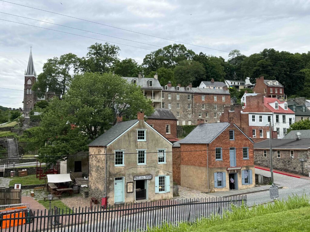
Harpers Ferry
After riding back to Brunswick, we continued west on the trail to Harpers Ferry. This also washed out but was temporarily patched with gravel. In 1987, the afternoon before visiting the Washington Monument, I had hiked along part of this section who also serves as the Appalachian Trail. Across from Harper’s Ferry, we locked our bikes up and walked across a pedestrian bridge. My Achilles ached and I mostly hobbled along. We explored a little of the Lower part of Harpers Ferry. Then we rode back to my car, loaded up our bikes and headed to our hotel, where I could ice my ankle. With only two hotel options in Brunswick and no B&B available, Warren had booked us in the closest hotel to the trail, a Travelodge, 1.7 miles away from the C&O. To reach this hotel on bicycles required a hard climb (as did the other hotel which was further away).
Hotel in Brunswick
We feared the hotel might be a repeat of the Super 8 night, but it was quite nice. It seemed odd to have a hotel like this off a major road or interstate, but we quickly surmised the hotel primarily customer to be the railroad. They even had a lounge only for CSX employees and featured a 1950s style dinner that was open 24 hours a day. A local taxi company shuttled train crews back and forth to the railroad.
A great ending dinner
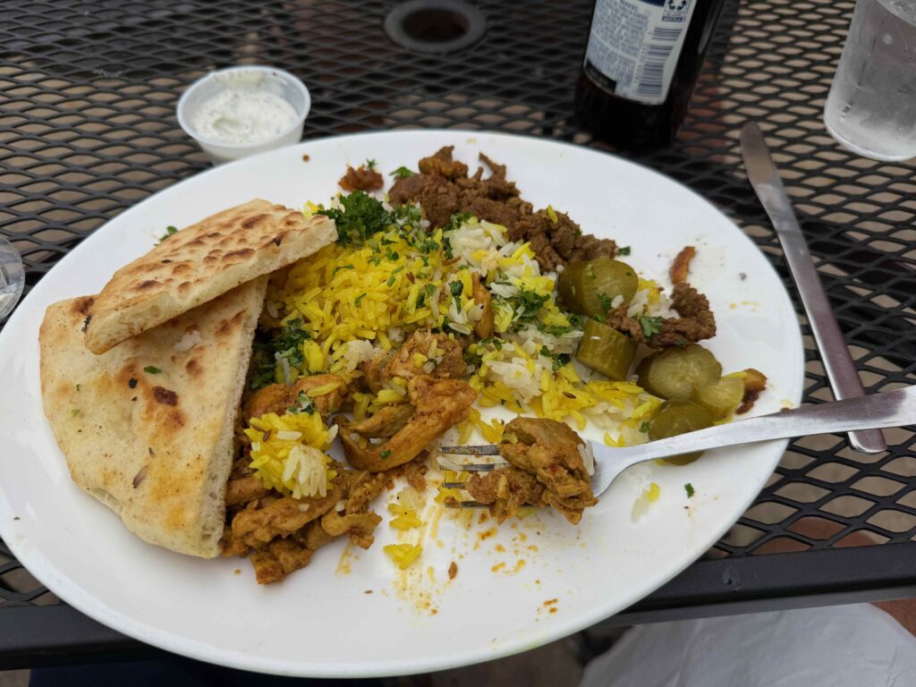
Chicken and lamb shawarma
That evening, we decided to forgo the diner and try the Potomac Street Grill near the railroad tracks. They advertised both American and Middle Eastern dishes. It was a good decision. I had a delicious combo shawarma platter, with both chicken and lamb, a wonderful mediterranean salad, and a local beer for $24.
Wednesday, May 21, 2025 zero miles on bike/350 in the car
The night before, we watched the news and weather channels for what the next day would bring. Everyone was saying 100% chance of rain, with rains heavy in the morning and again later in the afternoon. It poured as we walked over to the diner for breakfast. We decided to quit. Having already had gaps in our travels along the C&O, we could come back and do the C&O again. Besides, my Achilles hurt.
Our plan had been to ride into DC, stay with my brother’s sister and brother-in-law, then the next day, Warren would bring me back to my car and we’d head home. Now, we’d both be home a day early.
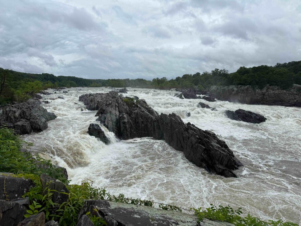
Great Falls on the Potomac, just outside Washington DC
We left Brunswick at nine, in the pouring rain, hoping to miss the worse of the traffic. As we approached DC, the rain slowed to a drizzle. We stopped at Great Falls to witness the power of the Potomac at high water levels. Amazing rapids! A few minutes after leaving the rapids, we arrived at Hitch’s home, where we transferred my brother’s bike to his car. A few minutes later, we took off on our separate paths. For me, it rained most of the way home.
Ankle Update
I was checked out on Tuesday. While I didn’t tear any tendons, I have angered a few. The recommendation is that I not do any bike riding or long walks for a few weeks while it heals. In addition, I will do a few weeks of physical therapy to strengthen the muscles in my ankles.
“I was asleep. I had been told to wear ear plugs to block the train noise,” he said. “At 4 AM, I woke up to my tent shaking and people yelling. At first, I couldn’t make it out, but then realized they were saying the water rising and I must get to get out.” This was the experience of another bicyclist along the Great Allegheny Passage. He had camped on the banks of the Youghiogheny River, just outside West Newton. He got up just in time to pull his tent and gear to higher ground. Then he joined in the effort to help others with the rising water.
I didn’t get his name. My guess is he was in his 40s and from York, Pennsylvania. We met him on Friday morning, at Meyersdale. He was heading out on his last day on the trail. He would complete the “GAP”, (the Great Allegheny Passage) that afternoon after a 24-mile downhill run. Later that day, as we ate lunch at an overlook just outside the Big Savage Tunnel, my brother recalled his positive attitude. Such an attitude pays off when confronted with challenges.
Day 1: Getting to Pittsburgh
Warren and I began our journey on Tuesday afternoon, when his brother-in-law Hitch dropped us off a block from “The Point” in Pittsburgh. This is the confluence of the Allegheny and Monongahela Rivers, where they form the Ohio River.
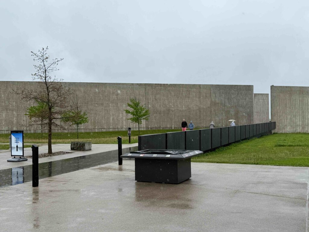
Flight 93 Memorial showing the flight path taken on Sept. 11, 2001
It had rain heavily for two days. On Monday, after planting the tomatoes I’d grown from seed in my garden, I’d drove in rain to Hancock, Maryland. The next morning, Warren and Hitch picked me up. I left my car at the Hancock Presbyterian Church. In the rain, we loaded my gear in my brother’s car and placed my bike next to his on this rack. We took the backroad, US 30, which had been the Lincoln Highway before the interstates, so that we could stop at the Flight 93 Memorial near Shanksville. The museum was sobering, but it rain too hard to do anything outside. Then, in Irwin, I introduced the two of them to a Western Pennsylvania stable, an Eat-n-Park Restaurant.
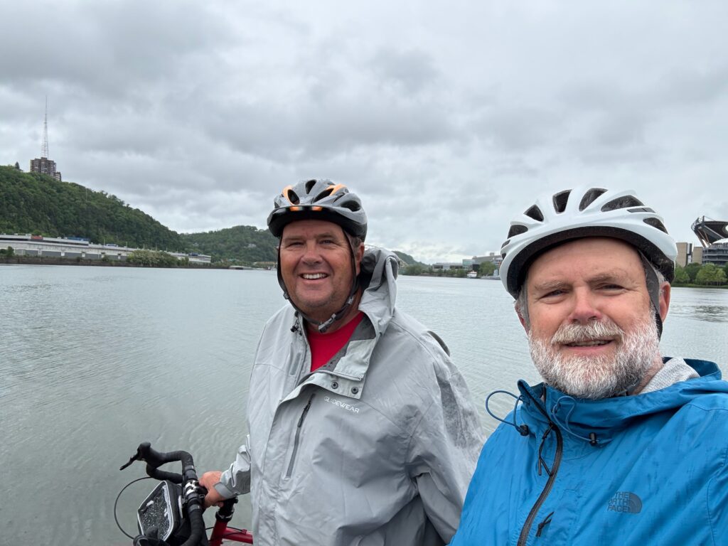
At Three Rivers
Thankfully, as we approached the city, the downpour weakened to a drizzle. Warren pulled the car over a block from Point State Park. We got our bikes off and loaded. Hitch took the keys to drive the car back to his home in Washington. Warren and I headed out to the Point. Looking over the city I called home for three years; I pointed out several landmarks to my brother. Of course, in the nearly 40 years since I moved to the Steel City, many things had changed. Three River Stadium was gone. Replacing it along the north side of the river was two new venues, one a football stadium for the Steelers and PNC Park, where the Pirates play.
Day 1: The Point to Homestead, 8 miles
Pittsburgh downtown from the Hot Metal Bridge
The GAP runs along the east side of the Monongahela through downtown, until it crosses over to the west side of the river on the “Hot Metal Bridge.” When steel was still being made on the Southside and at the J&L plant just outside of Oakland (home of the University of Pittsburgh), this bridge was still in use. When I lived in Pittsburgh, the Southside had been converted to an upscale shopping district known as Station Square. J&L was still running but would close before I left the city. We continued along the river, stopping at a hotel in Homestead. We only rode 8 miles in a hour which included a lot of stops along the way.
Homestead
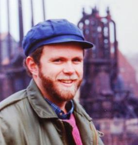
That’s me in Homestead, late 1980s
Homestead had been completely remade since I lived in Pittsburgh. While there, they began to tear down the huge US Steel plant, which ran for four miles along the river. The first book about the city I read after moving there was Thomas Bell’s Out of this Furnace. The novel, published in 1941, told the story of three generations of eastern Europeans who worked at the mills in Homestead and across the river in Braddock. I found myself making several trips to Homestead, especially after they started tearing down the mill. Today, where the mill once sat is a community of apartments, condos, hotels, restaurants, parks, and shopping. After arriving at the hotel, we explored the community on foot.
Day 2: Homestead to Connellsville, 51 miles
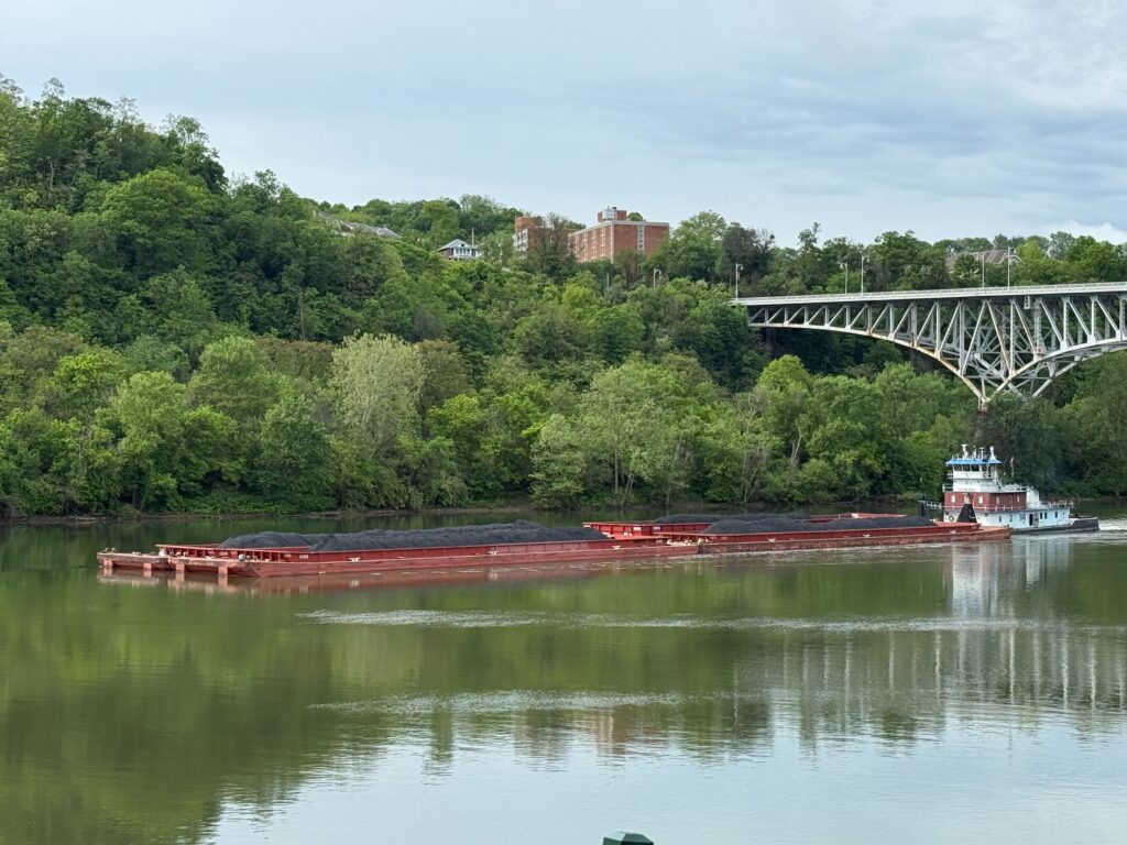
Barge on the Monongahela
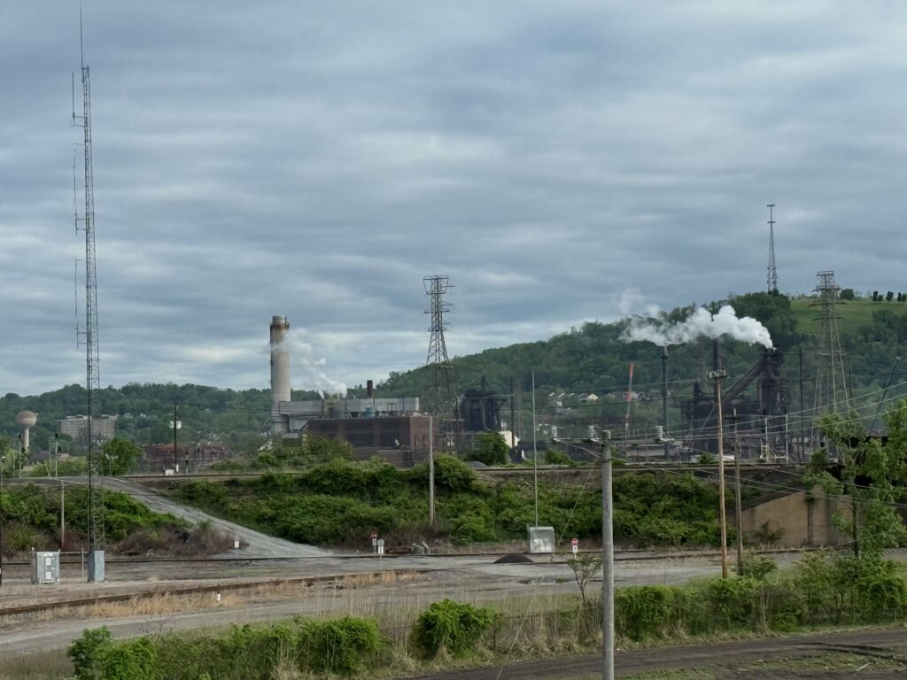
We left the hotel in Homestead at 7:45 AM. The remnants of steel mills were all around us with only one mill appearing to operate. Before McKeesport, we had a long detour as they resurfaced the trail. At McKeesport, we crossed over the Monongahela and began our climb alongside the Youghiogheny River. As we were leaving McKeesport, having traveled along some streets, my back tire went flat. Stopping, I discovered an inch and a half finishing nail through the tire and the tube. I replaced it with a fresh tube and after about 15 minutes we were again riding.
Steel mill
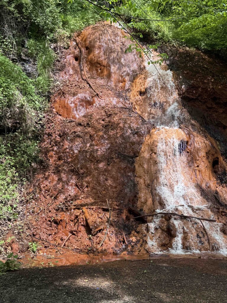
The trail along this section consisted of former industrial sites and some forest. With the river to our left, we occasionally would have a waterfall to our right. Often, these falls carried toxic waste from coal mines and left an orange sludge on the rocks.
Lunch in West Newton
At West Newton, we stopped at a bike shop where I picked up a new tube. I kept the old tube to repair so that I would have two tubes available. We’d been told of a good restaurant along the river, just behind the bike shop, but it was closed. The shop suggested we try Gary’s Chuckwagon, where for $15, I had a huge slab of a beer-battered fried cod (fish) on a homemade hoagie bun.
water from a mine (thankfully, you don’t have to smell the sulfur)
Coming out of West Newton, I spotted a possum. It appeared to have badly matted hair. When I got closer, I realized the matted mess of hair were younger possums getting a ride on mom. These weren’t small possums. They looked to be about half grown. I would have thought the mother would have told them it was time to start walking by themselves.
About eight miles from Connellsville, our evening destination, the skies opened. We took shelter for a while under an overpass with two other riders. When the rain subsided, we began to ride again, only to have another downpour. By the time we reached the hotel in Connellsville, we were both soaked, and our bikes were dirty from the mud. Thankfully, the Comfort Inn where we were staying had a wash station for bikes, which we used. They also had a room, which was locked at night, where we could store our bikes. That evening we ate at the River’s Edge Restaurant. I wasn’t overly hunger, so I had a bowl of crab bisque and a salad.
Day 3, Connellsville to Rockwood, 45 miles
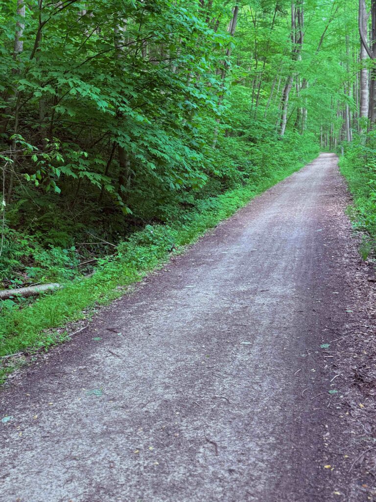
We left again at 8:15 in the morning. This was my favorite section as we left behind old industry and mostly peddled through woodlands with lovely stops at Ohiopyle, an old resort town that features some of America’s best whitewater. However, due to the high water levels, no one was kayak or rafting. We stopped at ate lunch in the park at Confluence. Warren had brought a couple of Underwood Chicken Salad cans and was wanting to rid himself of the extra weight. I grabbed an extra bagel at breakfast and used it to make a sandwich.
Rapids at Ohiopyle
The trail became noticeable steeper, especially after Confluence, as we broke away from the Youghiogheny River and followed the Casselman River. But the bed was wider, probably because of requiring double tracks on this steep section. It was easy to ride double through much of this section. For some reason, my left Achilles tendon began to bother me the more I rode. As for animals, I saw several deer and a few garner snakes.
We were the only people staying at the Rockwood Trail House, a bed and breakfast in which the hosts lived elsewhere. Max, whom we’d met the day before, stayed by himself in another B&B. The old home had been magnificently restored. It was also well stocked with healthy breakfast makings including yogurt, multiple kinds of granola, fruits, boiled eggs, and breads. For dinner, we walked into town (about a half mile) and ate at the Rock City Bar and Café. It was your typical Western Pennsylvanian bar with cheap bottle beer ($2.50 each) and great burgers. I had a Rocket Burger, which included sautéed mushroom, peppers, onions with cheese sticks. Including the beer, my tab was $13.65.
Day 4, Rockwood to Cumberland, 43 miles
I woke up after a weird dream mixed with people from the church I served in Michigan with the church in which I grew up in North Carolina. The morning was humid. After eating fruit, granola, and yogurt for breakfast, we headed out. It felt like rain. We still had 19 miles of climbing, but the grade was less than it had been the day before. After an hour, we were in Meyersdale. Thankfully, the trail runs high above the town where there was a nice museum in the old depot. I purchased a GAP/C&O Canal shirt. The town had experienced bad flooding earlier in the week. The trail also became more rutted from the water that eroded the bed. It was at the museum that we met the guy who had been flooded out of his tent site earlier in the week.
Washout near Meyersville
After Meyersville, we had another six miles of climbing as we made our way to the Eastern Continental Divide. Shortly afterwards, we passed through the Big Savage Tunnel. While I had a light for my handlebars, I didn’t need it as we discovered the 3,294 feet tunnel had lights. Coming out of the tunnel on the south end, we were treated to a magnificent view of the mountains to our east. As we took photos of the tunnel, we spoke to a biker heading to Pittsburgh. He was riding a commuter bike with a metal basket on the front. He’d come from Washington and told of the flooding and long detours and carrying his bicycle through knee-depth water along the C&O. He hoped for our sake; things would be drying out. It wouldn’t.
Downhill from the Savage Tunnel
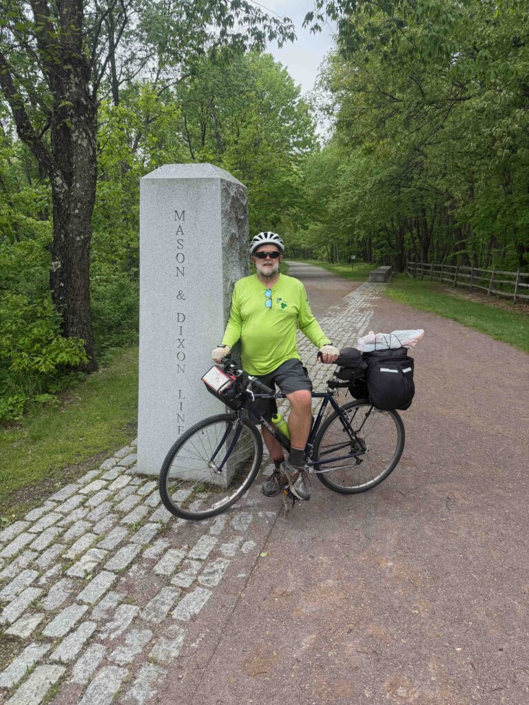
at the Mason Dixon line
After the tunnel, we stopped for lunch. Eating tuna salad sandwiches, we could hear the wisp of windmills generating electricity from the ridge above the tunnel. While we still had a little over 20 miles to go, we felt as if we had completed the trail as it was downhill from here. A mile or less after the tunnel, we paused at the monument for the Mason Dixon line, which separates Pennsylvania from Maryland. Crossing over, we were officially back in the South!
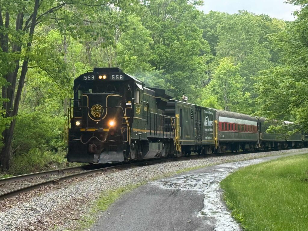
Western Maryland tourist train between Frostburg andCumberland
The GAP passes underneath the town of Frostburg. We talked of ice cream, but it required a climb to get into the town. Frostburg is a college town and on both sides of the town, we passed college students walking and running along the trail. About a mile south of Frost burg, I had another flat on my back tire. This time, I couldn’t find the cause. But the tube had a ¼ inch hole not far from the valve stem. One set of tracks of the Western Maryland still operate through this section and moments after having sat on the raised ballast to change my tube, a tourist train came down the tracks.
Taking refuge in the Brush Tunnel during a Thunderstorm
As the trail became steeper going down the hill, it also became more washed out. Instead of flying downhill, we had to control our speed on a roadbed that felt like a washboard. At places, the trail was so rough we walked the bikes. Clouds began to build, and thunder could be heard. We entered the 914-foot Brush Tunnel as the skies opened and waited out the storm inside. Another biker, who had ridden much of which had walked, joined us. The rocky and jarring path had caused him to lose both his light and his water bottles.
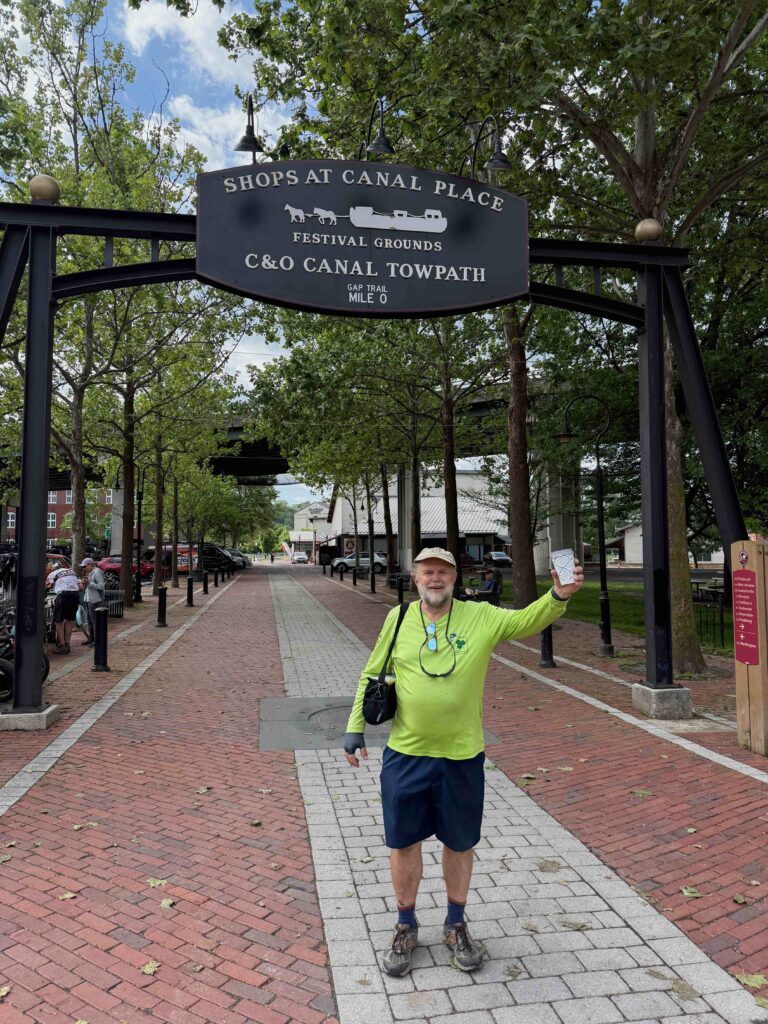
In Cumberland, at the end of the GAP
As the rain slowed, we again ventured out and rode all the way into Cumberland, arriving a little after 4 PM. We had hope to get there before the National Park Service office for the C&O Canal closed, but learned they work only till 4 PM. The rain and lightning had slowed us down and we just missed them. A maintenance employee for the park service came out and talked to us, confirming our fears. Parts of the trail were completely washed out and closed. We then went to a bike shop where we learned that the bypass to the C&O wasn’t a good option as it was a narrow windy road with semis traveling on it. We tentatively made plans for a shuttle in the morning.
Next, we headed to the Ramada Inn, where they had a room for bikes. After cleaning up, we headed out for dinner. Checking in as we were leaving was another biker who had passed us. He had continued along the C&O but came to place where he couldn’t go any further and didn’t want to ride the roadway. He came back to Cumberland and was planning to take the next day’s train to Pittsburgh.
We ate dinner at City Lights, a place that sounded a lot like a North Beach bookstore in San Francisco (and there’s another one in Iowa City). I had a Greek Salad with grilled chicken, which was delicious. After dinner, we walked around town, crossing a creek to see the Cumberland First Presbyterian Church, where I had once preached during my second year of seminary. We headed to bed early, not knowing what the next day would hold. At least, we’d completed the GAP.
Hopefully, I’ll write about the C&O experience next week.
To read about my journey from Edinburgh to Iona, click here. The trip involved two trains and two ferries!
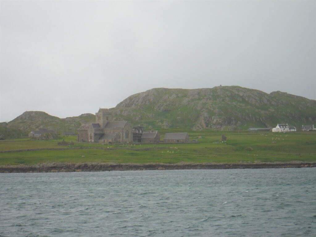
The abbey from the ferry (on the day we left)
Grasping the rail to hold steady, I stand on the starboard catwalk looking out across the waters. I pull up the hood on my rain jacket. I could go below, but I want to face the angry sea. The engines roar and black smoke puffs from the stack as the ferry pulls away from the Flonnphort’s dock. Moments later, we are in open water. The north wind whistles through the channel separating Mull from Iona. The pilot steers the boat into the wind, but the waves and tide push us southward. He increases speed as I spread my legs apart in order to remain upright. The boat rolls back and forth in the waves.
North end of Iona, looking toward Mull
In a few minutes, we’re well out into the channel. The Abbey is clearly visible, standing tall in the shadow of Dun I, the high point on the island. We’re just the latest travelers, joining a hoard of pilgrims reaching back to the sixth century. I have no idea what the week will bring, but the roughness of the channel reminds me of the island’s isolation. The ferry pushes harder as we approach the landing. The pilot steers the boat up into the wind then lands on the ramp. There is no natural harbor in Iona. The pilot keeps the engines engaged, keeping the boat in position as the crew lowers the bow ramp. The two cars onboard are allowed to drive off first, then the two dozen or so of us passengers follow. The first off the boat get wet when a wave breaks and crashes over the ramp. The rest of us learn to time our departure, waiting till a lull to move out on the ramp and to quickly make our way to shore. We’re on Iona.
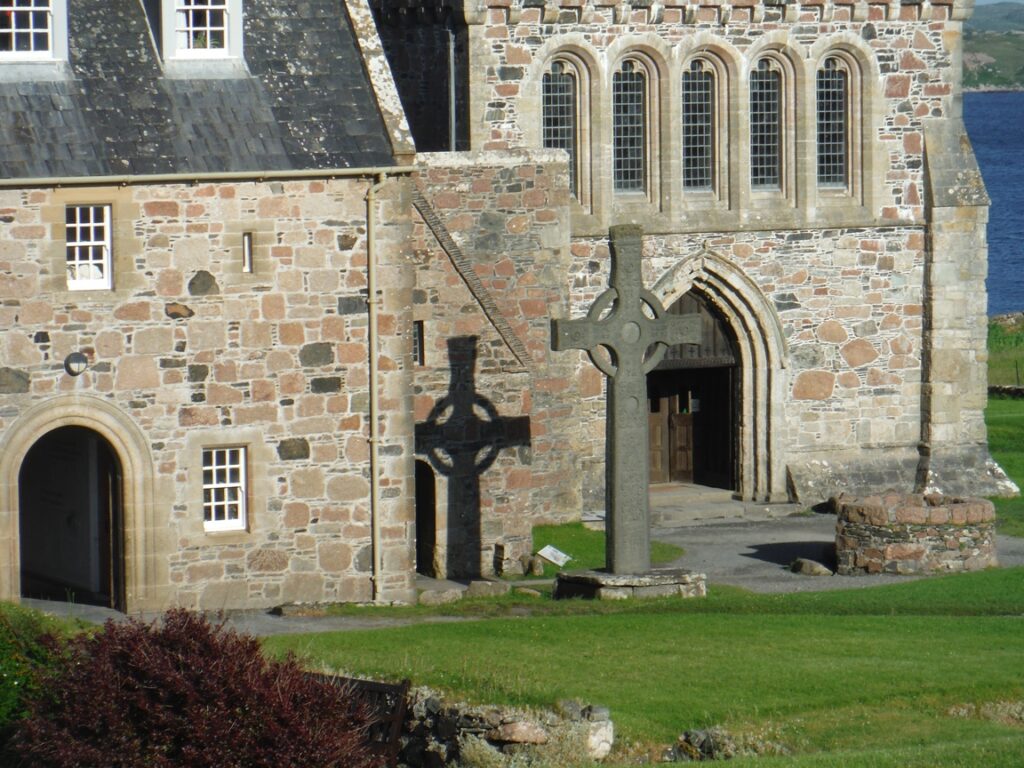
On Pentecost, 563, an Irish abbot named Columba and a group of twelve disciples landed on a pebble covered cove on the south end of Iona. They found on this small island what they were looking for and established a religious community. At this time, sea travel was easier than traveling overland on non-existent roads. The small island became a center of faith and learning that extended throughout the mainland of Britain and Ireland and surrounding islands. Some scholars believe the Book of Kells was originally produced here. Others think the large standing Celtic crosses, so common in Scotland and Ireland, were first carved on this island.
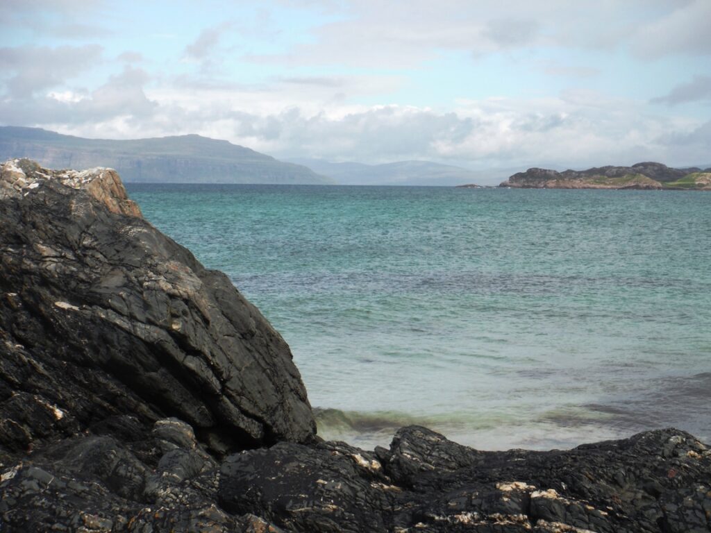
Looking across toward Mull
The religious community thrived on Iona for the next couple hundred years. People would travel by sea, making a pilgrimage to the island of the saint known as Columba. Scottish Kings sought out the island for burial. Legend has it that even MacBeth, of Shakespeare’s fame, is buried here.
Around the tenth century, hostile visitors from the north, the Vikings, arrived. With their art and wealth, churches and monasteries were attractive targets. After several raids and the deaths of scores of monks, Iona was abandoned as a center of learning. Most of the monks moved back to Ireland.
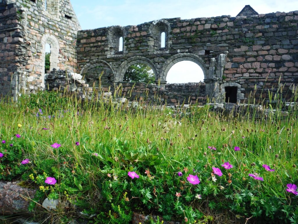
Augustine nunnery
By the twelfth century, the Viking threat had faded. The Benedictine Order reestablished the monastery on Iona, building the current Abbey. They were joined by an Augustine nunnery, whose ruins are just south of the Abbey. These two continued to thrive till the Scottish Reformation in 1560. Afterwards, the site began to crumble. But pilgrims and visitors continued to come.
In 1829, Felix Mendelssohn visited and although the seas were rough and he suffered from sea sickness, he was inspired to compose the Hebridean Overture on the nearby island of Staffa. A “Who’s Who” of British authors also made the trip including John Keats, Robert Lewis Stevenson, naturalist Joseph Banks, Dr. Samuel Johnson, James Boswell, Sir Walter Scott and William Wordsworth
After the abandonment of the monastery, the property came under the control of the Duke of Argyll. Over time, with the harsh wet climate of Iona, the trusses rotted and the roof caved in. In the 19th Century, George Douglas Campbell, the eighth Duke of Argyll, began restoring the Abbey. Although a devout member of the Church of Scotland (Presbyterian), he allowed a number of different denominations (Presbyterians, Scottish Episcopal and Roman Catholic) to use the site for worship. Before his death, he deeded the grounds to the Iona Trust which has responsibility today for maintaining the site. The site is open to all denominations. Since the 1930s, the site has been operated by the Iona Community which uses it to hold ecumenical worship and to train people to work with the poor around the world.
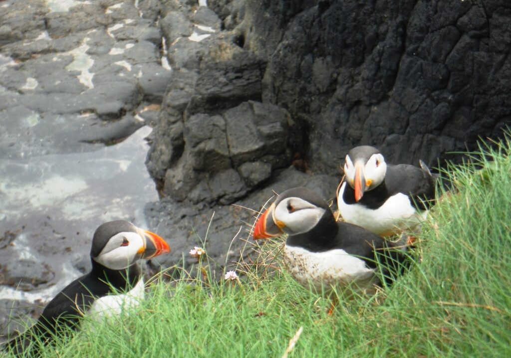
Puffins on Staffa
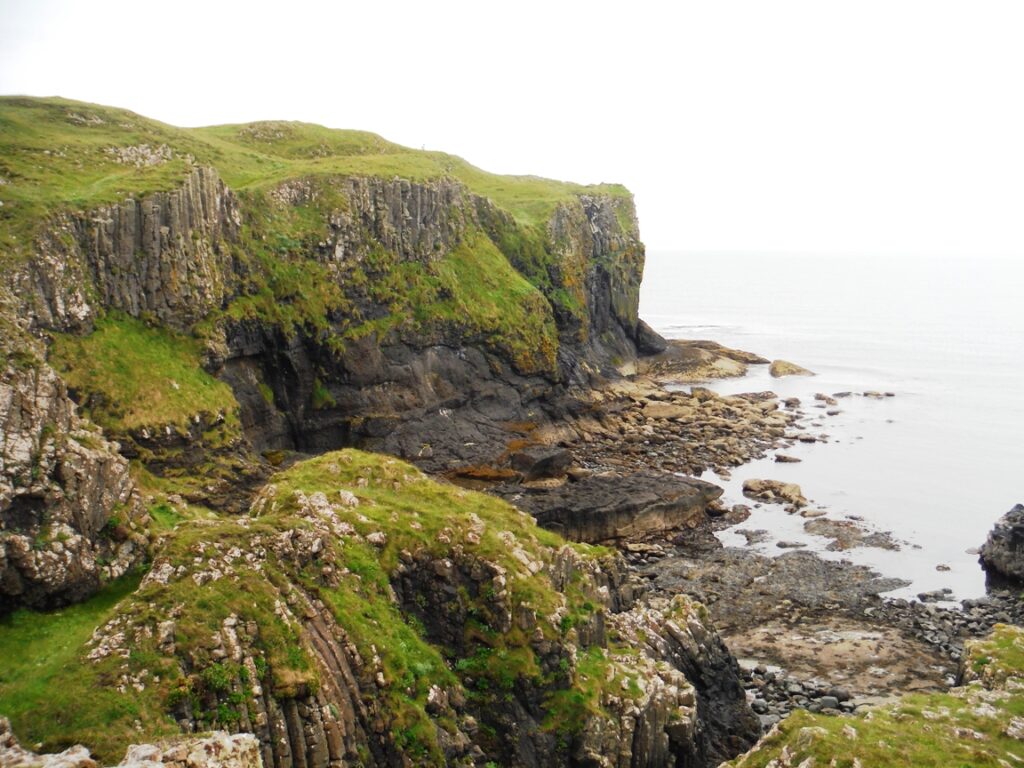
Those who wish to participate with the community today are expected to spend a minimum of a week on the island. Guests live as a part of the community, staying in dormitory rooms (six or eight people of the same sex per room). The guests help with the cooking and the cleaning, and participating in morning worship and evening prayers. The community strives to bring people together from all over the world as a way to foster a better understanding of one another. Groups meet together for Bible Study as well as to discuss other topics, with plenty of free time to explore the island or to take boat trips around the island or to other islands. Staffa, a small island with unique geology, known for puffins that nest there in the summer and “Fingal’s Cave” is a popular destination.
Straffa landscape
I spend my week on Iona meeting with a group led by two professors of British Universities. Both are poets. One teaches English while the other teaches in a seminary. As for my chores, I am in the kitchen, mostly chopping vegetables. Although the food is not exclusively vegetarian (we had meat three times during the week), we ate lots of wonderful vegetarian dishes that included roasted root vegetables and thick soups, all prepared from scratch.
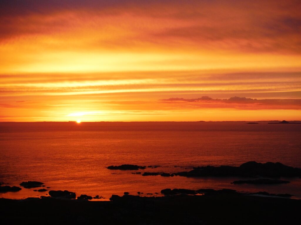
With my spare time I hike around the island. Daily, generally around sunset (10:30 PM), I hike to the top of Dun I, the high point of the island. The sunsets are incredible. At night, I can see distant lighthouses. One of the lighthouses was built by Robert Lewis Stevenson’s father in the early nineteenth century to warn boaters of Torran Rocks. This is also the site Stevenson’s chose for the shipwreck in. his book, “Kidnapped.’ I also gaze out on other islands in both the Inner and Outer Hebrides chain. Twilight seems to go on forever and provides some of the most beautiful light on the island and sea.
Friday is my last day and I, along with many other pilgrims, are leaving on the 8:15 AM ferry. Its drizzling rain, but calmer than the day I’d arrived. The Iona staff gather at the dock to wish us a safe trip. Once the ferry lands in Fionnphort, there’s no time to waste. A bus waits. We load up and ride across the Ross of Mull and Glen More, to Craignure, where we meet another ferry. It’s nearly an hour over to the mainland, to Oban, where we board a waiting train.
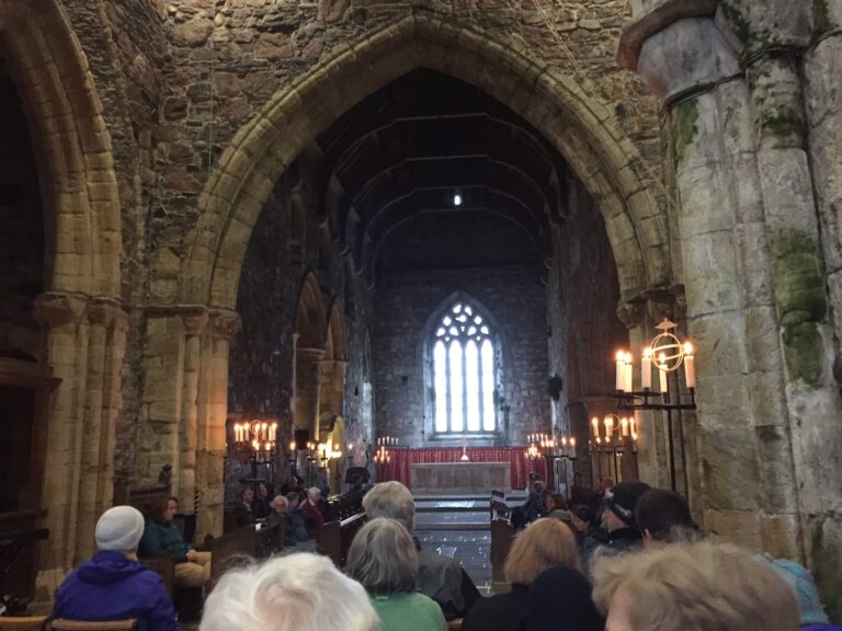
Worship in the Abbey
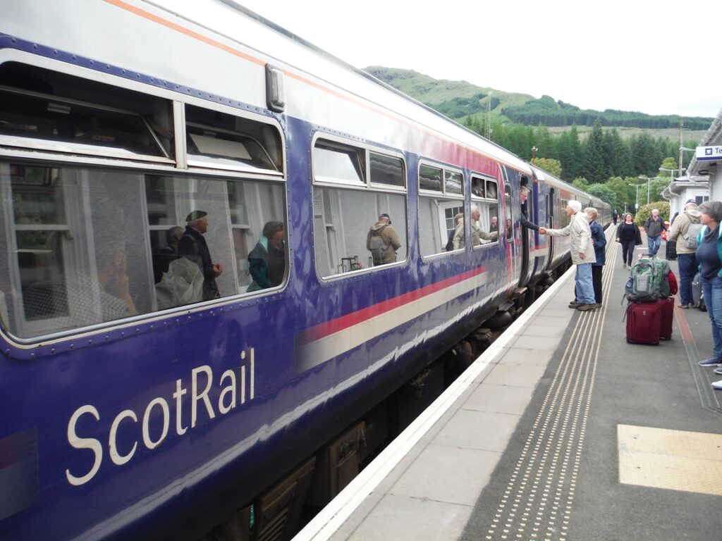
Most of those whom I’d spent time with on Iona continue on to Glasgow and home. But not me. At Crainlarich, where the Oban branch merges onto the Northwest Highlands mainline, I say my goodbyes to friends and step off the train. Thirty minutes later, I board a northbound train, taking me through Fort Williams and over the Glenfinnan trestle (made famous in the Harry Potter movies), and on to Mallaig where I catch the ferry to the Isle of Skye.
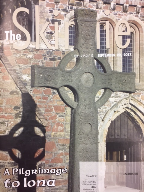
This story originally appeared in The Skinnie, a magazine for Skidaway Island, on September 22 , 2017.
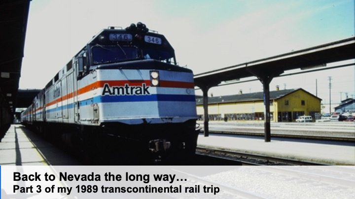
I wake up as the train crosses the Potomac, heading into the DC Station. I don’t get up, but continued napping as the diesel locomotives were traded for electric ones. Fifteen or so minutes later, we pull out of Washington and continue northward. Around mid-morning, I step off the train in Philadelphia. Shari stands at the end of the platform waiting. I have a long layover before catching the Pennsylvanian, a train that will take me overnight from Philadelphia through Pittsburgh and on to Chicago. (Today, the Pennsylvanian only runs to Pittsburgh).
Philadelphia
Shari
As it was Sunday morning, Shari drove into the city. I toss my bags into the back of her car and we stop at a bakery at the end of Fairmont Park for breakfast and coffee. We catch up on our lives as it had been nearly two years since we met along the Appalachian Trail at Delaware Gap. Having recently finished law school, she is debating two job offers to teach legal writing, one at Catholic University in Washington and another at Western Mass Law School in Springfield.
After breakfast, we walk over to the Philadelphia Art Gallery. We see Robert Adams collection of American Western photos along with several Monet and Van Gogh paintings. I was shocked to learn Shari doesn’t care much for art galleys, so we head across the river and walk around the zoo. Later, we drive across town to the old part of Philadelphia. There, on South Street, Shari insists on treating me with an authentic Philly Cheese Sandwich. This is a real treat, as she’s a vegetarian. She’d asked friends for the best place to buy me a sandwich. We then walk around the old city, stopping to look at the Liberty Bell, Independence Hall, and checking out Benjamin Franklin’s pew at Christ Church. As a Jew, she was more than willing to indulge my curiosity inside the church. Then it was time to head back to the Amtrak Station.
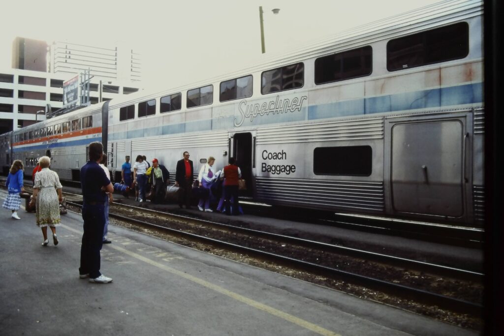
On the Chicago
That evening, as the train ran across Pennsylvania, I had dinner with a guy name Tim. He works in the computer import business and has spent a lot of time in Seattle. He provides several suggestions on getting around in the city and what to see. After returning to my seat, I alternate reading my academic advisor’s new book, Beyond Servanthood and Adela Yarbro Collin’s, Crisis and Catharsis: The Power of the Apocalypse before falling asleep.
Chicago and McCormick Theological Seminary
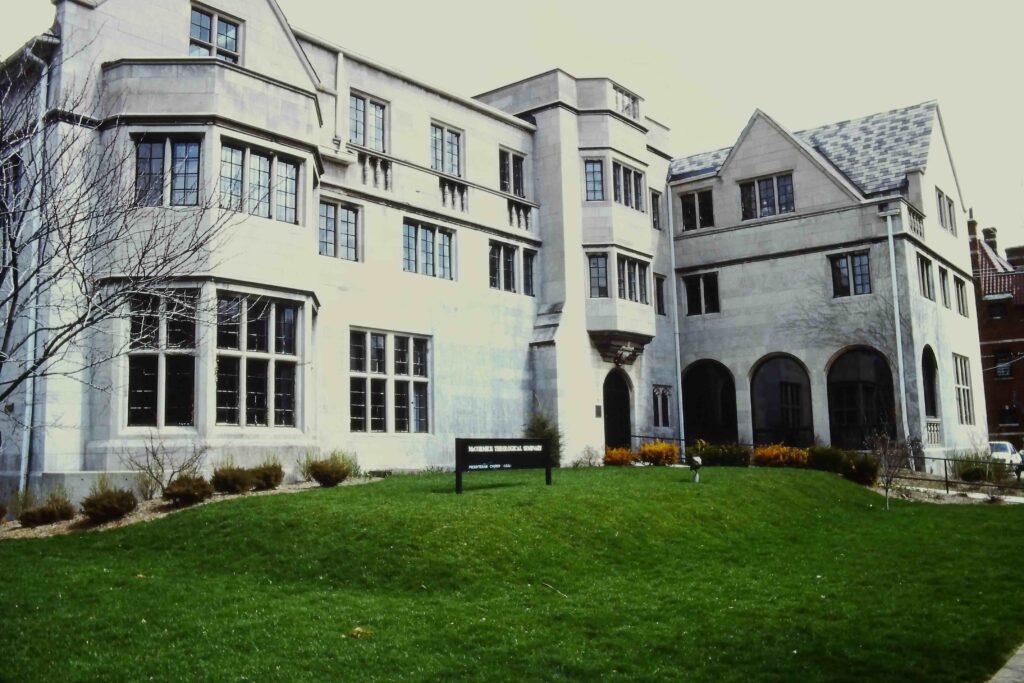
McCormick Theological Seminary
We arrived in Chicago on time, early in the morning. Having been given directions to McCormick Theological Seminary in Hyde Park, I walk a few blocks to the east and take a regional train. At the seminary, I’m met by several students whom I had worked with at the General Assembly in Saint Louis the previous summer. They introduce me to more students. We attend chapel together, then they arrange for me to take a shower in a dorm, before meeting for lunch. Afterwards, Marj, one of the students I knew from St. Louis, insists on driving me back to the Southshore Station, which was about a mile away. She had suggested I call when I arrived there and she would have picked me up, or I should take a cab. But I decided to walk down and surprise them. Undoubtedly, the neighborhood is worse than it looks. I take the Southshore back into the city center city to catch the Empire Builder that afternoon for Seattle.
While walking back to Union Station, I was surprised to be greeted by two kids running up to me. Aaron and Ashley and their mother Karen, whom I’d met on my journey from Pittsburgh to Washington, sit just outiside of the depot, while waiting on their train to Grand Rapids, Michigan. They’d just returned from their trip to the Nation’s Capital. We have enough time to grab an ice cream before I boarded the train to the West Coast.
Chicago to Seattle, Day 1
The Empire Builder, the northern most of the great western railways was built by and named for James J. Hill. He envisioned a railroad across the northern plains, connecting the twin cities of St. Paul and Minneapolis to the Pacific. The line runs just south of the Canadian border. The Amtrak line which goes by the same name, starts along the old Milwaukee Road line from Chicago and then picks up Hill’s Great Northern line at the Twin Cities.
My train leaves Chicago late in the afternoon. I finish reading Sue’s book, Beyond Servanthood, before bed. Sometime early in the morning, we stop in the Twin Cities. I don’t even get up and quickly fall back asleep.
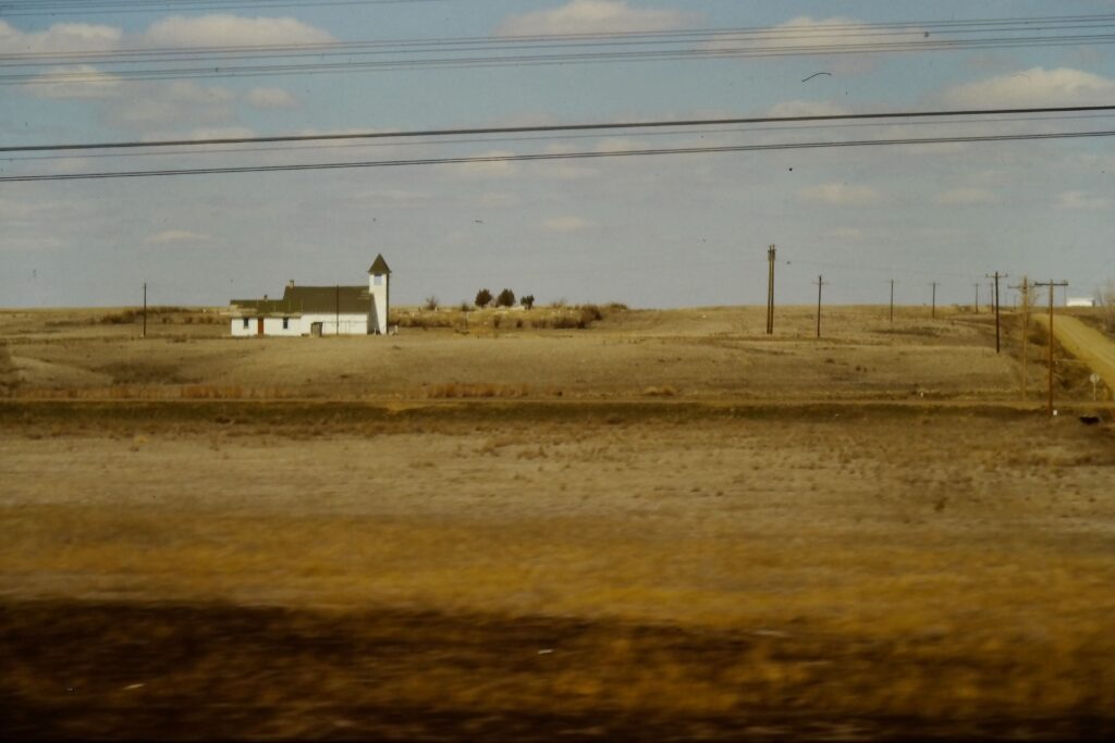
The next time I awake, the train gently rolls through curves, its wheels squeaking as they rub against the rail. I opened the curtains to see a thin strip of pink in the sky. I assume I’m looking out for the first time at North Dakota. A thin blanket of snow lays along the flat prairie, broken by an occasional row of trees or a line of utility poles. At regular intervals, a larger clump of trees indicates a small village. Above the trees stand a church steeple, water tower, and grain elevator. Nothing moves. Empty grain hoppers sit on sidetracks, waiting for the next harvest. A few cows huddle near isolated barns. I make out the silhouette of tractors, waiting for warmer weather. The state seems to be in a late winter nap. Then the train pulls up to the platform and I see the sign for Detroit Lakes. We’re still in Minnesota. I fall back asleep.
Church in Eastern North Dakota
Fargo
Our next stop is Fargo. The town hadn’t yet been made famous by the Coen Brother’s black comedy. I step off the train and take a brisk walk up and down the platform. My breath smokes like a steam locomotive in the cold air. But it wakes me up. After a few laps, I hear “All Aboard,” and step back onboard and head to the lounge car for coffee. I sit and watch the prairie as the day awakes. It’s spring but feels like it’s still winter. I can’t imagine the harshness of life up here along the high line, cold winters and hot summers.
I spend much of the morning alternating between looking out of the window and reading. Having tired of theology, I pull out the one book of fiction in my bag, Doris Lessings, The Summer Before the Dark. It wasn’t light reading, so I spend much of the time looking and talking to fellow passengers.
Delay
We’re running behind a bit, but late morning we come to a full stop. We’re informed of a train derailment ahead of us which needs to be clear. We sit, looking at the same barren prairie for two hours. The fences that run alongside the tracks seem mostly to corral tumbleweed. After we resume, I get off at all the towns where there’s a smoke stop, walking a few laps around the platform as the smokers puff down their cigarettes.
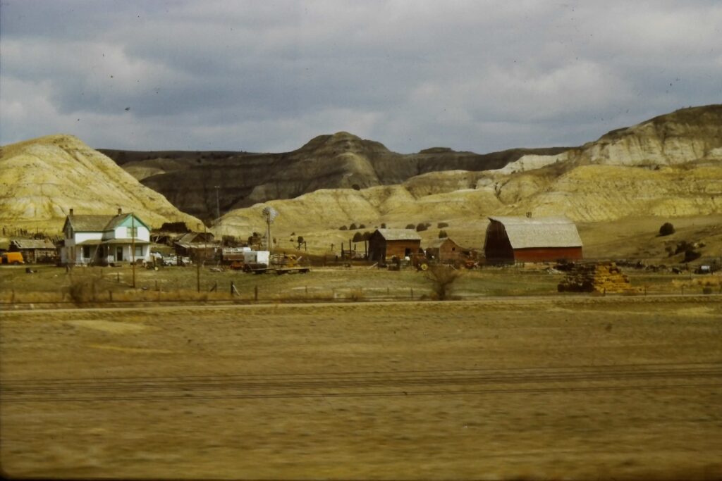
The further west we travel, the more familiar the landscape seems. I spot sagebrush and, in my journal, use the term “Sage Covered Hills,” first the first time. For years, it would be the name of my blog. Some of the towns have painted their initials on the hillside above them. This common western feature I first spot on a hill above Glasgow. There are massive powerlines pulling electricity from places like Fort Peck Dam. At the time, I knew nothing about the dam. Later, I’d become more familiar with it through the writings of Ivan Doig, a Montanan author.
Chicago to Seattle, Day 2
As the sun sets, we can make out the distant mountains. Running several hours behind due to the derailment up ahead means we’ll not see the majestic peaks as we cross into the northern Rockies. It’s two hours after dark when we arrive at Glacier Park Station. Instead of a light dusting of snow, as I’d seen in the morning, the mounds of pack snow are head high all around the station. A few passengers get off and others come aboard and soon we’re slowly climbing in the darkness.
I wake up at dawn and we’re in Spokane, having crossed the Rockies in the dark. Here, the train splits with part of the train heading to Portland, while the rest of us will continue to Seattle.
We run through eastern Washington and arrive in Seattle at midday. This is unfamiliar country to me. Years later, when I read David Guterson’s East of the Mountains, I recalled my trip across the state. I wished I had made more journal entries as I traveled reverse of Dr. Ben Givens, the novel’s protagonist.
Scanner
Seattle
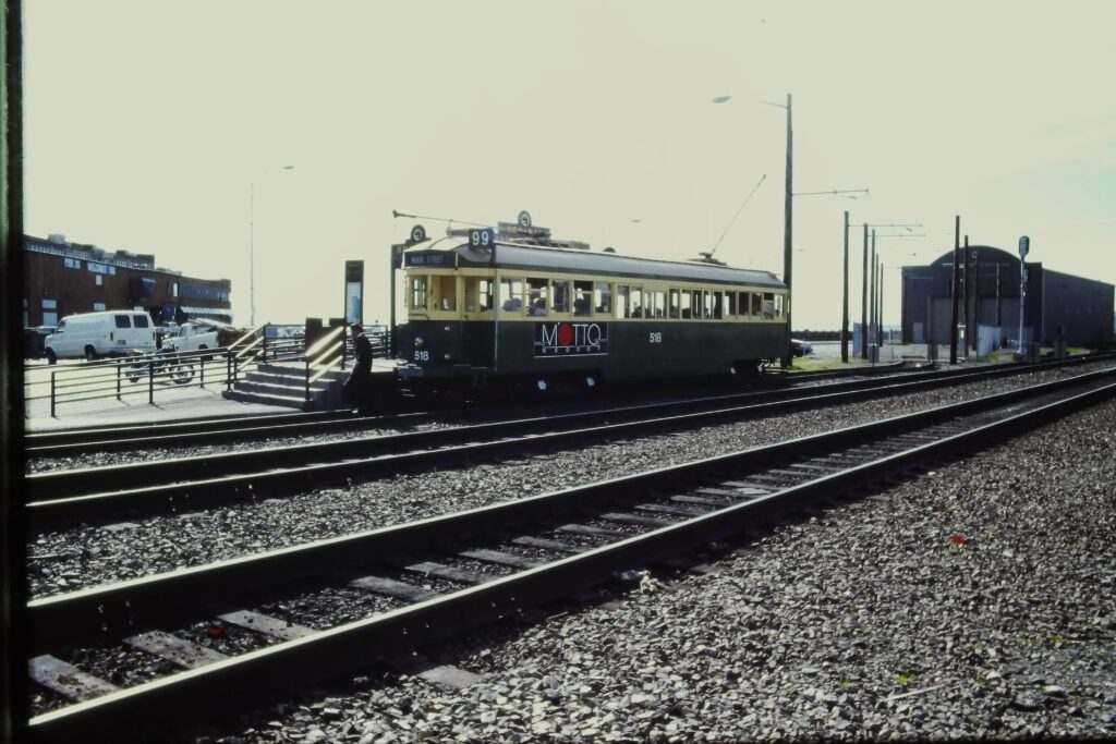
trolley
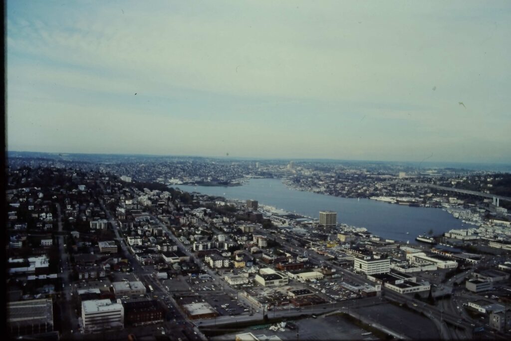
In Seattle, I gather my luggage and head to my hotel, two blocks away. I’m too early to get the room. I leave my luggage at the counter and set out to find lunch. Afterwards, I head to the Space Needle for a view of the city. I ride the city’s cable cars and walk along the wharfs and fish markets dotting the water. Later, I find a place to have seafood for dinner. I head back to the hotel before dark, wanting to sleep in a bed without waking up at stops. From the room, I call Carolyn and am surprised when she tells me she’ll meet me in Sacramento in two days. I’m both excited and nervous.
Seattle skyline take from the “Space Needle”
On the Coast Starlight to Sacramento
The next morning, in a misty rain, head back to the train station and checked my bags for home. The sky is hazy as we pull out of the station on the Coast Starlight. I can barely make out the shapes of St. Helens, Ranier, and Hood of the Cascade Range. This overnight train runs almost 1400 miles, connecting Seattle with Los Angeles.
I get off early the next morning in Sacramento. My ticket was for Oakland/San Francisco, where I would transfer to the California Zephyr. But since the Zephyr also stops in Sacramento, this allows me to avoid riding the same track and provides me with most of the day in California’s capital. It’s a beautiful day and the city is just waking up. As I arrive an hour before Carolyn, I hike up to the bus station, maybe a mile away. I stop for coffee and then, thinking it’s about time, walk on over to the station. Her bus is early and she’s leaving the station, when I call to her. We hug and set out to see the city.
Of course, nothing is yet open. We walk around the state capitol. Then we head to the Roman Catholic Cathedral. This had been built by the first Catholic Priest in Virginia City after he was made a bishop. Then, when the California State Railroad Museum opens, we head there. This is one of the premier railroad museums in the world and we spend the rest of the morning exploring. After lunch in the snack bar, we head back to the train station to the ride back to Reno.
The final lap to Reno
Sierras
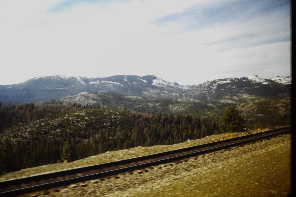
The ride across the Sierras is familiar as the tracks mostly parallel Interstate 80. The train twists and sways and often runs through snow sheds, designed to protect the tracks from avalanches such as one in 1954 which stranded a train for a week. We mostly sit in the lounge car, close to each other, our feet propped up on the rail below the window, as we take in the scene. After the stop in Truckee, we head back to our seats and collect our baggage. In Reno, where I started nearly three weeks earlier, we step off the train.
This is a second post on a trip I took with Ralph to the northern Mojave in California. Click here to read about the morning at Goler Gulch.
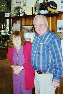
Olga’s the first 94-year-old redhead I’ve met. I’m sure she has some artificial help; even so, her hair shows spunk. She gets around well and lives by herself. “I wouldn’t have it any other way,” she confesses. She still runs “The Joint,” pulling a regular shift, tending bar. When things are not busy, she steps out front and pull weeds from the flower bed. That’s where we first saw her. Ralph and I along with Bill and his friend had stopped in Randsburg for a late lunch after our tour of Goler Gulch. As we headed to a restaurant, Ralph mumbled something about it can’t Olga pulling flowers. He recognized the woman who none of us had seen.
After lunch, Ralph and I walked down to “The Joint,” a bar in Randsburg. Olga’s washing glasses as we enter. She stops and turns to take our order. Olga doesn’t recognize Ralph, so he introduces himself. She looks at him for a minute, then smiles and comments about how much she misses his brother. He lived in the area and died a couple of years earlier. The two chat for a minute about Olga’s son, who was Ralph’s age. The two of them went off to war together in 1944. Ralph asked how long she’s been tending bar at “The Joint.” We learn she and her late-husband brought the establishment in 1955. “I’ve had honest work ever since,” she tells us. I was curious about what kind of work she’d done before but decide not to interrupt their reunion.
Selling booze in a mining town was lucrative business. Selling anything liquid use to be lucrative business as water in these parts was expensive, even as late as the ‘40s. Today, there is little mining and its mostly tourists who stop in want something alcoholic. The establishment is open from Wednesday through Sunday and they close in the evening when they are no longer busy. “The Joint” is in the heart of Randsburg’s business district and one of the original structures in town. The building was first a bakery. In the 30s, it was converted to a bar and a pool hall.
Ralph and I both order a couple of Mojave Greens, a local beer made in Inyokern and named for the famous rattlesnake of the Mojave. Ralph, who grew up in this area, said he’d only seen two of these snakes in his life. She pulls us two bottles out of the cooler, opens them, and ask if we want a glass. Ralph, always the civilized one, takes a glass and slowly pours his beer into it. I shake my head, grab the bottle and tip it up to drink. Ralph and Olga continue talking until Olga pauses to fix another drink for the woman sitting at the other end of the bar.
Its then I notice Faye, who’s sitting a few stools away and looking for a refill. I’m not sure why I hadn’t noticed her earlier as she wears a barely ample halter displaying more than ample breasts. She’s attractive or certainly could be. With her tight mini-skirt and heels which must be five inches high, I wonder what kind of business she’s in. We chat for a few minutes and learn she’s the proprietor of the Silver Dollar Saloon in Red Mountain. This is her day off.
The day before, when we drove through Red Mountain, Ralph had told me earlier about the red-light district there. It was a hoping place when he was a schoolboy before the war. The saloons in Red Mountain lined the west side of the street and featured backroom gambling. Gambling was illegal in California, but this wasn’t exactly on the main highway and most people looked the other way. On the east side of the street were “cribs,” where prostitutes who free-lanced in the bars and around the gambling dens, led their clients. It was a cozy arrangement, and local authorities did little to discourage business.
But then World War 2 came along. The Navy built a base on China Lake. Since there’s not enough water in China Lake to float a canoe most years, they used the base to train pilots. Naval authorities found that after a night of drinking, gambling and whoring, the drive over the mountain was too difficult to negotiate. They lost many pilots before they had a chance to sight in on a Japanese Zero. The Navy called in the FBI, who shut down the gaming establishments and ran the women off.
A few minutes later, Faye’s partner at the Silver Dollar joined us at the bar. While I’d enjoyed glancing over at Faye as we talked, I now divert my eyes. This guy is scary. His bare skinny legs end within fancy black leather cowboy boots, with pointed toes, and scroll threading. Personally, I think wearing cowboy boots without long pants should be a misdemeanor. Wearing cowboy boots with super tight short shorts, the kind which hadn’t been seen since the 80s, should be a felony! This guy’s pants are shorter than his partner’s mini skirt.
I’m glad I’m not alone in the bar with him. Had it just been me drinking and he came in, I think I’d wallowed over to the Methodist Church and take the temperance pledge. But he joins the conversation and seems to be an okay. However, he and Faye, to say the least, are one unique couple.
Ralph and I finish our beers and head out. The darkness in the bar forces our eyes to squint as we adjust to the bright desert sky. We take the long way back to Ridgecrest, through Inyokern. I tell Ralph about my one other trip to Inyokern. It was approaching midnight. I was with Eric, another friend of mine who Ralph knows. We’d been looking for a place to stop for the night. We were on our way to do a week hike from New Army Pass, to the Pacific Crest Trail and then up the backside of Mt. Whitney, and then north along the John Muir Trail to Onion Valley. And we wanted to get an early start the next morning so we kept driving late into the night.
Eric sighted a spotlight for an airport. As a pilot, he suggested we head there and camp, telling me about camping under his plane at such places. There was no one to stop us. I slept on one side of the car and Eric on the other. The night was warm. I laid out my pad and sleeping bag and slept on top. I must have been exhausted for I don’t remember anything else until 5:00 AM, when a loudspeaker rudely awaken me as it called out for those boarding the 5:30 AM flight to LAX. Shortly afterwards, we were on the road.
Ralph, who always had a way with words, quipped something about how Eric and I must not of been living right. Ralph and I had camped out when in the wilderness. But he felt if we’re going to stay in civilization, we should, at least, find a motel.
We drive back into Ridgecrest as the light softens. The shadows of the barren peaks provide definition to the distant hills in the low warm light. It’s nearly dark when we arrive. Unlike Randsburg, Ridgecrest is a new town, built during World War II. The purpose of the town is to serve the China Lake Naval base. We drive around, looking for a place for dinner. In our search, as we navigate ubiquitous four-way stop signs, But what amazed me of the town was to see not only had a dollar store, but also a 99-cent store and, for those who that’s even too much, a 98-cent store. Every place needs to be known for something.
Last week, I told a story about an adventure with Ralph into Central Nevada. This week, I rewrote a piece I wrote in 2010, shortly after Ralph’s death. This trip I spent more time jotting down in my journal some of Ralph’s unique bits of wisdom. Hopefully, you’ll get a better view of my friend who died 15 years ago.
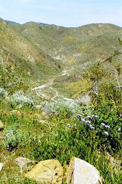
Flowers in Goler Gulch
Ralph and I stayed the night in Ridgecrest. Before heading out for the desert early in the morning, we stopped at a grocery store to pick up fruit and pastries along with coffee and juice. Dawn broke as we drove along the highway toward Goler Gulch. In the soft morning light, the carpeting of highway shoulder with flowers amazed me. The wet winter had given growth to white and yellow asters, daisies and bluish heliotropes. Even beyond the road, the flowers grew under clumps of greasewood.
It was March 2005. I had flown out west the day before so I could officiate at a wedding. I picked up a rental car in Las Vegas. As I had a few extra days before the celebration, Ralph took a bus down from Cedar City and met me in Vegas. We then headed over into the Southern California desert, to see where he grew up. We’d talked about doing this trip several times while I lived in Utah, but had never gotten around to it.
Our next stop this morning was Sam’s Cabin, located just off the highway. Arriving, we sit outside on a picnic table and ate our breakfast while watching the changes in the morning light across the El Paso Mountains to our north. “You can find any kind of mineral up there in those mountains,” Ralph noted. “Just don’t start a mine, because whatever your digging will quickly disappear.” It was the words of one who knew a bit about the folly of mining.
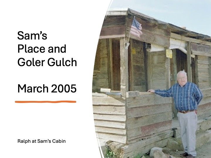
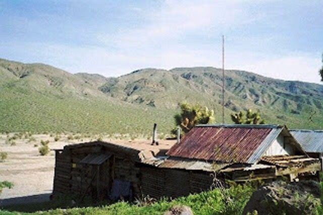
Sam’s Cabin
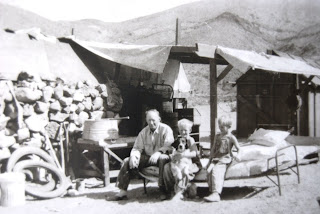
I’d heard a lot about Sam, who’d built this cabin seventy-some years ago. Once, I met his daughter, who’d recently died in her mid-nineties. Sam was an old-time miner. He’d worked in Nevada and as a young man headed up to the Klondike in 1898. He supposedly made enough money up north that he didn’t have to do much work the rest of his life. In the 1930s, he showed up in the Mojave, working as a caretaker for a mining firm. It didn’t take much to live like he did. He had a wife, who lived over on the coast. Sam would go visit her a couple times a year and occasionally she’d come out to the desert, that being the extent of their marriage.
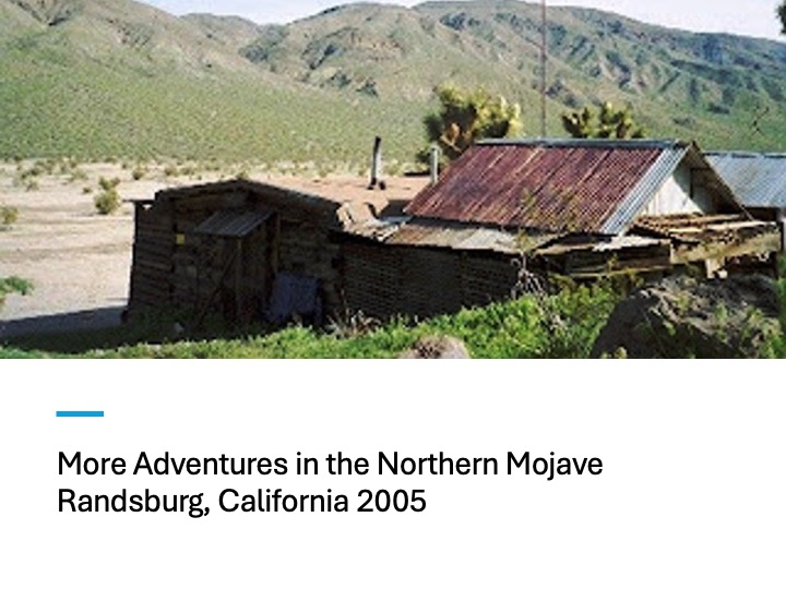
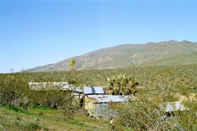
Sam’s homestead
My favorite story of Ralph and Sam was their trip to Death Valley in Ralph’s family Model T truck, taking it across China Lake early in the World War II, before the government converted the dry lakebed to a Naval Aviation bombing site. Ralph had fond memories of the trip, including meeting Scotty of Scotty’s Castle in Death Valley. Today, this trip would be impossible because the bombing range is still in use.
We discovered Sam’s cabin in a state of “arrested decay.” The BLM keeps it from blowing down and one can rent it for up to two nights. Sam died in 1965, in his early 90s.
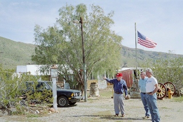
After breakfast, we looked around the old cabin while waiting for Bill, a friend of Ralph’s from Southern California to arrive. Rocks and boulders of all shapes, colors and sizes dot the yard. Ralph pointed to many of them and told me which gulch from which they’d been taken. Most of the rocks had been hauled in by Sam with the help of Ralph and his brother Charlie.
Another view of Sam’s homestead
Ralph’s family homestead in Goler Gulch
Bill arrive a few minutes later, driving a huge Suburban SUV. We decide to take his Suburban and leave my rental car at Sam’s Cabin. We climbed in and Ralph began the tour of Goler Gulch. The gulch has always been a placer mining district, meaning the ore is found in sediment washed down from the mountains. Attempts have been made to find the ore body from up in the mountains, but no one has ever identified the source. When Ralph was a kid, old miners held to the belief the gold had been pushed down during the last ice age, by glaciers. Of course, there is no evidence of glacier activity this far south. Another popular theory, according to Ralph, who reported this with a straight face, is that the gold came from Alaska.
Ralph showing us around the old Behren homstead
Ralph’s family’s Model T
Ralph was born in Kansas. When he was an infant, his parents moved to California. They added a bed to their Model T coupe, making it into a truck in which the family made the journey. After a short stint in Los Angeles, they headed into the desert, where his dad worked as a miner and a cook. Interestingly, the Model T still runs. Ralph has driven me around in it and even let me drive it.
Ralph told about his brother Charlie and him taking the Model T on trips through the desert. In the spring or after rains, when the water would be raging in the gulch, they’d stop the car on one side of the stream, take off the fan belt and drive through the water, hooking the fan belt back up on the other side. The car seemed to go anywhere; you just had to know the tricks. If the fan was spinning, it would kick water over the distributor cap and short out the electrical system. The engine could take a little more heat than the electrical system could take water.
The homestead around 1930 with Ralph, his father and his brother and pet dog. They often slept outdoors, especially in the summer.
Ralph’s family homestead includes a collection of buildings. Ralph pointed to a building he and Sam had built at the beginning of the war for some women from Pasadena who wanted a place to flee when the Japanese invaded. “They were sure the Japanese were coming to rape them,” Ralph said sarcastically. They hired him and Sam to build them a home in the desert. Another building Ralph rescued from the Navy, who’d set up operations at China Lake during the war. Abandon as surplus, he brought it and hauled it home so he could have his own room when he returned from the Pacific.
The Old One-Room School House
We made another stop at the site of the old one room school. Ralph and his brother attended school here with eight or ten other kids from 1932, when the schooled opened, to 1936 when they were bused into Randsburg. He told us about his first-grade teacher who’d just celebrated her 100th birthday. Ralph pointed up stream and said that the girl’s outhouse was up there, and the guys were downstream. “Why didn’t they just have a unisex bathroom with a lock,” I asked, “since there were never more than a dozen students.” Ralph, in all seriousness, responded. “I assume the school board had concerns about mixing urine.”
We saw the shaft for the Yellow Aster mine, one of the larger mines in the district. As we explored, Ralph picked a leaf of Indian Tobacco and talked about as a kid he’d harvest it and sell it to an old miner. The other miners forbid the old miner from smoking it underground because it stank. He also found an “Indian pickle,” a plant with a long stem and an open chamber on the end where you could place your tobacco as you drew the smoke up the stem. The “Indian pickle” made a perfect bong. He also showed how the new growth on a greasewood (also known as Creosote bush) could be crushed and smoked for a “natural high.” “This also stinks, which is what you’d expect from such a plant,” Ralph informed us. None of us wanted to try it out for ourselves.
Heading up the gulch
We next headed into the gulch itself, a canyon where much of the mining took place. There were five shafts dug down into the dirt, named Fine Gold Number 1 though 5. Only Fine Gold #1 had a traditional gallows frame, the others being pick and shovel operations with a windlass. In time, the miners discovered that the gold was mostly deposited in the sand within a few feet of bedrock, some eighty feet down. They’d sink a shaft then work out following the bedrock as they made their way up and down the gulch.
Old miners Ralph knew
As we drove up the gulch, Ralph told us about miners he’d known growing up the desert. One was a kid, just 18, who discovered enough gold to buy himself a brand new ’36 Ford with an 85 horsepower V8 engine. Another was a guy named Happy, who was the first pot-head Ralph knew. This was before the Second World War. Happy came looking for work and the miners wanted him to work with them. So, he asked where he might find a place to prospect. One of the old-timers, to be done with him, sent him to the most unlikely place around. Happy discovered a 14-ounce nugget. He remained happy for some time thereafter.
Some of the miners were more adapt at mining outsiders, an ancient trick of the mining trade. Curly would pull out his pan anytime he saw a tourist driving by. They’d get to see him work out some nuggets from his washings. He’d tell him he dug the ore at his mine, Eagle’s Roost,” up in the mountains. It they seemed interested, he’d ask if they’d like to buy a few inches or feet of the mine from him. During the war, Curly talked to a man from Kansas. Ralph’s father, who was from Kansas, warned the man not to trust Curly. Curly moaned to the man about how everyone talked bad him and were always saying that he was dishonest because they were jealous. So, the man brought from Curly a bunch of land that wasn’t worth much and most of it, Curly didn’t even own. Afterwards, Ralph said, “Curly went into Randsburg and brought war bonds and became a hero.”
Turning around and heading for lunch
The creek ran strong, and the ground softened before we reached the end of the gulch. Bill said he had a shovel in the back if we wanted to keep going, but none of us were excited about using it. We turned around and headed back to Randsburg for lunch. That’s a story I’ll have to share at another time.
Postlude
Ralph lived in the Gulch until he graduated from High School in 1944, at which time he joined the Army Air Corp. He was hoping to become a pilot, but they had enough so he became a crew member of a B-24. He made it to the South Pacific in time for the war to end. Ralph received a combat citation, and just so no one thought of him as a hero, he loved telling the story about how some General thought he should have another medal, so the General sent several hundred airplanes into the sky to blow the hell out of some island a few Japanese soldiers had the misfortune of being marooned on as their island had been leaped over in our drive toward the Japanese homeland. “We blew the hell out of them,” Ralph said. His second mission was to drop supplies, mostly boots, into POW camps after the surrender. After the war, Ralph attended school on the GI bill and became a chemist. He spent the rest of his life in the Southwest. Ralph died in 2010. Two weeks ago, on his birthday, he would have been 99 years old.
Other Ralph Stories:
Camp Bangledesh: Ralph as my assistant scoutmaster the summer I was the summer camp scoutmaster for Troop 360
This was a trip I made with a friend from Cedar City in the late 1990s. I wrote this piece for another blog about 15 years ago, around the time of Ralph’s death. I bring it back out because in last Sunday’s sermon, I mentioned this trip. I have updated the writing a bit. I should go back through my slides and pick out more to feature (or maybe add a map of our travels).
Camping on Main Street, Treasure City
“This street used to be bustling with noise,” I think, as I stroll down Main Street, Treasure City. The sounds of wagons and the clicking hooves from horses, added to the cussing of teamsters, the pounding of stamp mills and the music from saloons would have too much. But I swear I can still hear voices in the brisk wind, bringing a chill the summer air. My belly is full. Ralph and I had just eaten a steak and a baked potato, along with a salad. We’d drown it with a beer. Before hitting the sack, I decide to walk the length of the road. Ralph stays behind to tend the fire. The distant mountains are turning purple. This street had once a thriving business district with forty stores and a dozen saloons, but today just the shells of collapsing rock structures remain.
By the time I get back to the truck, Ralph has let the fire die down and is already in his sleeping bag. I blow up my mattress and rolled my bag out on the other side of the truck. Plopping down, I watch the summer stars and listen to the wind and Ralph’s snoring. Soon, I too am asleep. I wake at first light. The wind has died and silence seems eerie. While the coffee perks, I explore some nearby ruins. The evening before, I stayed on the gravel road for the mountain is pitted with mine shafts. A wrong step could send you several hundred feet down and into oblivion.
History of the mining region
In the later part of the 1860s, miners from Austin and the Reese River Mining District in search of another mother lode discovered rich in what became the White Pine Mining District. One of the first discoveries, in 1865, was named Monte Christo. It’s just a few miles west of here. From there, miners set out in all directions and in 1867, discovered what became known as Treasure Hill, the mountain upon which we’d camped. The land was unforgiving. There was little shade in the summer and an altitude above 8,000 feet created brutal winters. But with some of the ore as pure silver chloride and assayed as high as $15,000 a ton, people were willing to put up with the hardships.
Ruins of an old mill
By 1869, Treasure City with a population of 6,000 had been established on top of the mountain. There were nearly 200 mines along with ten mills to crush the ore into powder, in preparation to leaching out the silver and gold. A water company laid pipe and had the ability to pump 60,000 gallons a day to the top of the thirsty mountain. But it was all short lived. Most mines played out after a few hundred feet and the rock proved a formable challenge. Early in 1870, the excitement began to wane. By the end of 1870, only 500 people remained. In 1880, when the Post Office closed, there were only 24 people left living on the mountain.
Economic lessons for the region
A look at Treasure Hill’s rise and fall provides an economic lesson in the danger of speculation and bubbles and international finance. Western Historian W. Turrentine Jackson, in his classic study on the region, Treasure Hill, goes into great detail of the financing of the district. In the late 1860s, so much money was poured into the region, more than was ever needed to develop the mines. Much of this capital was wasted; some of it spent on bogus mining operations that existed only to mine the pockets of capitalists who hoped to make a fortune and were willing to take great risks. Then, as the availability of high grade ore begin to wane, money begin to be withdrawn from the region. John Muir visited the area after the rush and wrote in Steep Trails:
“Many of [the mines] do not represent any good accomplishment and have no right to be. They are monuments of fraud and ignorance—sin against science. The drifts and tunnels in the rocks may be regarded as the prayers of the prospectors offered for the wealth he so earnestly craves; but like prayers of any kind not in harmony with nature, they are unanswered.” (Elliott, 105)
Leaving Cedar City
Ralph and I got an early start for this remote spot in the Nevada desert. Leaving Cedar City, we drive north to Minersville and then on to Milford, where we cross the Union Pacific tracks and set out across the desert on Utah 130. Our travels take us just south of the ghost town of Frisco and north of the Wah Wah Mountains. We enter Nevada at Baker. Shortly after meeting up with Highway 50, we leave the pavement for a rough road that skirts the north boundary of Great Basin National Park.
Osceola
Our first stop is at the site of Osceola. Here, In 1872, a unique mining community for Nevada existed. Hard rock mining is the norm in Nevada. This was industrial mining. Miners dig shafts and drifts as they blast into rock for ore. The ore was then crushed and chemically treated to extract the metals. However, in Osceola, free ore existed in sediment. Placer mining, as was done in the California gold fields, was possible. All one needed were shovels and pans, some water, and perhaps a sluice box. The difficulty with placer mining here was the lack of water. Early in the town’s history, they dug a ditch up Wheeler Peak to divert water to the town. This mining district boasts the largest gold nugget ever found in Nevada. There is not much left of the town that existed here for nearly fifty years. Fires, the bane of mining camps, sent most of the town up into smoke. Modern mining operations destroyed the rest. Only the graveyard and some mining equipment used more recently remains.Interestingly, even with gold near historic lows (this was in the late-90s), there’s still a few people mining in this district.
Ely
Leaving the cemetery behind, we drive out of the canyon and head west, across an alluvial fan and toward the highway. Reconnecting to US 50, we continue on to Ely where we stop and have lunch at the historic Hotel Nevada. I suggest we eat on the road to make better time, but Ralph cringes. “If I can’t sit down and enjoy my meal, I’m not living right,” he insists. After lunch, we continue west on US 50, passing the huge open pit copper mine at Ruth and thirty minutes later, the Illipah Ranch. Somewhere between Ely and Eureka, we abandon the pavement and head south on a gravel road.
Hamilton
Hamilton is our first stop, nine miles south of US 50. It sits on the north side of Treasure Hill and served as a logistical point for the various mining communities south of here. The town was first called Cave City as so many miners from the mountains sought refuge there in caves during the harsh winters. As mining flourished, they laid out a town. By the spring of 1869, more than 10,000 people lived here. It became the county seat for the newly established White Pine County. They built a courthouse. Stage coaches connected the town to Austin and Pioche and the railroad at Elko.
But the town’s life was short. The excitement lasted on a few years and by the time of the 1870 census, less than 4,000 people remained. The town struggled on. In 1873, a shopkeeper by the name of Cohen, seeing his investment falter, set his store on fire in the hopes of collecting on his insurance. The fire spread and much of the town burned. Another fire destroyed the courthouse in 1885. In 1887, the town’s future died as the county seat moved to Ely. Today, only a few ruins and a cemetery remain. There’s plenty of mining junk left out, along with the leftovers of a cyanide leaching operation and a few junked house trailers used in the last attempt to mine in the area. We see no one as we poke around.
Treasure City
After Hamilton, we head south to Treasure City, located just a mile and a half from Hamilton, but on top of the mountain. We take the wrong road and I find myself out in front of the truck with a shovel, clearing rocks as we make our way up a switchback road to the top. Had we known, another road to the west would have taken us to the top without any trouble. It’s getting time for dinner and we find a place along Main Street where we stop for the evening.
I build a charcoal fire behind the truck. As soon as we have coals, I put in two foil wrapped potatoes and, in a wire basket, begin to grill the steaks we had socked away in the cooler. As the sun drops toward the horizon, the wind picks up and soon we’re both pulling on jackets. We eat dinner, washing it down with a beer. I throw a few pieces of pinion onto the coals and the fire blazes. After chatting for a bit, I take off on my walk.
Shermantown, Eberhardt, and Charcoal Kilns
The next morning, we head south off the mountain and stop by the sites for Shermantown and Eberhardt. We link up to the Hamilton-Pioche stagecoach trail and follow it to US 6. Turning left, he head back into Ely in time for lunch and to gas up the truck. Then we head south, stopping at the Ward Charcoal Kilns, a state historic site. It’s interesting that there was a large charcoal operation in this desert region. They harvested all the pinion and juniper for miles around to feed these massive kilns. The charcoal was mostly used to roast the ore in the milling process. Leaving the kilns behind, we head down US 93, stopping at Pioche, another mining town.
Pioche and Home
Pioche is still alive and holding on now as an out-of-the-way tourist town. The community received a new lease on life in World War Two, at a time when the government was forcing the closure of gold mines as non-essential industries. But the ground around Pioche included large deposits of zinc,. Considered an essential mineral for the war effort, zinc mining lead to a revival of Pioche. They continued mining zinc around Pioche till the 1980s. We stop long enough to have dinner at the Overland Saloon, and then headed on home. At Panaca, a Mormon farming community, we leave US 93 and head east, toward Cedar City. An hour later, as we approach the city with the sun setting to our back, the red hills glow in the evening light.
Sources: Shawn Hall: Romancing Nevada’s Past: Ghost Towns and Historical Sites of Eureka, Lander and White Pine Counties(University of Nevada Press, 1994)
W. Turrentine Jackson, Treasure Hill, (University of Arizona Press, 1962)
Russell R. Elliott, History of Nevada, revised edition. (University of Nebraska Press, 1987).
Neil King, Jr. American Ramble: A Walk of Memory and Renewal
Illustrations by George Hamilton (New York: Mariner Books, 2023), 354 pages including notes on writing and reading.
A friend lent me this book. When I heard what it was about, I was skeptical. King, an editor for the Wall Street Journal, walks from his home in Washington, DC, to New York City. I thought, “that’s not that long of a walk, certainly nothing like the Appalachian or Pacific Crest Trail.” Then I began to read and quickly fell in love with the story.
King, after battling cancer and Lyne disease (which resulted in paralyzed left vocal cords), and as the nation is coming out of the COVID epidemic, leaves his D.C. home. He heads out of town and toward New York City. He carries an 18-pound pack; his one luxury being a Japanese style fly rod. It was a Monday in April, the month Chaucer set off in the Canterbury Tales. But this wasn’t a quick escape. King spent months lining out a path, contacting people along the way, and learning the vast amount of history of the region.
Unlike Appalachian Trail hikers, King spends his nights in bed and breakfasts, boutique hotels, and a few traditional chain hotels. The B&Bs allows him to meet more people and, as a journalist by trade, that’s what King does best. He meets people and learns their story, while sharing parts of his own. Most people are incredibility gracious, but a few, such as the young man in an upscale neighborhood who refused to let him fill his water bottle, are not.
King’s choice for lodging also keeps him from encountering ticks which might happen if he sleeps on the ground. Having had Lyme Disease, he wants to avoid ticks which spread it, if possible.
Throughout the book, King draws on literary references. From Chaucer, the Bible, Homer, Bruce Chatwin. Edgar Allen Poe (who few suspect was also a walker), John Muir, and Henry David Thoreau.
War along the route
King’s route allows him to explore war. Battles against Native Americans (which turned William Penn’s “City of Brotherly Love” into a hotbed against the native population), to the Revolutionary and Civil Wars all occurred along his walk. He crosses the Mason Dixon Line, but even in York, Pennsylvania he finds a city who welcomed the Confederates in the days leading to up to Gettysburg. At another place, he walks the old railbed to a Y in the line at Hanover Junction. Here, Lincoln’s train took the left track for Gettysburg where he gave his address. Two years later, his train took the other Y, as his body was taken on a tour through the northeast before his burial in Springfield, Illinois.
In conversations about no trespassing signs, King reflects on how they became popular only after the end of the Civil War with millions of freed slaves trying to find their way in the world. He also finds it ironic that the middle ground in the colonies, between the north and south, were settled by pacifist (Quakers, Pietists, Dunkers, Amish, and Mennonites).
At Valley Forge and along the Delaware River, King explores the struggles of George Washington’s Continental Army during the dark days of the Revolutionary War. He even crosses the river by boat (as opposed to a bridge) to sense what Washington may have experienced. King will cross other rivers by boats as he makes his way north to Manhattan.
Learning about religion and race
Wandering through Lancaster County, King meets Amish farmers and has an opportunity to explore the role religion plays in our nation… Lancaster is the home for both James Buchanan and Thaddeus Stevens—men so similar (both lifelong bachelors) and so different as they played major roles leading up to and during the Civil War. King refers to them as America’s yin and yang. He talks with members of the African American community who has helped keep Steven’s memory alive. Steven fierce hatred of slavery came from his Vermont upbringing by Baptist parents and being born with a disability that helped him have empathy for others. Steven even decided to be buried in a small mixed-race cemetery.
While with the Amish, he reads an old book published in 1660, the Martyrs Mirror which spoke of persecution of anabaptist (Amish) in Europe and provides a glimpse for what some sought in America.
While much of King’s walk is relatively flat, his one “hill” is a garbage mountain in New Jersey. On the top, he catches his first glimpse of New York City while pondering our throw-away culture.
Recommendation
I really enjoyed this book. Particularly impressing was how King wove in so many themes (race, the land, our heritage) into his journey. I was also impressed how he didn’t shy away from unflattering pieces of our history but dealt with it all. In the end, King provides us an example of ending the division in America by humility, acknowledging that which we don’t know, while being neighborly and talking to one another.