Michigan Ramblings (June 16-July 3)

Title slide with photos from northern Michigan

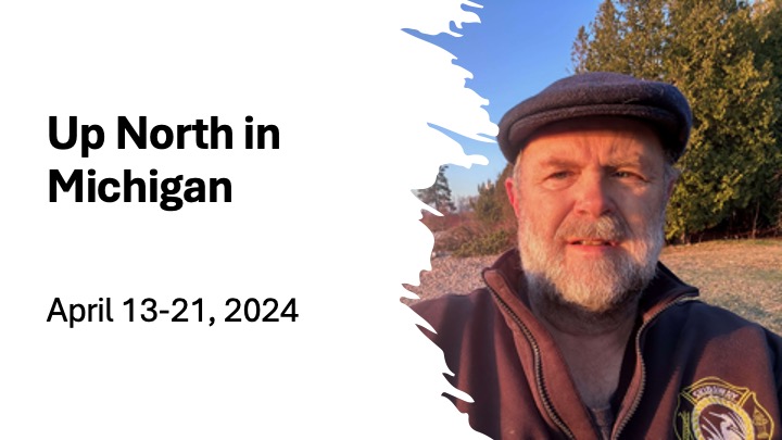
I spent the last half of June mostly in the Upper Peninsula of Michigan. While I have already written about my solo kayak trip around Drummond Island, I thought I’d share some of my other adventures. 

Jim at Richies Koffee Shop

I arrived in Michigan on June the 18th, staying with my friends Bruce and Katie on Jordan Lake. We enjoyed dinner and sitting out by the lake, along with a late evening boat ride around the lake. The next morning, I headed early into Hastings to have breakfast with my friend Jim, at Richies Koffee Shop, a place I often ate breakfast when I lived in Hastings. As I drove up, Dave and John were at the table by the front window. They wondered who pulled up with a sea kayak on top of their car. When I got out, John said to Dave, “Oh, it figures, it’s Jeff.” I talked with them along with Sandy, my favorite waitress, until Jim arrived. Then I moved over to a booth and caught up with my old canoeing partner. 

I left Hastings a little before 9 so I could make it to the Upper Peninsula (UP) by 2 PM. It rained most of the way, but I made good time.

Me, Gary, Ron at Snows Bar and Grill

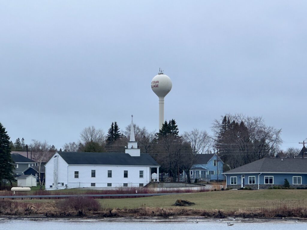
At 2, I had lunch with Gary and Ron. Gary and I were in the fire department on Skidaway Island and paddled together several times in the Okefenokee Swamp. I hadn’t met Ron before, but he also lives on Skidaway during the winter and on an island outside of Cedarville, Michigan in the summer. Gary and his wife were traveling through, visiting friends in Michigan before going on into Canada. We met at Snow’s Bar and Grill in Cedarville, a great place for white fish and walleye. It enjoyed catching up with Gary, who grew up in Michigan.  We said goodbyes at 4:00 PM. I stopped by Cedarville’s grocery store and arrived in Detour Village a little after 5 PM. 

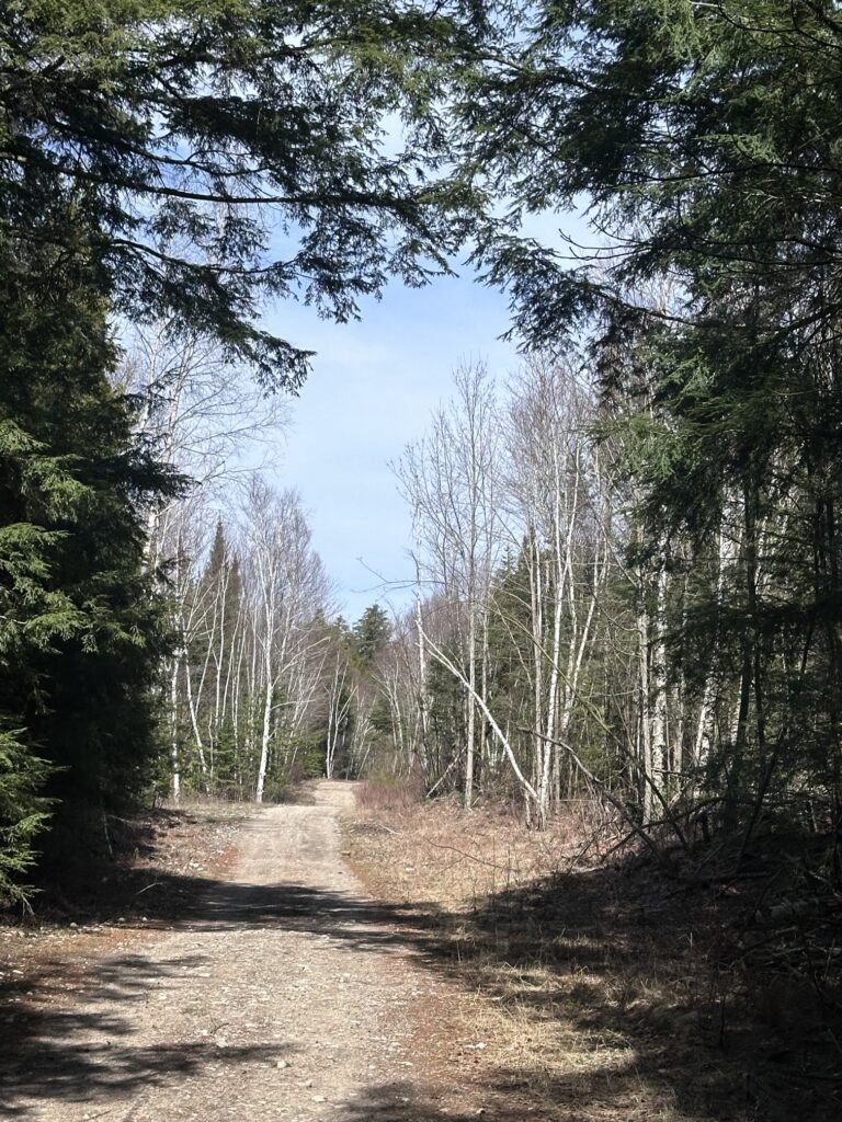
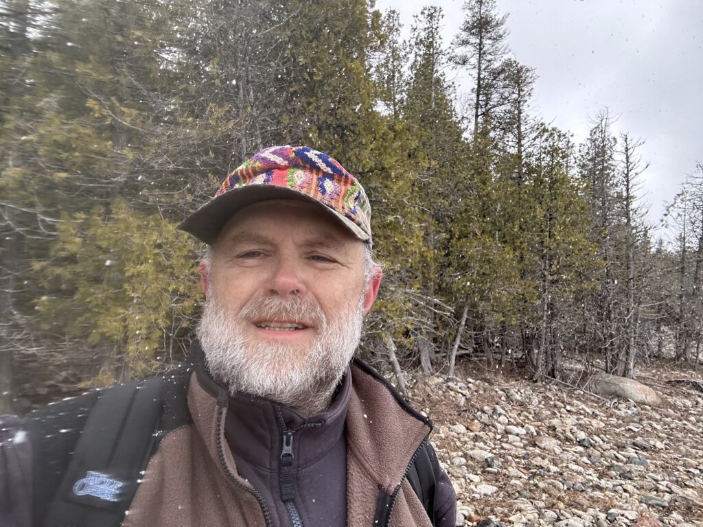
On Thursday, I rested and checked out my gear for my trip around Drummond. I realized I had forgotten to bring a battery pack to recharge my cell phone. On Friday, I paddled around Detour Point early in the morning. Then I headed to Sault St. Marie for Walmart, where I picked up a battery pack and the rest of what I needed for my trip.  Afterwards, I decided to travel over to Point Iroquois Lighthouse. 

Point Iroquois Lighthouse

I’d been here once before but forgotten the reason why it was named after a native American tribe found much further east. In the 17th Century, facing pressure from European settlers, the Iroquois tried to extend their territories further west.  Here, on the east end of Lake Superior, the Chippewa, the native tribe of the Great Lakes Region, stopped the Iroquois advancement after a bloody battle. Then, in honor of their dead foe, the Chippewa named this point along the lake, Iroquois. With all the talk about changing or not changing names to make it more “American,” I had to salute the Chippewa graciousness. The next week, I would learn that Drummond Island was named for the British General in charge of northern Michigan. At the end of the War of 1812, he was ordered to move his garrison back into Canada.  

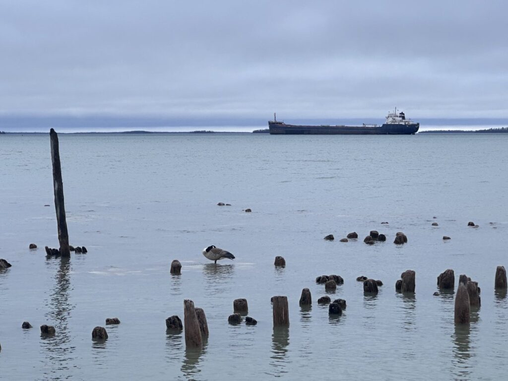
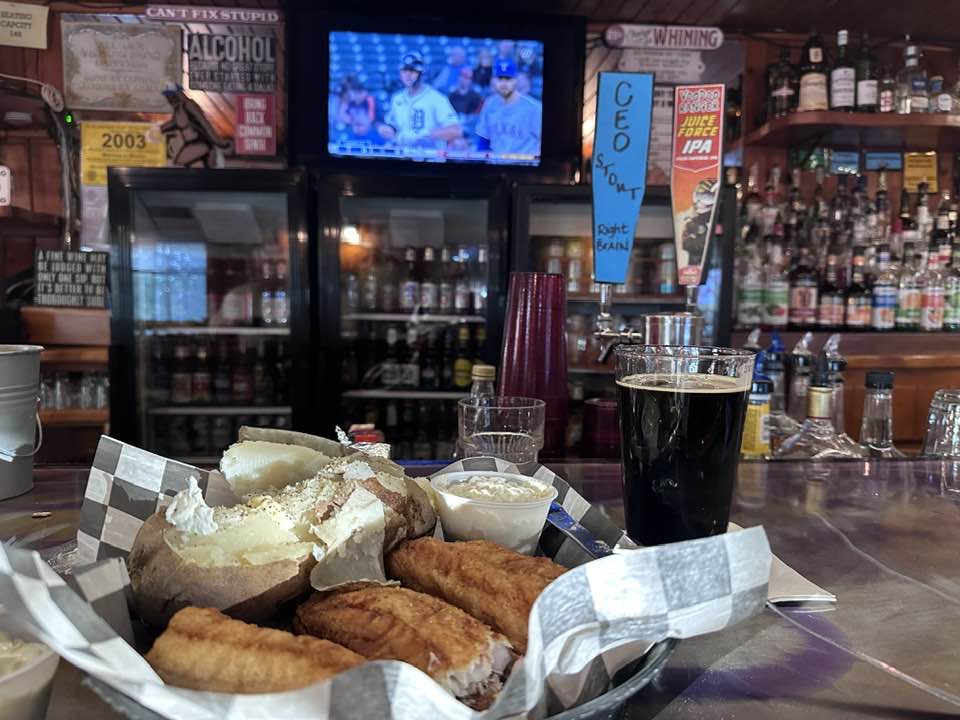
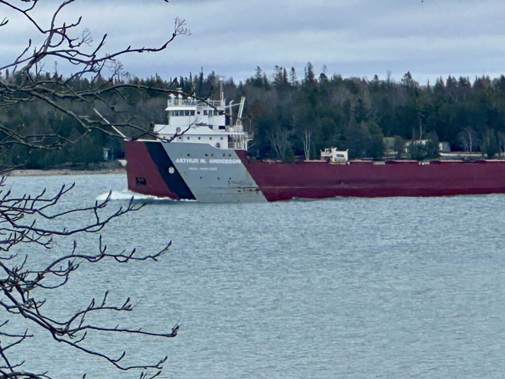
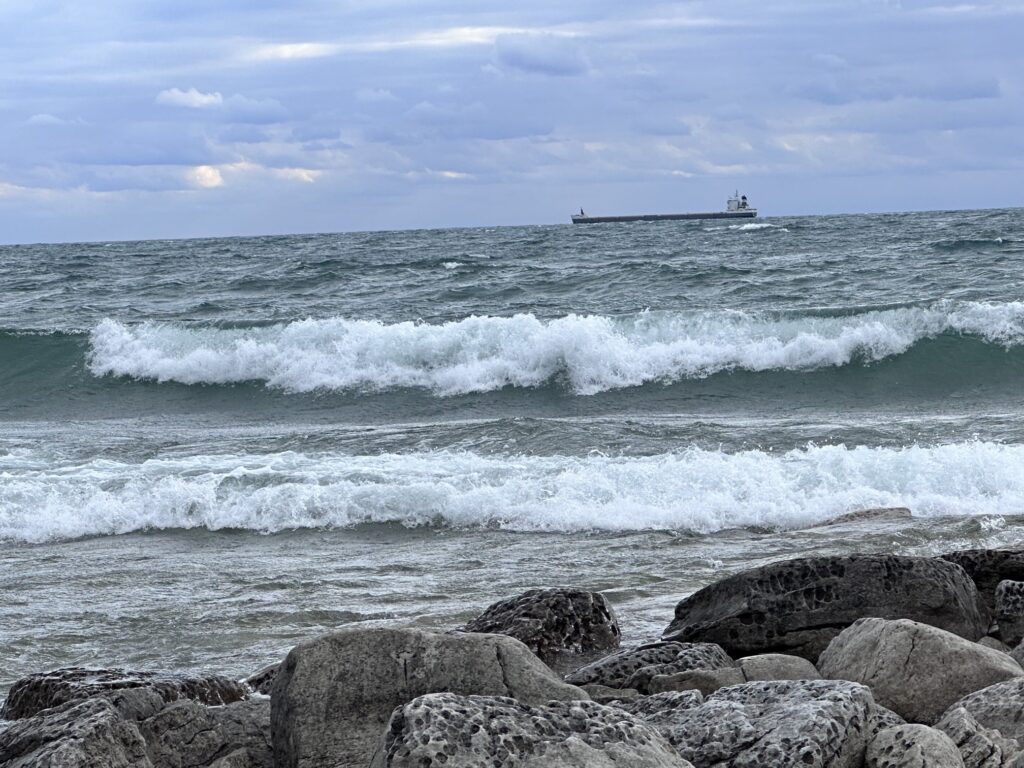
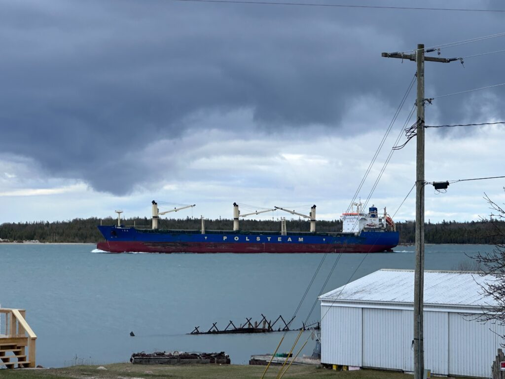
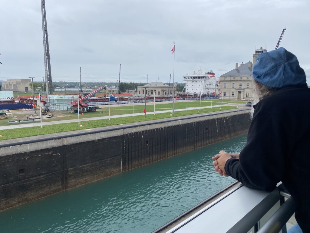
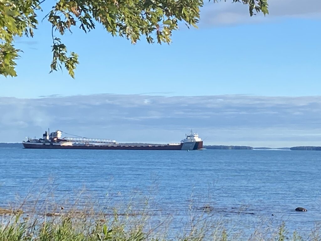
On my way back that Friday, I stopped for dinner at Cozy Corners in Barbeau. I’d eaten at this place before, but never on a Friday night. The place was packed. I sat at the bar, talking to my neighbors, watching the Detroit Tigers play on TV, while also catching glimpses of two southbound freighters.  I ate fish tacos made with walleye. 

The Manse

On Sunday, in exchange for staying at the church’s manse, I preached at the Union Presbyterian Church, using a sermon I had preached a few weeks early at home.  On Monday morning, I headed over on an early ferry run for my paddle around Drummond. 

If you didn’t read about my Drummond Island circumnavigation, you can catch up here: Days 1 & 2,  and Days 3 & 4

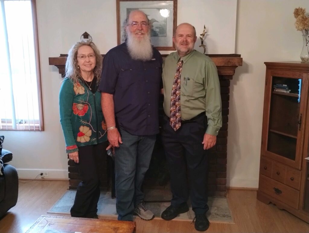
I came back to Detour from Drummond Island around 2 PM on Thursday. I laid out my gear in the garage and the sunporch to dry, showered, and took a nap. Around 5:30 PM, I got up and drove over to St. Ignace to pick up Bob, a friend of mine from Hastings. He took a bus up to the UP from Grand Rapids. He was scheduled to arrive at 10:10 PM, so I decided to go over early and eat dinner.  

Of all the times I have been across the Mackinaw Bridge, which crosses at St. Ignace, I have never been into the town. I exited I-75 at Castle Rock and drove through the town and realized soon it was a mistake. The place was packed. I found myself at the end of a parade of old cars, not knowing that this was the first night of a four-day car rally. All the restaurants were packed.

I stopped at a grocery store to pick up a few supplies, then decided to try the St. Ignace Truck Stop. It, too, was busy, but by 9 PM had slowed down as patrons left. I sat at the bar and ordered walleye. I was finishing my meal at 9:45 PM, when Bob called. The bus arrived early. Thankfully, he was only a couple of blocks away. I picked him up and we headed back to Detour Village. 

Friday was wet and foggy. I spent the morning reading while Bob, who’s an editor, worked on a project. Occasionally, Bob shared his frustration at the book he was editing. He felt he had to rework too much of the author’s words. But he had been hired by the publisher to get the book ready for print, so he kept at it. Around 2 PM, we took a break and headed over to the Detour Village Inn for one of their great hamburgers. 

The Village Inn is a baseball themed park. Tim Grisdale (Grizz) started the inn after he hung up his glove having played minor league baseball in the Detroit Tigers organization. In addition to running a bar and grill, he was a big supporter of baseball and softball in the town. He died in 2018, before I started coming up to Detour Village, but his memory lives on. There’s the Grizz burgers and lots of photos and newspaper clippings posted on the walls. 

Whitefish Sandwich at Snows

After lunch, we headed to a preserve off Prettiss Bay, where we stayed exploring till almost sunset. Plants seen included wood lilies, thimbleberry, yellow coreopsis, yellow lady slippers, shrubby cinquefoil, red osier dogwood, along with irises, columbines, and shinleaf. Then we drove over to Cedarville and I had a whitefish sandwich for dinner at Snows Bar and Grill.

You might think that Snows gets its name from the extreme winters of the UP, but that’s not the case. There is a “Snows Cut,” which runs between the islands, just south of the joint. I have always found this interesting since I grew up just north of “Snows Cut,” where the Intracoastal Waterway cuts from Myrtle Grove Sound to the Cape Fear River, just north of Carolina Beach. That cut was named after the engineer who directed digging this part of the waterway in the 1930s. 

Bob playing the Sax on Drummond

On Saturday, after a morning of reading and editing, we took the ferry over to Drummond Island and met Dave and Sandy, who took us to a potluck dinner hosted by Lighthouse Church. The dinner was outside. Bob, who is an excellent saxophonist, did a short concert. 

On Sunday, I again preached at the Union Presbyterian Church and Bob supplied special music. He had come up with me in April 2024, so folks on the island knew him and enjoyed his music. Afterwards, we were invited to join a group at the Mainsail Restaurant for Brunch.  

Botanist Bob

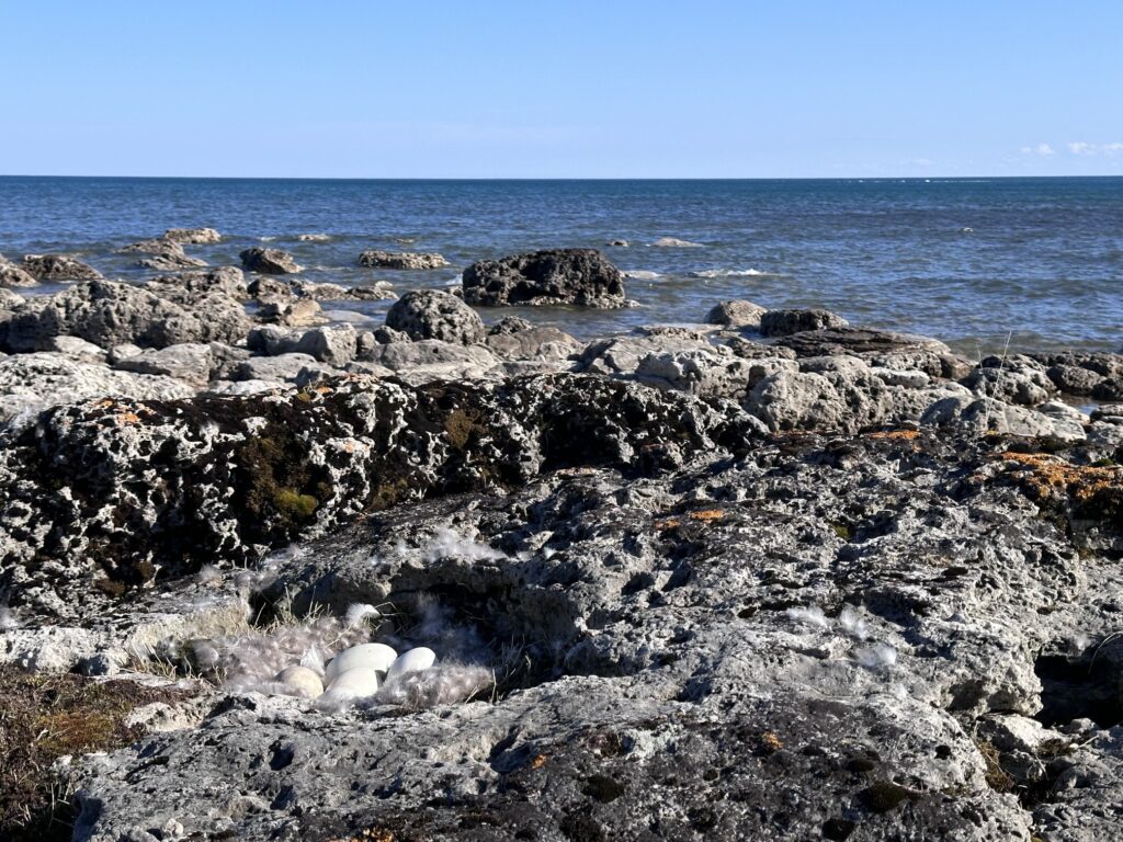
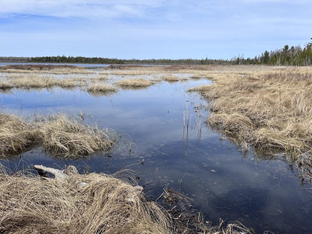
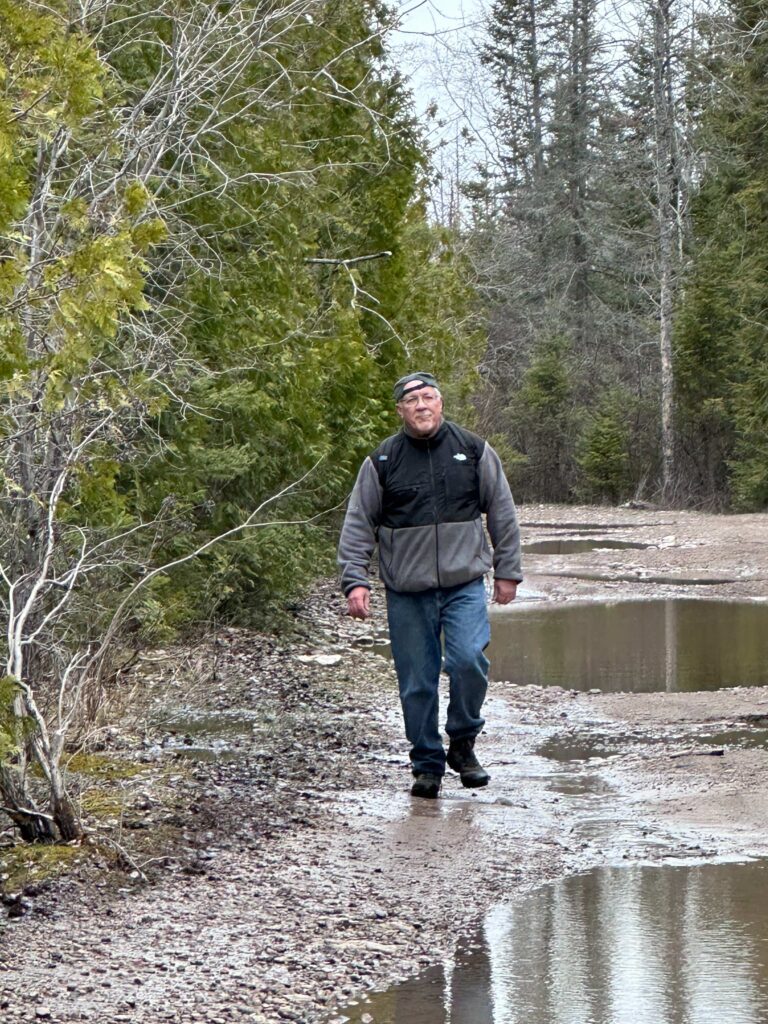
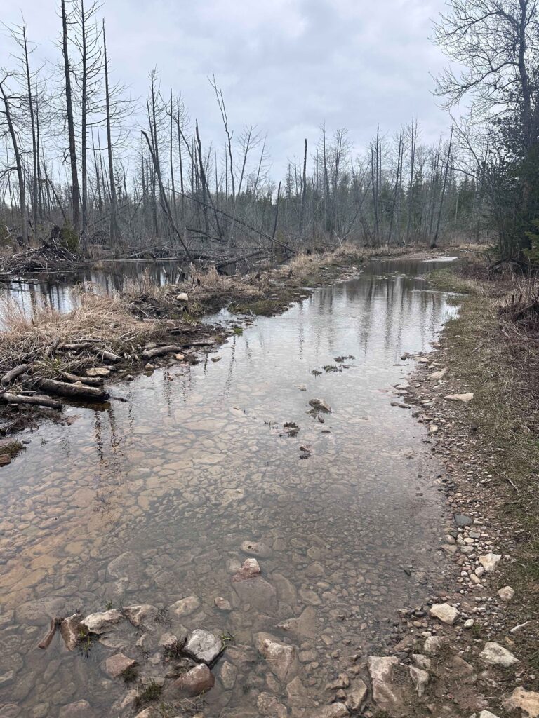
In the afternoon, after a nap, we explored the fins along Lake Huron, just east of Albany Creek. A fin is a wet boggy area. In this case, it’s separated from the lake by a series of dunes. This place is rich of wildflowers, especially carnivorous plants. While Bob has worked much of his life in the publishing business, he is the best botanists I know. Not only does he know the names of all the plants, but he also knows most of their Latin names.

Al

Albany Fin

Plants seen: Northern Pitcher Plant, Butterwort (rare), round leaf sundew, linear leaf sundew (rare), horned bladderwort, rose pogonia (orchid), and pitcher thistle (rare). 

After exploring the Albany fin, we came home and fixed steak for dinner. Monday, we lounged around reading and editing. On Tuesday, we packed up and headed over to the Detour Village Inn for lunch before driving south. On our way south, we stopped at Wilderness State Park to look for some rare plants which Bob had seen there years earlier. He found the plants, but it was after they’d bloomed. I stayed at Bob’s Tuesday night. 

Wednesday morning, before leaving Hastings, I had breakfast with “Doc,” my former associate at First Presbyterian Church. Now confined to a walker, “Doc” or Jim, cares for his wife who struggles with dementia. But Doc still gets around some and remains in good spirits. Then I started the long drive home.  

Selfie at Hocking Hills

I decided to spend one more night out in the woods, so I headed to Ohio’s Hocking Hills. I’ve heard about this place before and wish I could have spent more time there. The hills are beautiful with some interesting rock formations around the creeks. I slept in my hammock and enjoyed dinner at the lodge as I watched the sun set. I arrived home on Thursday afternoon, after racking up almost 3,000 miles over 16 days. 

On the way back, I discovered Southern Ohio is filled with Covered Bridges. I’ll have to explore these some other time.

Completing my trip around Drummond Island

title slide with photos around Drummond Island

Wednesday, June 25, 2025

To read part 1, click here.

My well worn map of Drummond Island
The fossil ledges which are found on the north and northeastern side of the island.

After the windy evening, the morning turned out calm. The calm mornings are normally the pattern, with the exception being on Thursday. But on Wednesday, I woke early, fixed coffee and oatmeal, read and wrote in my journal before beginning my paddle along the north shore of Drummond.  Much of the paddling this morning was along the fossil ledges, where the alvar limestone meets the lakeshore.

For the first few miles, there was no one else in sight, but a couple of miles from Chippewa Point, I began to run into boats fishing just offshore. Chatting with two of the boats, I learned that no one had caught any fished. One said this was the worse for fishing that he recalled. Normally there were a couple of inland lakes along the north side which one could explore, but the lake was so low that wasn’t possible.  I also saw two bald eagles during the morning.

I stopped for lunch on a rock bar between Chippewa Point.  The wind was blowing out of the east, just strong enough to keep the bugs from bothering me. After lunch, I headed due south, across the wide waters of Potagannissing Bay. The bay is filled with islands. I kept my sights on Bald and Grape Island, setting a course between the two which would land me back on the mainland approximately where Pine Street met the water. I wasn’t exactly sure where I was heading as an address doesn’t do much good on the water, but I knew it was just east of H&H Boat Launch. 

Approaching Chippewa Point

After three days of paddling, my arms were tired. I had considered exploring Harbor Island, which has a large inside lake which creates a safe harbor, but since I had been to the island a few years earlier when a member of the DeTour Union Church took me out on his boat, I decided against it. I paddled on, between islands and could make out the marina.

After about an hour of paddling, I found myself just east of the marina. There was a woman out with a toddler. I asked her if she knew the Ledy’s. “You must be Jeff,” she said and introduced herself as Irma. The toddler was her granddaughter. I pulled my kayak up on their sandy beach and spend the next couple of hours talking to her and her husband Clayt, while enjoying a tall Long Island Iced Tea.  Clayt, a contractor, had spent time building mission projects in Ethiopia. His stories were fascinating. 

That night, I joined them, along with Dave and Sandy for dinner.  Dave and Sandy had brought the meal which included tender pork chops which were a lot better than anything I could have fixed. While their cabin was full, they invited me to camp on their porch. I decided my hammock strung between trees would be more comfortable and I could get up earlier in the morning and be on my way. 

Thursday morning, June 26

The rain came at 4 AM. Not expecting it, I crawled out of my hammock and pitched out my fly to keep the water from seeping in. I checked the weather. Off and on showers through the morning, but winds only 6-8 mph.  It’d be a good day to paddle.  Soon, I was back asleep. 

At 6:30 I woke. It’d been light for nearly an hour, but the dark low hanging clouds made it seem earlier. I wanted to get a good start to the day, as I was going to complete my circumnavigation around Drummond Island. I needed to be back on the mainland in time to clean up before driving over to St. Ignace to pick up my friend, Bob. 

Quickly packing my stuff., most of the gear I stored in a shed where, the night before Clayt, said I could I could store anything I didn’t want to carry. Since I wasn’t camping, I dropped most of my gear in the shed, taking only what I needed for the morning paddle. Then I ate a couple granola bars but decided to forgo coffee to get out earlier on the water. 

A little after 7 AM, I was ready to push off. I noticed that the wind seemed to be blowing a lot more than forecasted, but it didn’t seem too bad. Heading out a way into the water, I turned due west. The wind blew out of the northeast, helping me make good time. Quickly passing Sandstone Point, I set my sights on Sims Point, some three miles away.

This course took me across the mouth of Sturgeon Bay. I noticed the water looked choppier than expected. As I moved further from the islands that I’d paddled through the day before, the wind picked up. About a 1/3 of the way across the mouth, I found myself in gale force winds. The waves built and the wind kept pushing me southeast, into Sturgeon Bay, I had to fight to stay on course, dropping my skeg (a small keel) and surfing at a 45-degree angle across 2- and 3-foot swells. The water foamed from the whitecaps. 

Paddling with my life jacket zipped up (After crossing the lee of the island)

There were no boats out this morning. I wore my life vest over my rain jacket. Most of this trip, I only snapped the jacket at the bottom, but now I quickly zipped it up tight. In my jacket was a marine radio, in case I got into real trouble, along with snacks and bug spray. The later wasn’t needed this morning. Whatever happened to those 6-8 mile per hour breezes?  Paddling became exhausting, but my boat handled the waves well. About a quarter mile from Sim’s point, I slipped behind an unnamed and uninhabited island for a break. 

I rested for a good half hour. At least, I thought, I was done with the open water piece. From now on, I’d be along the shoreline, with roads and cabins if I got into trouble. I set back out paddling, with a half mile more to go till I would be on the lee side of Drummond. The waves grew taller as the wind pushed around the islands. A few waves appeared to be nearly 4 feet tall. Several times, I would miss a stroke as I crested a wave, with the water too far below the paddle.

Shelter on the lee side of an island. It’s hard to see the white caps in the photo.

Once, a wave caught me sideways and I almost rolled the kayak. At the last second, using a high brace, I pulled myself back upright and over the swell. This was scary. While continuing to paddle hard, I prayed for God to protect me and give me strength. Then, after another hundred yards, I passed Dix Point and turned my boat south, paralleling the island. The water calmed. I watched an ore freighter make its way north toward the Soo in the St. Mary’s River The current pushed me south. I relaxed. 

waiting for the ferry to clear the dock before passing the terminal.
Limestone quarry loading docks

For the next hour, I paddled south along the west side of Drummond. The only obstacle was the ferry, which I decided to wait for it to leave instead of trying to race across it’s bow as it made its way back and forth from DeTour Village.  Since there were no ships loading at the limestone quarry dock, I was able to see the operation up close as crush limestone falls into piles based on its size and use. Some of the rock is used in the steel making process, other is used in construction and agricultural. 

Soon, I was at the southwestern end of the island. I thought I could skirt through the gap between Barbed Point and Crab Island but found that because of the low water in the Great Lakes, the channel was closed. Across the rocky bridge, waves were beating on the other side. I realized my challenge wasn’t quite over. I paddled around Crab Island and headed northwest, with the wind in my face. For a few minutes I was able to rest behind Arnold Island, but as I headed back northeast the wind howled. There was nothing to do but to keep paddling as I was taken back out into open water. But paddling into the wind is just tiring, not as dangerous as when the wind is coming across the boat. After about two miles I was finally in the tributary where Fort Drummond Marina was located. Once there, the last mile was a little easier as the shoreline blocked the wind. 

Fort Drummond was named for the British General during the War of 1812 who controlled British troops in Southern Canada. At the time, the British held Mackinac Island. After the war, they gave it up. At first, Drummond moved his solders to the island that now bears his name.  Later, they would move back into Canada, which was just north or east of the island. 

Thursday morning, back where I started on Monday

I arrived at the marina a little before noon. After loading my boat on the top of the car, talked to the guy at the marina, then drove over to the Ledy’s to pick up my gear. I had to wait a few minutes for the ferry, but by 1 PM, I was back on the mainland, setting out my gear to dry in the garage.  I had lunch, took a nap, and late in the afternoon set out for St. Ignace to pick up Bob. 

A Solo Paddle Around Drummond Island, Days 1 & 2

title slide with photos of Drummond Island

Tuesday afternoon and evening, June 24, 2025

Campfire in Raynolds Bay

Rounding Raynolds Point, the northeastern corner of the island, the situation changed. I was no longer on the lee side of the island. The wind was in my face and much stronger. Swells suddenly appeared, breaking over my bow and attempting to push me onto the rocky ledges around the shore. Dark clouds gathered.  I headed out away from the ledges and paddled harder. Having already covered approximately 19 miles, I was tired. As rain pelted me, I decided to head into Raynolds Bay. The wind helped this decision. I was not sure what’s public and private land, but there were no signs of human activity. The bay provided enough protection for me to safely come ashore. After thirty minutes of excitement, I was exhausted. This was the first bit of difficulty on my trip, but it would not be the last. 

Beaver’s Work

I walked along the cobblestoned beach that’s sprinkled with fossils. There is also evidence of beaver activity, but wonder what they might attempt to dam up here. A dam on these waters would be beyond the Army Corp of Engineers ability. Finding a nice place where I could pitch my hammock and with a good view of the shore, I move my kayak.

Fossils

Again, as the previous night, I found a rock out near the water where I set up my kitchen.  After dinner, I gathered wood for a fire along the beach. The skies cleared. As the daylight fades, I read and write by the water. Then I build a fire and fix a pot of tea. I hope to see the northern lights., but don’t see them. As darkness falls, I see distant lights of navigation markers and Canadian radio towers. I also pick out cabins by their lanterns on islands on the Canadian side of the water. Twilight seemed to last forever. I crawled in my hammock at 11 PM, after making sure the fire was extinguished. The stars had just begun to appear. 

Sunset from Raynolds Bay. The waves are now much calmer than when I came ashore.

Monday, June 23, 2025 

My trip started on the previous morning. I take the 7:50 AM ferry from Detour Village to Drummond Island. Arriving at the Fort Drummond Marina at 8:15 AM, shortly after they opened, I unloaded my boat from the top of the car and stowed my gear into the hatches. While I plan for a three-night, four-day trip, I bring extra food in case the weather deteriorates.  After loading my boat and moving my car to where it’ll be out of the way. I then leave a float plan with the operator.

Easy paddling

I’m on the water at 9 AM, paddling south out of the tributary where the marina is located. At first I paddle rather slowly as I finish my thermos mug of coffee. Then paddle much faster as I reach Whitney Bay and set my course between Bird and Garden Island. Once I clear Garden, I’m in the upper ends of Lake Huron. From here, I can watch freighters coming up from the south. I turn east and round Anderson Point, then aim between Bootjack and Espanore Island. Next, I head southeast toward Cream City Point. At 11 AM, I pull up on the backside of Gravel Island in Huron Bay for a rest and lunch.  I’ve covered 8 miles in two hours of paddling. 

Today’s lunch is fancy. I have a left-over steak over from Saturday night dinner. Placing the steak inside a hoagie bun, I eat it while watching another freighter make its way from below the horizon towards the Soo. I then take care of a few messages I received on my phone. One is from my brother and I snap and send him a photo of my kayak resting on the cobblestones. Another is from Dave, a friend on Drummond, who invites me to dinner at a friend’s place on the third night. He asks if I can make it. I think I can. This will be the last reliable cell service until I have paddled around most of the island. For the rest of the day, I leave my phone on airplane mode to save battery. 

Gravel Island

After lunch, I paddle around the north side of Gravel Island, and set my course for the distant Traverse Point, 2 ½ miles away. My course takes me further from land. Having paddled by several points, I realize I must give these points wide berth to avoid the rocks which often sit at or just below surface.

After Traverse Point, I head due east toward Scammon Point. This route takes me far from the shore as I pass Canoe Point and Scammon Cover. There are also fewer cabins along this isolated part of the shore. Most of this land is managed as a Michigan State Forest. Leaving Scammon Point, I am tempted to head into Big Shoal Cove, where there is a sandy beach. Having been there before, several years ago, I decide against it. I head southeast toward Long Point, the third of four points I can see (the last is an island). 

I arrived at Long Point around 4 PM and paddle around both sides of the point. After looking around, I decided to camp on the west side, a 100 or so yards inside a small bay. The beaches were covered with cobble stones. As I had done at lunch, I paddled close to the water’s edge and get out of the boat while it’s still in about a foot of water. I lift the boat up, to avoid most of the rocks. After unloading and my boat was lighter, I carry the boat up onto dry land. 

Before setting up camp, I take a brief swim. The water in the shallow bay was cool, but not cold. Then I put on long pants, socks, a clean long sleeve shirt. 

I find two cedar trees at the edge of the woods, where I hang my hammock. Around it, I felt I am in a garden with purple irises, buttercups, Indian paintbrush, and other flowers. On a large rock about 75 feet away, I place my stove and pot along with my folding chair.  After everything is up, I update my journal before preparing dinner. This consists of a beef stew which just had to be heated along with two tortillas and some apple sauce in a squeeze container. Paddling allows for heavier food than backpacking.

After dinner, I hang my food between two trees and explore the shoreline. Afterwards, I fixed a cup of tea. Sitting down, I sip my tea as I watch the sun set and a thunderstorm build south of me. For the next half hour, I observe the storms moving east, just south of me. Huge lightning bolts strike the water a mile or two to my south. These are followed with delayed rolls of thunder. As darkness falls I am treated with a display of synchronous fireflies. Each of these bugs, along the woods, emits four or five quick blinks of light. This is followed by 10 seconds or so of darkness before another set of blinks. To the west, I caught glimpses of the new moon hang between the clouds, low in the west. 

Sunset from my camp on Long Point

I fell asleep to the waning sound of thunder. About 3 AM, I wake and crawled out from my hammock to take care of business. The skies have cleared and to the south I see the pincher stars of Scorpio above the horizon. Moments later, I snuggle back in my hammock home and fall back asleep. 

Tuesday, June 24, Morning to Midafternoon

Perking coffee

When I wake again, a mosquito buzzes just outside my netting. The sun rays are lighting the trees on the other side of the bay. I get up and fixed breakfast. This consists of oatmeal and perked coffee. Then I packed up everything, and spend some time reading and writing in my journal.

By 9 AM, I am again on the water. I paddle east, crossing to the outside of Shelter Island and the points on each side of Bass Cove. Afterwards, I turn northeast as I reached the eastern side of the island. Unlike the day before, where the island consisted of many points of land the eastern side is smoother. There are only a few jagged points extending into the water. Around Bass Cove, I pass many cabins, As I paddle north, I see fewer cabins. Most of this land is owned by the state. With Drummond Island just a hundred yards to my left, Canada is less than a mile to my right. 

Unlike the day before in which, after leaving Whitney Bay, I saw no boats (except for distant freighters), I passed a large sailboat heading east. The boats sails are furled, and it motored on. I later see a few boats come down through the False Detour Passage that links the Northern Passage to Lake Huron. 

South of Marblehead

I planned to make my first stop at Marble Head, a rough outcrop of limestone at the eastern most point of Drummond Island. Who knows why they named this place Marblehead. Drummond, as far as I know, has no marble. It is mostly limestone and the mine on the island produces shiploads of limestone every week, which is used in steelmaking, cement, and agriculture. I suppose the name had a nautical sound. I crossed by Marblehead and pulled ashore on the north side. Stepping out of the boat, the biting flies started. I grabbed snacks for lunch and bug spray. I sprayed my bear legs, where the flies seemed drawn (I wore a long sleeve sun shirt which seemed to provide some protection from the flies. But the spray didn’t deter these buggers, and I spent lunch swatting them away. 

I had planned to hike up to Marblehead, but the bugs seemed just as nasty inside the forested canopy, so I returned to my boat and slowly continued to work my way north toward Stigraves Bay. I’d also planned to paddle into Pilot Harbor, which has a narrow entry that opens into an inland lake, but decided against it. I paddled north around Glen Point and into Glen Cove. It was only 1:30 PM. 

map of the northeast side of Drummond

Most people who paddle around Drummond Island spend their second night at Glen Cove, but since it was too early to stop, I decided to continue north. In the distance, I see a rock that looks like a giant bald eagle sitting. Getting closer I see the white part is from bird poop. But, as I pass this rock, I do see a bald eagle soaring above.

The weather was delightful with a breeze out of the northwest, keeping me cool when I stayed offshore. When I came in close, to explore the limestone ledges which began appearing north of Marblehead, the shore blocked the wind and the bugs would attack.  I assumed once I crossed Raynolds Point, 6 or 7 miles ahead, the wind would blow the bugs away. 

My decision to continue also was influence by the invitation to have dinner with Dave, Sandy, and their friends on Wednesday night.  Except for the bugs, I find the northeast side of Drummond delightful. Much of the shoreline consisted of flat ledges, table-like limestone, a few feet above the waterline. The “tables” appeared properly set with wildflowers growing in cracks. In most places, a second ledge extended out six or 12 inches below the water line.

Getting ashore isn’t difficult, as I exit the boat in six inches of water and climb upon the ledge. It would have been more difficult to have camped along the shoreline north of Glenn Cove, as one would have to load and pack the boat in the water and then lift the boat up onto the higher shelf to keep it safe at night. I decided to camp west of Raynolds Bay. Furthermore, most of this land is privately owned. However, only a few cabins dot the shoreline. 

To continue, click here.

Map of Drummond Island. See https://www.visitdrummondisland.com/di-heritage-water-trail.html
Map from the website of the Drummond Island Tourist Association. Click on the map to be taken to their webpage about paddling around the island.

Up North

Title Slide with photo of me along the shore of Lake Huron

I’ve been wanting to post something about my time in the Upper Peninsula of Michigan, but things have conspired to keep me from writing about it.  After a week of Continuing Education, I took a week of vacation to head further north.

Saturday, April 13, 2024

Looking at the Presbyterian Church in DeTour Village, MI
Union Presbyterian Church, DeTour Village, MI

After finishing up with the Festival of Faith and Writing at Calvin University in Grand Rapids, I meet up with Bob, a friend of mine from my Michigan days. I had invited Bob along on this trip, as I have always enjoyed spending time with him. Professionally, he’s an editor and a saxophone player. He has incredible knowledge of plants, with a fondness of carnivorous plants. And he’s a storm chaser. Bob had a friend bring him up from Hastings, so he wouldn’t have to worry about where to leave a car. He threw his sax and his suitcase in my car, and we were on the road. As it’s over five hours, I wanted to get as much driving done before dark as we headed north. 

As the sun began to set, we could see we were entering a different climate zone, as farmland disappeared and hardwoods gave way to forest of paper birch mixed with pines and spruce.

We had a great conversation, talking about several topics along with listening to some Robert Raurk short stories from The Old Man and the Boy. We didn’t stop until after dark, picking up fast food at Burger King in Kalkaska, a town featured in two short stories by Ernest Hemingway. A hour or so later, we stopped for gas in Petoskey. These were our only stops and we arrived in DeTour Village a little after midnight. 

Sunday, April 14, 2024

Ship heading up to the Son
Heading toward the Soo

In a way, my time off was a busman’s holiday. The church in DeTour has a nice manse overlooking the St. Mary’s River. I agreed to preach (I reused sermons I’d preached in January) for the opportunity to stay in the Dmanse and to relax for the week. This meant that we had to get up early on Sunday morning. Knowing that I was arriving late the night before, some people in the church provided food in the refrigerator so that Bob and I could enjoy bacon and eggs with toast for breakfast the next morning. 

Church came early the next morning as we were both exhausted. I preached and Bob excited the crowd by playing a couple of songs on the sax. Afterwards, we had lunch and the Mainsail, one of two restaurants open this early in the season in Detour. Afterwards, we both retreated into our bedrooms and took a nap, before going out and spending some time exploring fins along Lake Superior.  These wetlands that were separated from the shore by dunes are diverse with plant life, most of which was left over from last season. Bob pointed out several carnivorous plants: pitcher plants and sundews.  While he continued to look around, I hiked out onto the rocks jutting into the water and discovered a nest laid by Canadian geese. 

We can back to the manse for a nice dinner of cabbage rolls made by another Bob, along with his wife Nelda, members of the church. As Bob had never seen “A River Runs Through It,” and there was a DVD of the movie in the manse, we watched it. 

Canadian Geese Eggs along the shore of Lake Huron

Monday, April 15, 2024

Monday, we set what would be our routine for the week. We spent the mornings in the manse. While Bob would work on his edits, I spent the time reading and writing. We’d take an occasional break to watch a ship make its way up or down the St. Mary’s River. Bob was especially excited when I pointed out the Arthur Andersen, the ship that was behind the Edmund Fitzgerald the night it sunk in November 1975.  On my first day, I read The Cellist of SarajevoLater in the week, I started reading Danielle Chapman’s Holler, along with sections of Augustine’s City of God, along with some writing.  The afternoons were reserved for hiking. 

In the afternoon, we spent time exploring some of DeTour and the trails nearby. Then, as the day sun dropped lower into the sky, we drove to Cedarville for the grocery store. We had dinner at Snows Bar and Grill, located above Snow Channel, along the north shore of Lake Huron. The place was wonderful. I had the walleye special and a Great Lakes Brewing CEO Stout while Bob had the UP special, a Cornish pastry. Afterwards, we went back to the manse and watched “The Jesus Revolution,” a movie I had brought along with me to watch in preparation of using it on a movie night at church. Bob, who is more familiar with contemporary Christian music, knew more about those portrayed in the movie than I did (Chuck Smith, Greg Laurie, and Lonnie Frisbee).  We discussed this movie several times over the week. 

Walleye Dinner
Walleye Dinner at Snow’s Bar and Grill in Cedarville, MI

Tuesday, April 16, 2024

Hiking in Michigan's UP

Tuesday afternoon, we hiked to around Cranberry Lakes to Caribou Lake, a walk of about 6 miles which I had done before. The trail takes us through cedar swamps with high ground consisting of paper birch forest mixed with spruce. It’s too early for wildflowers, but lots of smaller plants under the canopy have begun to brighten up after the winter.

After our hike, we head back to Snows Bar and Grill, where I enjoyed a wonderful Pepper Jack Burger with an Atwater Dirty Blonde. The burger was great, but the CEO Stout of the previous night I felt was superior to the Dirty Blonde. As there were a set of movies that featured Sandra Bullock. Since we both like her, we watched “Two Weeks’ Notice.” We were surprised to see Donald Trump in the movie, as he was featured much in the news with the beginning of his latest trial, as well as we recalled Sandra Bullock’s refusal to back him for the Presidency. 

Cranberry Lake
Cranberry Lake

Wednesday, April 17, 2024

Wednesday was a rainy day.  I still did a couple of miles hiking in the rain, coming home to a hot shower.  We stayed close to home for dinner, eating a great burger in the DeTour Bar and Grill, where we got into a conversation with locals.  We watched Sandra Bullock in “Ms. Congeniality” in the evening. 

The Arthur M. Anderson freighter
Arthur Anderson, a freighter built in the 1950s
and the last ship to see the Edmund Fitzgerald afloat in 1975

Thursday, April 18, 2024

Thursday morning, I received a text from my sister, telling me that our father would be having surgery. I called, but he was already being prepped for surgery for a blockage in his intestines. I talked with my sister and brother for a bit. Little did I know this event would change my plans for the next month. She later texted to say he came through the surgery and was doing fine. We went for an early evening dinner at Snows in Cedarville, followed by a stop at the grocery store there for food to serve that evening. A group of people from the church came over and we had desert and a Bible Study.  

a 1000 foot freighter
1000 foot freighter leaving Lake Huron

Friday, April 19, 2024

Friday, Bob and I spent the day on Drummond Island. After talking with my father in the morning, we caught the ferry over the island. David and Sandra, members of the church in Detour, picked us up and toured us around the island. Then they dropped us off at Maxton Plains for a hike.  

Hiking in Maxton Plains

Hiking in Maxton Plains
Bob hiking on Maxton Plains

I was hoping to make it to the cliffs along the northeast side of the island, but the recent rains had created ponds on the alvar surface. Alvar is limestone pavement. The glaciers of the last ice age had smoothed the limestone leaving only a minimal amount of topsoil. At places the pavement is like smooth finished concrete, allowing plant growth only in cracks. Unfortunately, for us, water takes longer to work though the rock, so the rains of Wednesday and Thursday have resulted in ponds which we have to work around. We make it almost to the cliffs, when we are blocked by a larger impoundment of water due to beaver activity.

Alvara pavement
Alvar pavement
Beaver dam
A beaver swamp blocking our path

As it’s getting late and we’re scheduled to be at a dinner at 6 PM, we hike back. This is my second failed attempt to make it to the cliffs, as I’d tried to find them when in the UP in 2021.

We were picked up at the trailhead by Dave and Sandra and taken to a home on the lake where a group from the Lighthouse Church on Drummond was holding a potluck. There were a few musicians present, Bob got to play the sax with them. I spent the evening getting to know new friends, especially Scott, the pastor. A former Episcopal priest, he’d been the pastor on the island for 10 years and joked about how he no longer dresses up on Sunday morning. Instead, he just finds a clean pair of jeans. We had a good time with everyone and caught the 9:30 PM ferry back to DeTour. 

Saturday, April 20, 2024

A ship going through the St. Mary's River, MI
A “Saltie” (grain hauler),
making it’s way up toward the Zoo

On Saturday, winter returned. We had several snow squalls. Bob was working on a project for a new client, so I left him and hiked out on DeTour Point, through a large Nature Conservancy protected area. At times the blowing snow, mixed with sleet, pelted against me. Then the sun would make a brief appearance before the wintry mix returned. I saw several ships, both salties (ships that travel across the oceans and enter the Great Lakes through the St. Laurence Seaway and the Wellington Canal, and lakers (ships that haul mostly iron ore, coal, and limestone and are too large to leave the Great Lakes Basin. I arrived back to the manse around 6 PM and grilled steaks for dinner. Then we began to pack up. 

Photo of shoreline along Detour Point
Between snow squalls
DeTour Point Lighthouse in fog

Sunday, April 21, 2024

The next morning, we had a joyful time at church where Bob again played the sax. We then went out to lunch at the Mainsail, before packing up and heading back south. I dropped Bob off in Hastings, then drove to friends in Portage Michigan for the evening. On Monday, I drove back to Virginia. 

An old laker heading south toward Detroit or maybe Cleveland

Previous posts on trips to DeTour Village

July 2021

September/October 2022

Photo of author of blog in a snow squall
Selfie during a snow squall

I’m traveling for a few weeks

Waiting for the sun (on a day that turned out stormy)

Did you miss my sermon on Sunday? Well, I ran away last week. And through this week I will have limited internet. My technology dry spell continues through the weekend. Next week, I’ll be at Calvin University and Seminary in Grand Rapids, Michigan. But right now I am in a beautiful part of God’s creation, Michigan’s Upper Peninsula. I’m staying in DeTour Village, watching the freighters sail by. I am also doing a lot of reading and planning. Many of the books I brought with me I read years ago, but I’m reviewing them for a seminar group I meet with next week. Others are new books to me, which I’m reading for the first time.

Can you guess which books I’ve read before? And which are new to me?
Hint, I’ve read 7 of the 13 books in the photo.

Last weekend, I was blessed with a visit from Robert and Donna, friends of mine from my Utah days. They, along with Robert’s sister (who took the photo below before church on Sunday) are on a cross-country trip and spent three days with me. While Robert and I come from different theological traditions, talking theology with him is always enlightening and I much appreciate his insights. On Saturday, we made a trip up to the Soo Locks at Sault Ste. Marie.

Do you like my Jerry Garcia designed tie?
Robert watching a 700+ foot freighter move through the Poe Locks
A freighter passing by last Friday, before the weather went south….

I’ve learned something new this week. That’s always good, to learn something new… In the yard by the house where I’m staying there are two apple trees overflowing with fruit… The fruit that drops from these trees are being eaten by sea gulls. I never knew gulls would eat apples. I also expect I’ll have to find a car wash when I leave this place!